MyTopo
Byron Hot Springs California US Topo Map
Couldn't load pickup availability
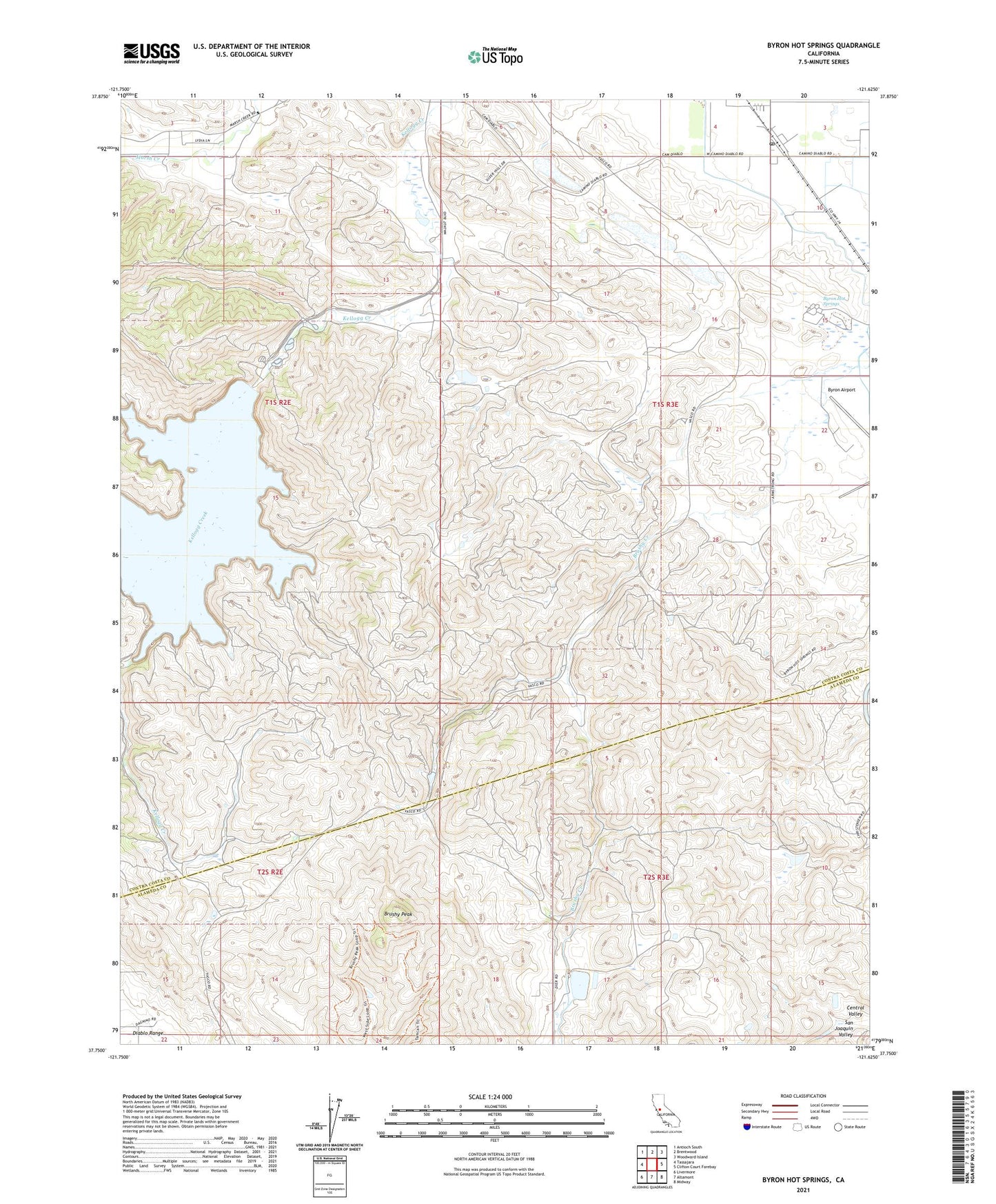
2021 topographic map quadrangle Byron Hot Springs in the state of California. Scale: 1:24000. Based on the newly updated USGS 7.5' US Topo map series, this map is in the following counties: Contra Costa, Alameda. The map contains contour data, water features, and other items you are used to seeing on USGS maps, but also has updated roads and other features. This is the next generation of topographic maps. Printed on high-quality waterproof paper with UV fade-resistant inks.
Quads adjacent to this one:
West: Tassajara
Northwest: Antioch South
North: Brentwood
Northeast: Woodward Island
East: Clifton Court Forebay
Southeast: Midway
South: Altamont
Southwest: Livermore
This map covers the same area as the classic USGS quad with code o37121g6.
Contains the following named places: Altamont Landfill, Armstrong Ranch, Brushy Peak, Byron, Byron Airport, Byron Hot Springs, Byron Hot Springs Post Office, Byron Post Office, Byron-Bethany Irrigation Canal, Canada De Los Vaqueros, East Contra Costa Fire Protection District Station 57, Forty-Five Canal, Johnson Ranch, South Bay Aqueduct, Vasco Ranch, Vasco Road Landfill, Vasco School, Warm Ranch, ZIP Code: 94551