MyTopo
Antioch South California US Topo Map
Couldn't load pickup availability
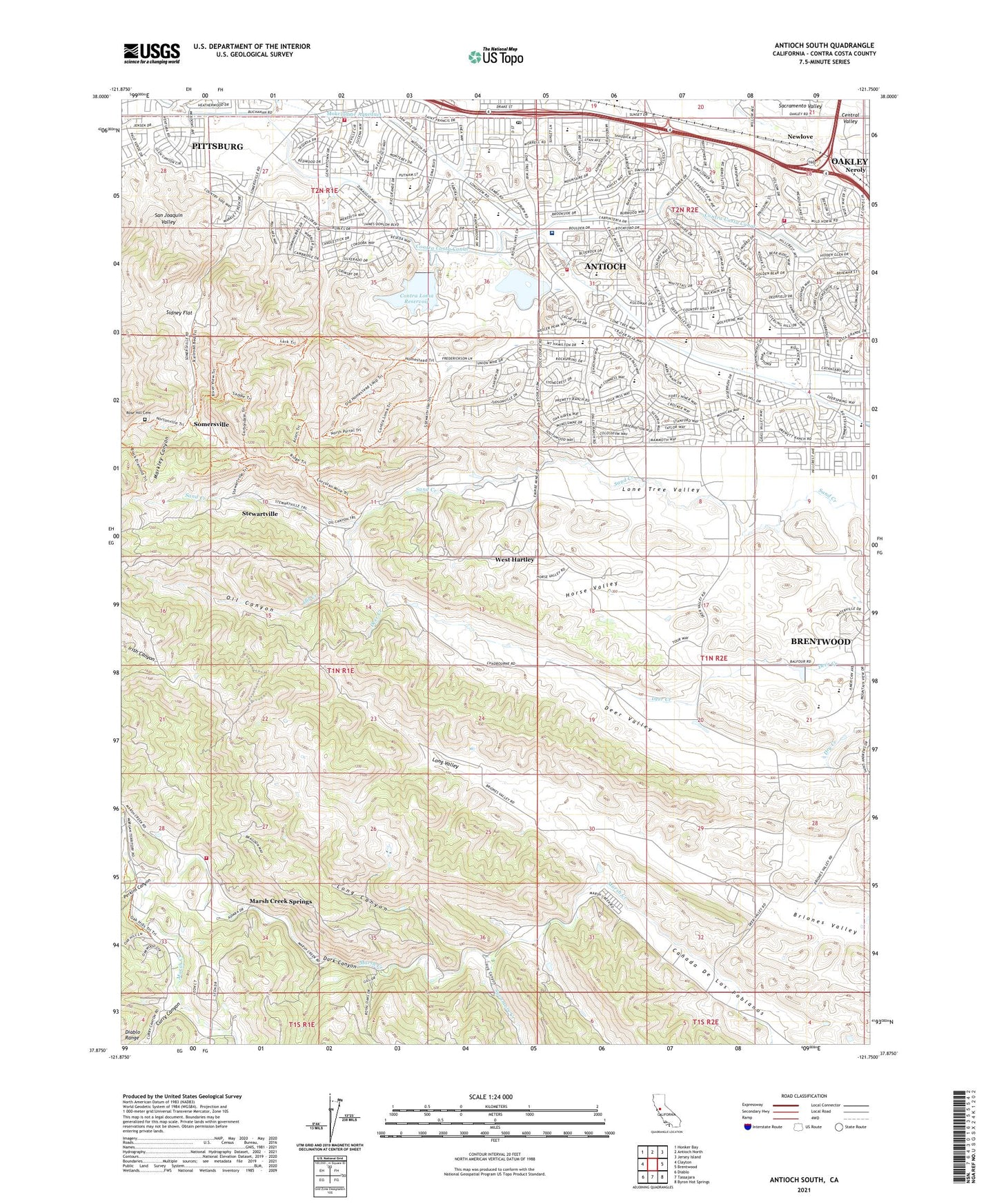
2023 topographic map quadrangle Antioch South in the state of California. Scale: 1:24000. Based on the newly updated USGS 7.5' US Topo map series, this map is in the following counties: Contra Costa. The map contains contour data, water features, and other items you are used to seeing on USGS maps, but also has updated roads and other features. This is the next generation of topographic maps. Printed on high-quality waterproof paper with UV fade-resistant inks.
Quads adjacent to this one:
West: Clayton
Northwest: Honker Bay
North: Antioch North
Northeast: Jersey Island
East: Brentwood
Southeast: Byron Hot Springs
South: Tassajara
Southwest: Diablo
This map covers the same area as the classic USGS quad with code o37121h7.
Contains the following named places: Antioch Community Park, Antioch First Church of God, Antioch Municipal Reservoir, Antioch Post Office, Antioch Reservoir 3-000 Dam, Belshaw Elementary School, Canada De Los Poblanos, Canal Park, Cattail Picnic Area, Chichibu Park, City of Antioch, Coal Mine Tunnels, Contra Costa County Fire Protection District Station 82, Contra Costa County Fire Protection District Station 83, Contra Costa County Fire Protection District Station 88, Contra Costa County Jail Farm, Contra Loma Dam, Contra Loma Dike Number 2 Dam, Contra Loma Reservoir, Curry Canyon, Dark Canyon, Deer Creek 1007-003 Dam, Deer Valley, Delta Fair Shopping Center, Department of Forestry and Fire Protection Station 16 Sunshine, East Bay Regional Park District Ambulance Station 8, First Congregational Church of Antioch, Gentrytown Park, Harbour Park, Hillcrest Park, Hilltop Christian School, Hog Canyon, Horse Valley, Liberty School, Locust Grove Picnic Area, Lone Tree Golf Course, Lone Tree School, Long Canyon, Long Valley, Lupine Rock Picnic Area, Markley Canyon, Marsh Creek Springs, Memorial Park, Mira Vista Hills Park, Mira Vista Park, Mission Elementary School, Morgan Territory School, Mountaire Park, Mustard Hill Picnic Area, Neroly, Newlove, Nortonville Pass, Oil Canyon, Oil Creek, Park Middle School, Perkins Canyon, Prewett Family Park, Raleys Shopping Center, Rose Hill Cemetery, San Joaquin Valley, Sidney Flat, Somersville, Star Mine, Stewartville, Sunny Ridge Park, Sunshine Camp, Sutter Delta Medical Center, Sutter Elementary School, Sycamore Creek, Village East Park, West Hartley, Williamson Ranch Park, ZIP Codes: 94509, 94531