MyTopo
Clifton Court Forebay California US Topo Map
Couldn't load pickup availability
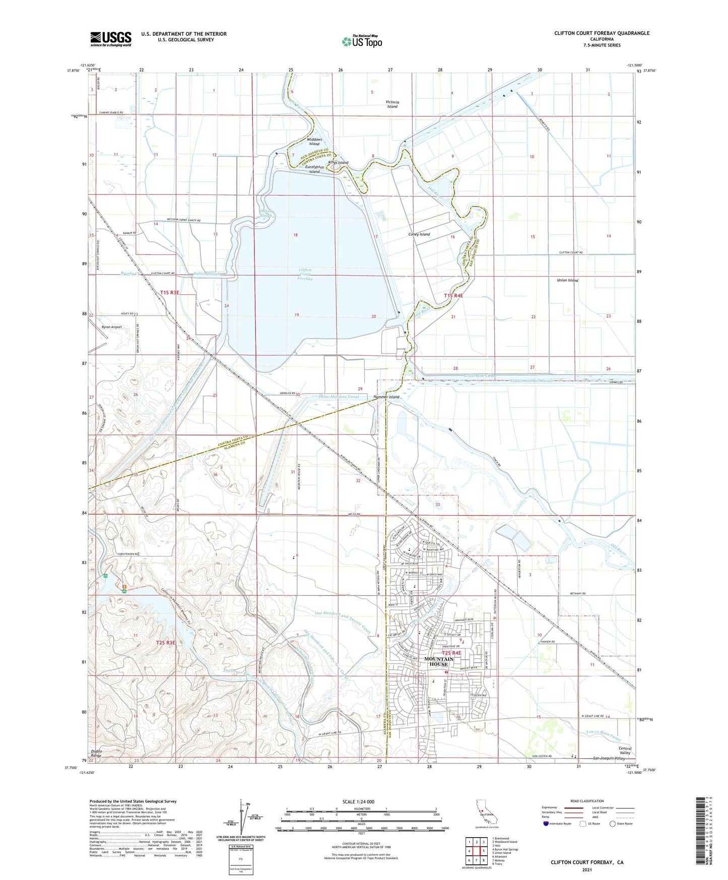
2021 topographic map quadrangle Clifton Court Forebay in the state of California. Scale: 1:24000. Based on the newly updated USGS 7.5' US Topo map series, this map is in the following counties: San Joaquin, Contra Costa, Alameda. The map contains contour data, water features, and other items you are used to seeing on USGS maps, but also has updated roads and other features. This is the next generation of topographic maps. Printed on high-quality waterproof paper with UV fade-resistant inks.
Quads adjacent to this one:
West: Byron Hot Springs
Northwest: Brentwood
North: Woodward Island
Northeast: Holt
East: Union Island
Southeast: Tracy
South: Midway
Southwest: Altamont
This map covers the same area as the classic USGS quad with code o37121g5.
Contains the following named places: Bethany Ferry, Bethany Forebay 1-045 Dam, Bethany Reservoir, Bethany Reservoir State Recreation Area, Brushy Creek, Byron Hot Springs School, Byron Hot Springs Station, Califton Court Forebay 1-064 Dam, Clifton Court Forebay, Coney Island, Delta Fish Protective Facility, Eucalyptus Island, Hammer Island, Harvey O Banks Delta Pumping Plant, Italian Slough, Kings Island, Lammersville Elementary School, Livermore Yacht Club, Mountain House, Mountain House Census Designated Place, Mountain House Creek, Mountain House Elementary School, One Hundred and Fifty-five Canal, One Hundred and Twenty Canal, South Bay Pumping Plant, Tracy Fire Department Station 98, Tracy Pumping Station, Tracy Substation, West Canal, White House Landing, Widdows Island, ZIP Codes: 94505, 94514, 95391