
MyTopo
Chimineas Ranch California US Topo Map
Couldn't load pickup availability
Also explore the Chimineas Ranch Forest Service Topo of this same quad for updated USFS data
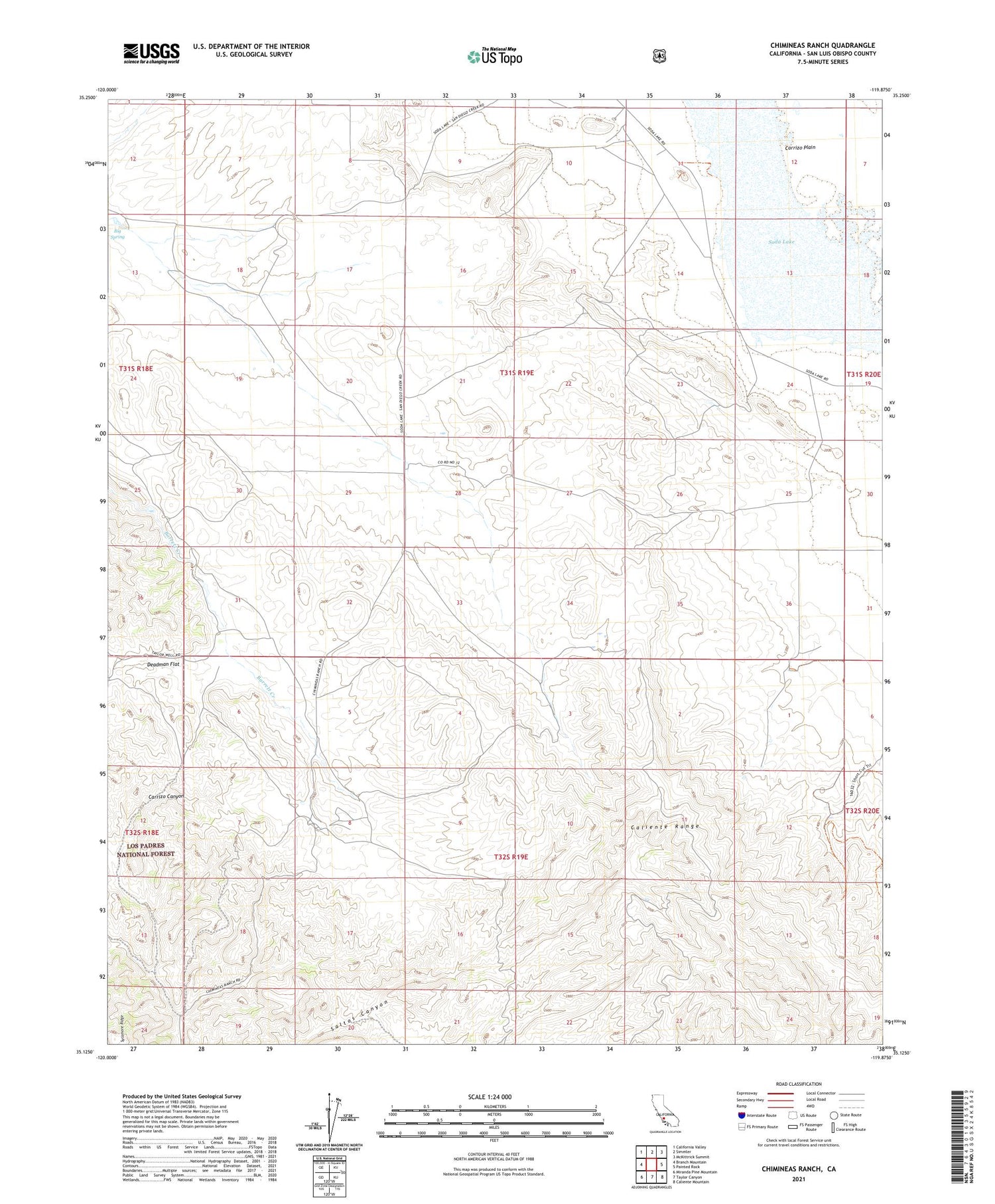
2021 topographic map quadrangle Chimineas Ranch in the state of California. Scale: 1:24000. Based on the newly updated USGS 7.5' US Topo map series, this map is in the following counties: San Luis Obispo. The map contains contour data, water features, and other items you are used to seeing on USGS maps, but also has updated roads and other features. This is the next generation of topographic maps. Printed on high-quality waterproof paper with UV fade-resistant inks.
Quads adjacent to this one:
West: Branch Mountain
Northwest: California Valley
North: Simmler
Northeast: McKittrick Summit
East: Painted Rock
Southeast: Caliente Mountain
South: Taylor Canyon
Southwest: Miranda Pine Mountain
This map covers the same area as the classic USGS quad with code o35119b8.
Contains the following named places: American Ranch, Big Spring, Chimineas Ranch, Deadman Flat, Goodwin Ranch, Saucito Ranch, Soda Lake, Turkey Camp, Turkey Camp Well


