MyTopo
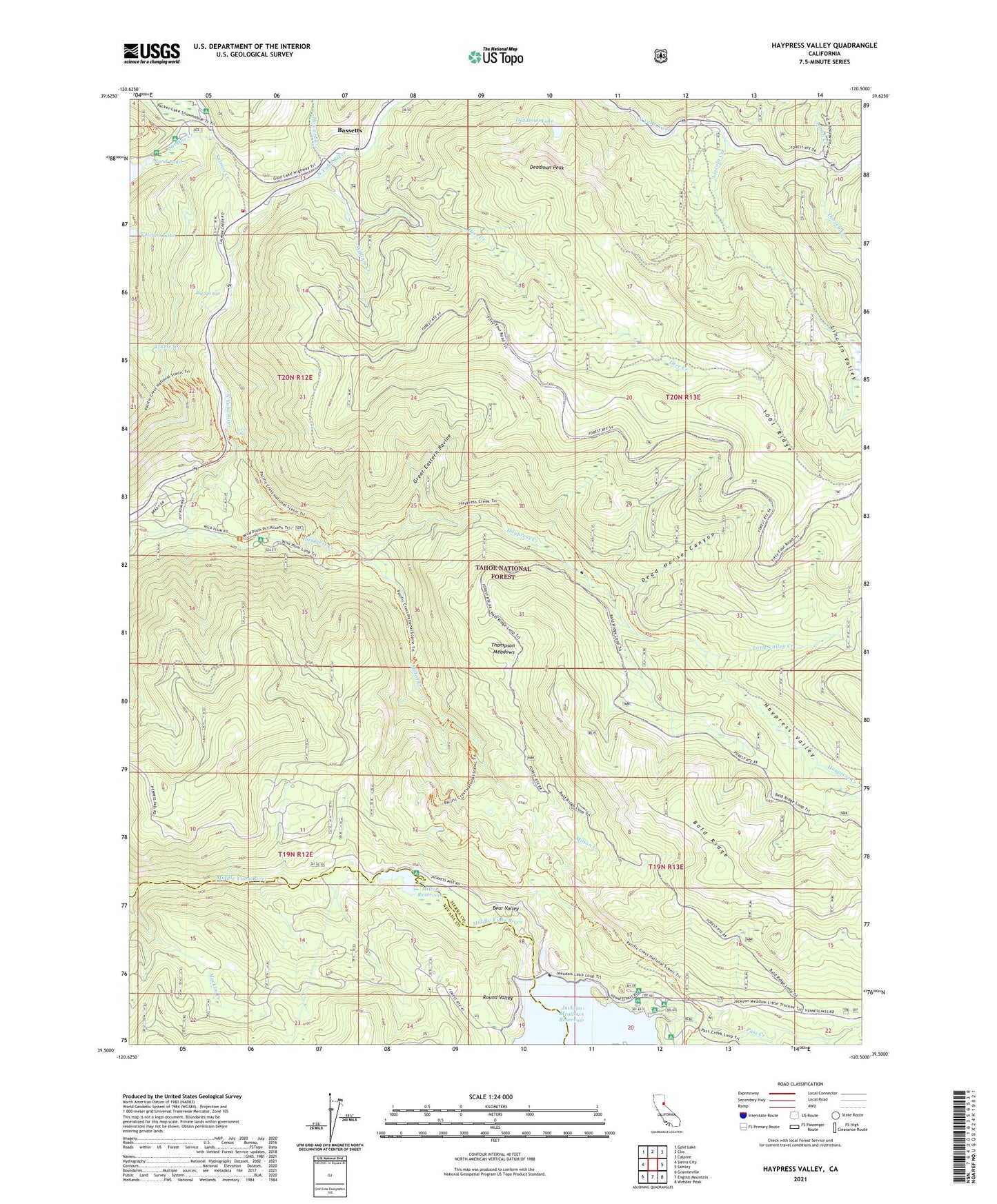
Haypress Valley California US Topo Map
Couldn't load pickup availability
Also explore the Haypress Valley Forest Service Topo of this same quad for updated USFS data
2021 topographic map quadrangle Haypress Valley in the state of California. Scale: 1:24000. Based on the newly updated USGS 7.5' US Topo map series, this map is in the following counties: Sierra, Nevada. The map contains contour data, water features, and other items you are used to seeing on USGS maps, but also has updated roads and other features. This is the next generation of topographic maps. Printed on high-quality waterproof paper with UV fade-resistant inks.
Quads adjacent to this one:
West: Sierra City
Northwest: Gold Lake
North: Clio
Northeast: Calpine
East: Sattley
Southeast: Webber Peak
South: English Mountain
Southwest: Graniteville
This map covers the same area as the classic USGS quad with code o39120e5.
Contains the following named places: 1001 Ridge, Ahart Sheep Camp, Aspen Campgrounds, Aspen Group Campgrounds, Aspen Picnic Area, Bald Ridge, Bassetts, Bear Valley, Big Springs, Carvin Campground, Chipps Mine, Clark Station Homesites, Dead Horse Canyon, Deadman Lake, Deadman Peak, Deer Creek, Dorsey Creek, East Meadow Campground, Flume Creek, Great Eastern Ravine, Haypress Campground, Haypress Creek, Haypress Creek Trail, Haypress Valley, Hilda Mine, Howard Creek, Jackson Meadows, Jackson Meadows 61-020 Dam, Kentuck Mine, Lincoln Creek, Lincoln Creek Campground, Lincoln Valley, Long Valley Creek, Loves Falls, Lower Sardine Lake 1-051 Dam, Lunch Creek, Milton, Milton Creek, Milton Diversion 61-007 Dam, Milton Reservoir, One Hundred One Mine, Pass Creek, Pass Creek Campground, Pass Creek Guard Station, Phoenix Mine, Pride Mine, Round Valley, Salmon Creek, Salmon Creek Campground, San Francisco State College Camp, San Francisco State University Camp, Sand Pond, Sand Pond Picnic Area, Sardine Campground, Sardine Creek, Sardine Lake Resort, Sierra City Fire District Station 3, Sierra County, Summit House, Thompson Meadows, Volcano Lake, Wild Plum Campground, Wild Plum Forest Service Station, William Creek, William Tell Mine, Williams Creek, Yuba-Sutter Camp