MyTopo
Latrobe California US Topo Map
Couldn't load pickup availability
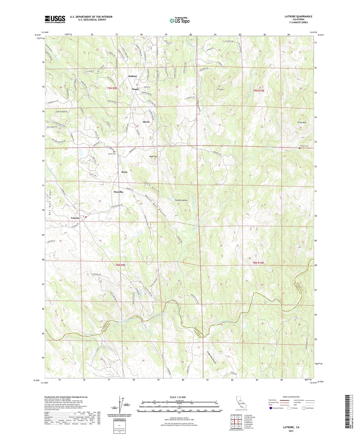
2021 topographic map quadrangle Latrobe in the state of California. Scale: 1:24000. Based on the newly updated USGS 7.5' US Topo map series, this map is in the following counties: El Dorado, Amador. The map contains contour data, water features, and other items you are used to seeing on USGS maps, but also has updated roads and other features. This is the next generation of topographic maps. Printed on high-quality waterproof paper with UV fade-resistant inks.
Quads adjacent to this one:
West: Folsom SE
Northwest: Clarksville
North: Shingle Springs
Northeast: Placerville
East: Fiddletown
Southeast: Amador City
South: Irish Hill
Southwest: Carbondale
This map covers the same area as the classic USGS quad with code o38120e8.
Contains the following named places: Big Canyon Creek, Big Canyon Creek 469 Dam, Big Canyon Mine, Brandon Corner, Brandon School, Brela, Bryant Cemetery, Bugtown Mine, Bullard, China Mountain, Chinese Cemetery, Clark Creek, Copper Hill Mine, Dugan, Fanny Creek, Flonellis, French Creek, French Creek School, Grapevine Ravine, Hungry Hollow, Latrobe, Latrobe Elementary School, Latrobe Fire Protection District Station 91, Little Indian Creek, Marble Creek, Marble Valley, Michigan Bar Ditch, Miller Ranch, Millers Hill School, Mount Aigare, Shingle Creek, Shrub, Slate Creek, Slug Gulch, Sugarloaf, Sugarloaf Mine, Vandalia Mine, White Man Ravine, ZIP Code: 95682