MyTopo
Tehipite Dome California US Topo Map
Couldn't load pickup availability
Also explore the Tehipite Dome Forest Service Topo of this same quad for updated USFS data
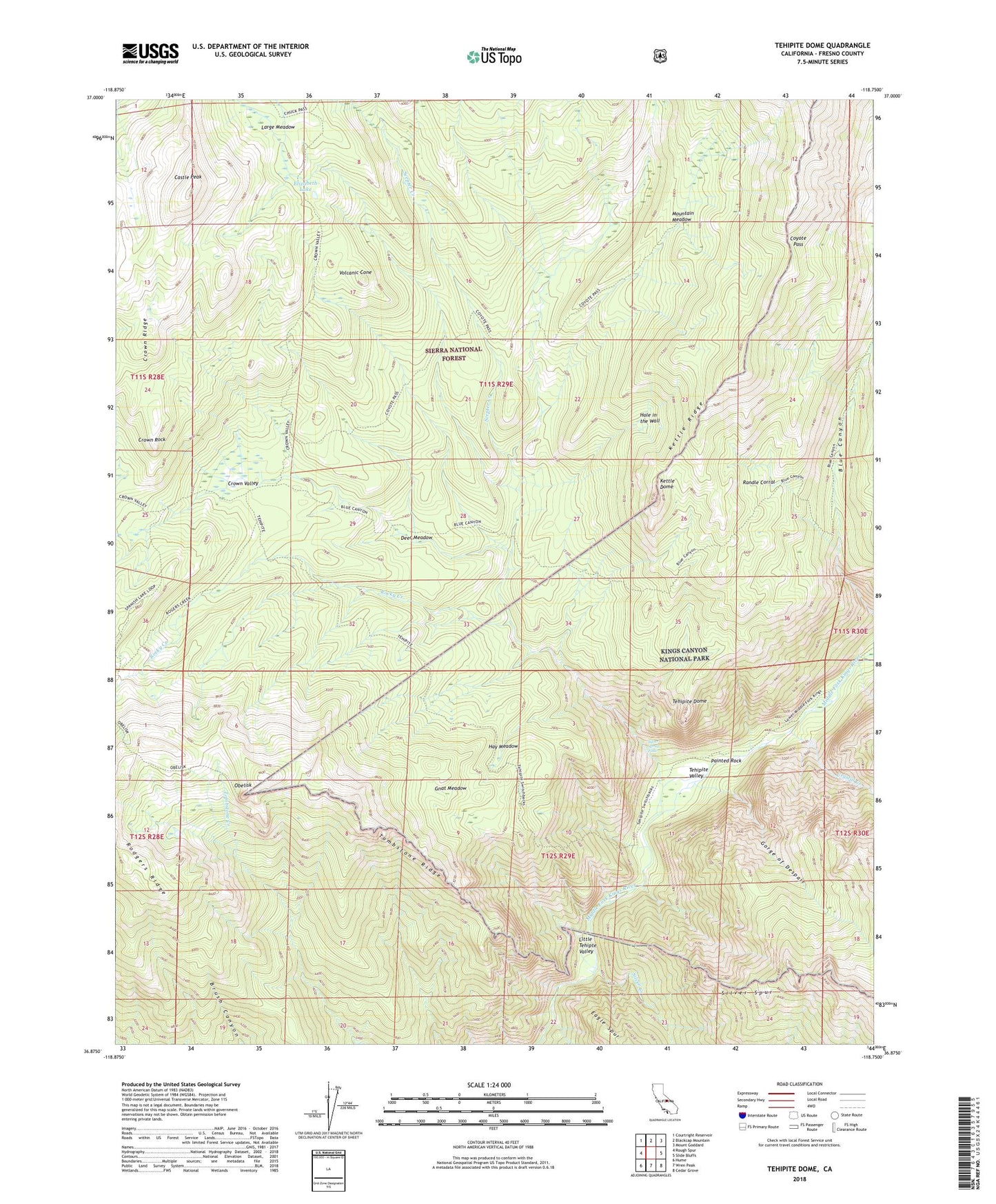
2021 topographic map quadrangle Tehipite Dome in the state of California. Scale: 1:24000. Based on the newly updated USGS 7.5' US Topo map series, this map is in the following counties: Fresno. The map contains contour data, water features, and other items you are used to seeing on USGS maps, but also has updated roads and other features. This is the next generation of topographic maps. Printed on high-quality waterproof paper with UV fade-resistant inks.
Quads adjacent to this one:
West: Rough Spur
Northwest: Courtright Reservoir
North: Blackcap Mountain
Northeast: Mount Goddard
East: Slide Bluffs
Southeast: Cedar Grove
South: Wren Peak
Southwest: Hume
This map covers the same area as the classic USGS quad with code o36118h7.
Contains the following named places: Castle Peak, Coyote Pass, Crown Creek, Crown Ridge, Crown Rock, Crown Valley, Crown Valley Guard Station, Crown Valley Station, Crystal Creek, Deer Meadow, Elizabeth Lake, Gnat Meadow, Gorge of Despair, Hay Meadow, Hole in the Wall, Kettle Dome, Large Meadow, Little Tehipte Valley, Mountain Meadow, Obelisk, Painted Rock, Randle Corral, Rodgers Creek, Scepter Creek, Silver Creek, Silver Spray Falls, Tehipite Dome, Tehipite Valley, Tombstone Ridge, Volcanic Cone