MyTopo
Wren Peak California US Topo Map
Couldn't load pickup availability
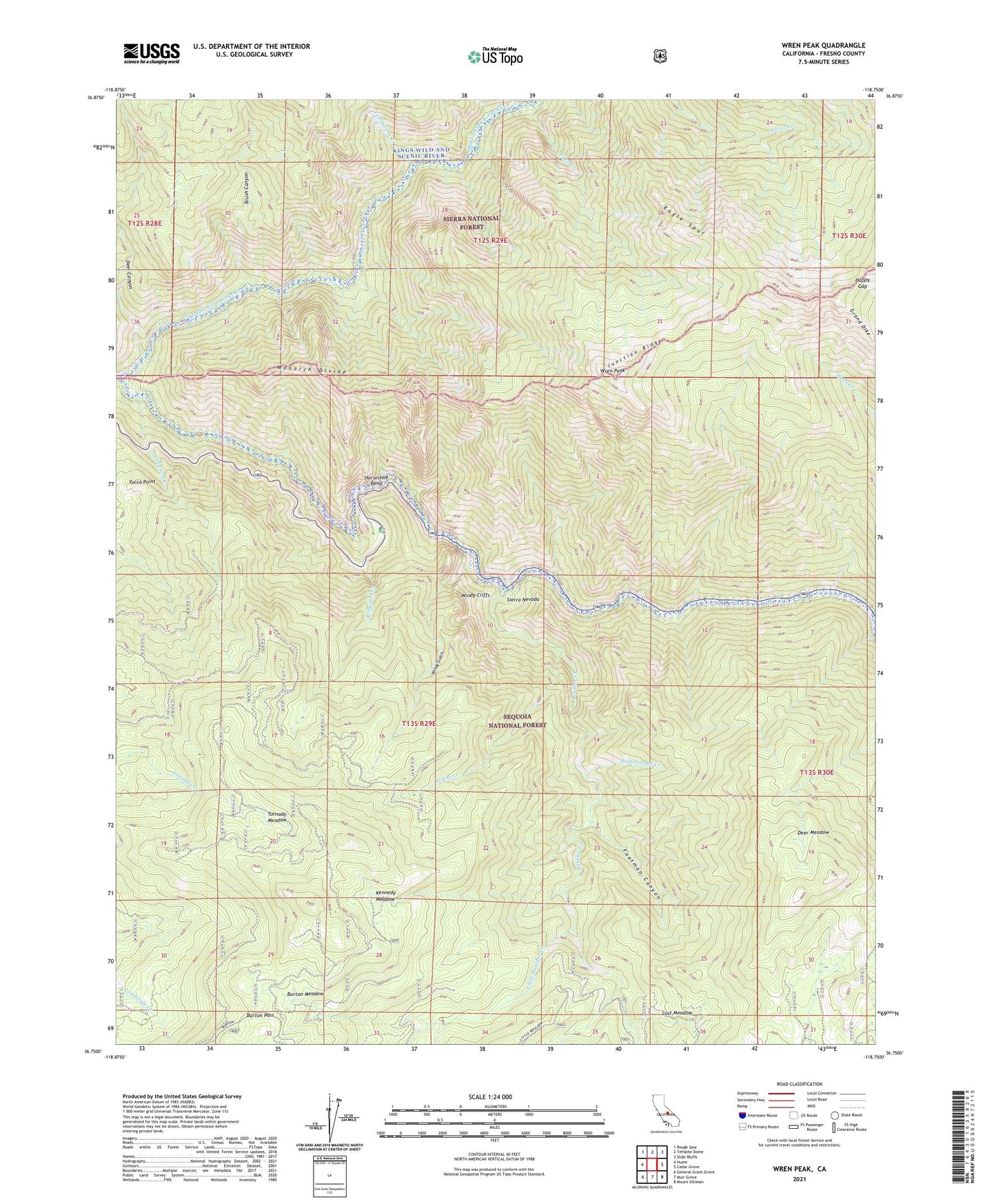
2021 topographic map quadrangle Wren Peak in the state of California. Scale: 1:24000. Based on the newly updated USGS 7.5' US Topo map series, this map is in the following counties: Fresno. The map contains contour data, water features, and other items you are used to seeing on USGS maps, but also has updated roads and other features. This is the next generation of topographic maps. Printed on high-quality waterproof paper with UV fade-resistant inks.
Quads adjacent to this one:
West: Hume
Northwest: Rough Spur
North: Tehipite Dome
Northeast: Slide Bluffs
East: Cedar Grove
Southeast: Mount Silliman
South: Muir Grove
Southwest: General Grant Grove
This map covers the same area as the classic USGS quad with code o36118g7.
Contains the following named places: Agnew Grove, Boulder Creek, Brush Canyon, Buck Rock Creek, Burton Grove, Burton Meadow, Burton Pass, Camp Seven, Deer Canyon, Deer Meadow, Deer Meadow Grove, Eagle Spur, Evans Creek, Evans Grove, Footman Canyon, Grand Dike, Happy Gap, Horseshoe Bend, Horseshoe Bend Grove, Junction Ridge, Kennedy Grove, Kennedy Meadow, Landslide Grove, Little Boulder Creek, Lockwood Creek, Lockwood Grove, Lost Meadow, Monarch Wilderness, Rattlesnake Creek, Redwood Creek, Tombstone Creek, Tornado Meadow, Windy Cliffs, Windy Gulch, Windy Gulch Grove, Wren Creek, Wren Peak, Yucca Point