MyTopo
Ceres California US Topo Map
Couldn't load pickup availability
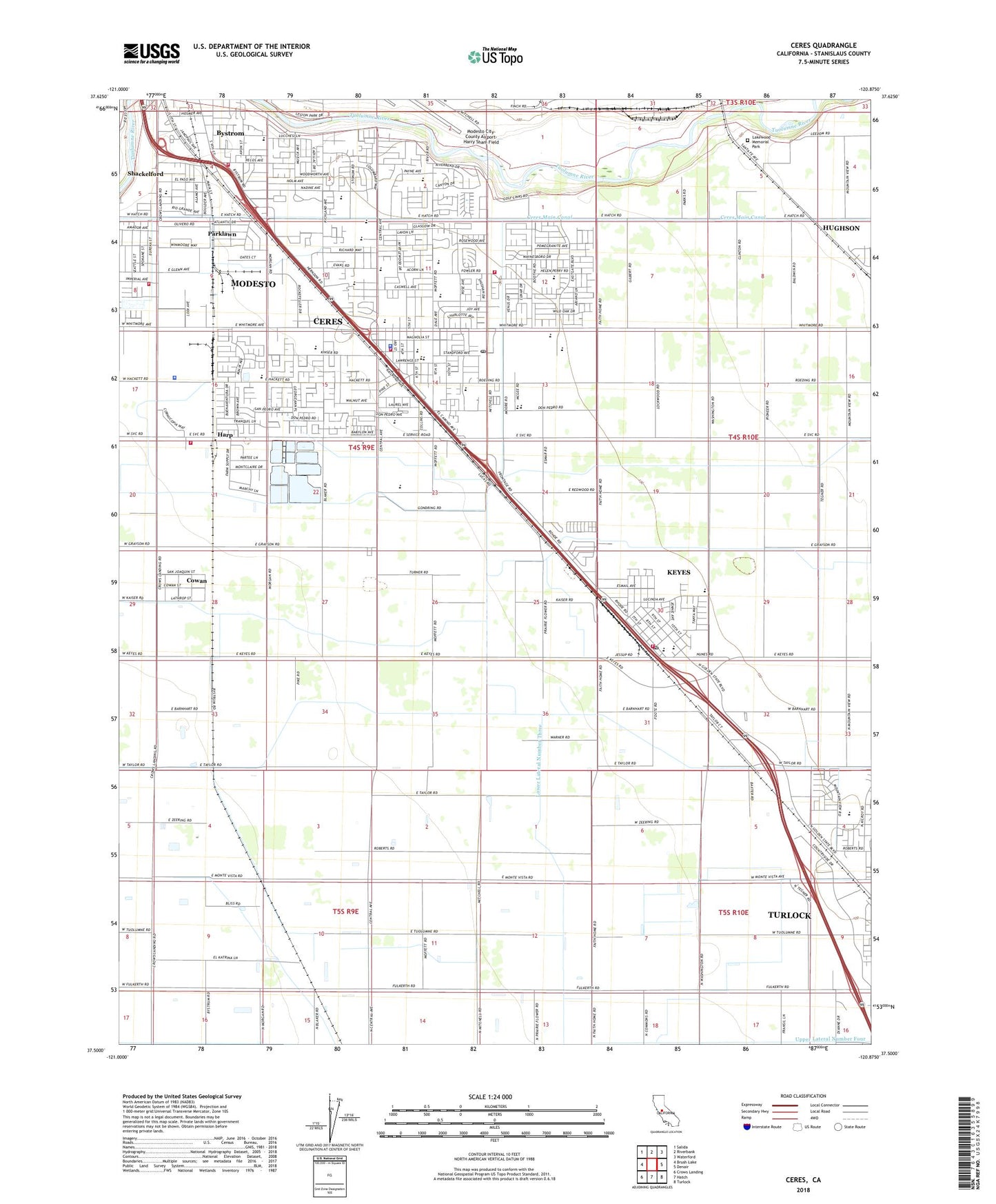
2021 topographic map quadrangle Ceres in the state of California. Scale: 1:24000. Based on the newly updated USGS 7.5' US Topo map series, this map is in the following counties: Stanislaus. The map contains contour data, water features, and other items you are used to seeing on USGS maps, but also has updated roads and other features. This is the next generation of topographic maps. Printed on high-quality waterproof paper with UV fade-resistant inks.
Quads adjacent to this one:
West: Brush Lake
Northwest: Salida
North: Riverbank
Northeast: Waterford
East: Denair
Southeast: Turlock
South: Hatch
Southwest: Crows Landing
This map covers the same area as the classic USGS quad with code o37120e8.
Contains the following named places: Ackerman Dairy, Argus and Endeavor High School, Aspire Summit Academy, Atch Pedretti Park, Berry Grove Park, Bystrom, Bystrom Census Designated Place, Carroll Fowler Elementary School, Caswell Duel Language School, Central School, Ceres, Ceres Branch Stanislaus County Free Library, Ceres City Hall, Ceres Emergency Services Station 2, Ceres Emergency Services Station 3, Ceres Fire Station 1, Ceres Fire Station 4, Ceres High School, Ceres Memorial Park, Ceres Plaza Shopping Center, Ceres Police Department, Ceres Post Office, Ceres Shopping Center, Ceres-Whitmore Park, City of Ceres, County Memorial Hospital, Cowan Census Designated Place, Don Pedro Elementary School, Double D Dairy, El Katrina Dairy Farms Number 1, Esmar, Faith Home Teen Ranch, Gilman School, Harp, Hatch Park, Howard Training Center, Independence Park, KADV-FM (Modesto), KBES-FM (Ceres), Kennedy Complex for Special Education, Keyes, Keyes Branch Stanislaus County Free Library, Keyes Census Designated Place, Keyes Elementary School, Keyes Fire Protection District, Keyes Post Office, Lakewood Memorial Park, Legion Park, Lower Lateral Number Four, Lower Lateral Number Three, Lucas Dairy, Mae Hensley Junior High School, Mancini Park, Modesto Fire Department Station 10, Monte Vista School, Parklawn Census Designated Place, Parklawn Park, Persehone Park, Plaza del Rio Shopping Center, Redwood Park, River Oaks Golf Course, Riverside School, Roeding Heights Park, S and S Dairy, Shackelford, Shackelford Census Designated Place, Shackelford Elementary School, Shoemake Siding, Smyrna Park, Stanislaus County, Stanislaus County Sheriff's Office Modesto, Trinker Dairy Farms, Tuolumne Elementary School, Upper Lateral Number Four, Walter White Elementary School, Whitmore Plaza Shopping Center, Yoris Grove, ZIP Codes: 95307, 95328, 95351