MyTopo
Waterford California US Topo Map
Couldn't load pickup availability
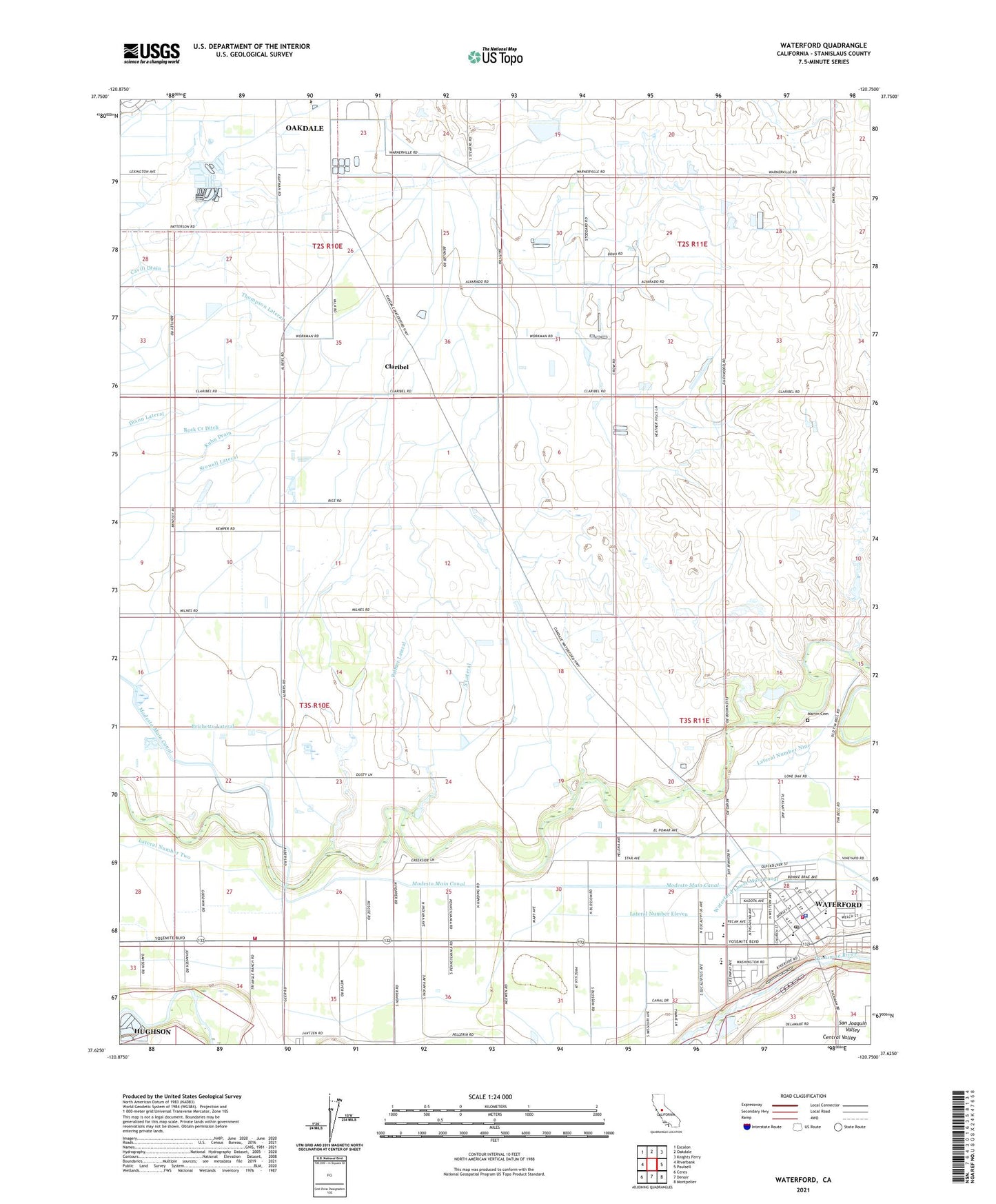
2021 topographic map quadrangle Waterford in the state of California. Scale: 1:24000. Based on the newly updated USGS 7.5' US Topo map series, this map is in the following counties: Stanislaus. The map contains contour data, water features, and other items you are used to seeing on USGS maps, but also has updated roads and other features. This is the next generation of topographic maps. Printed on high-quality waterproof paper with UV fade-resistant inks.
Quads adjacent to this one:
West: Riverbank
Northwest: Escalon
North: Oakdale
Northeast: Knights Ferry
East: Paulsell
Southeast: Montpelier
South: Denair
Southwest: Ceres
This map covers the same area as the classic USGS quad with code o37120f7.
Contains the following named places: Albers Lateral, Brichetto Lateral, City of Waterford, Claribel, Claribel Lateral, Crane Lateral, Desimas and Bairos Dairy, Dotinga Dairy, Dry Creek Lateral, Dutch Star Dairy, Foster Poultry Farms, Frazier Nut Farms, Heritage Nut Farm, Kearney Lateral, KLOC-AM (Ceres), Kuhn Drain, Lateral Number Eleven, Lateral Number Nine, Lateral Number Twelve, Martin Cemetery, Michel Ranch, New Hope School, Palmer Lateral, Postma Dairy Number 2, Riverbank Lateral, Robinson School, S and H Dairy, South Lateral, Stanislaus Consolidated Fire Protection District Station 33, Stanislaus Consolidated Fire Protection District Station 34, Stanislaus County Sheriff's Office Waterford Police Services, Stowell Lateral, Sunset Farms, Union Lateral, Van Leeuwen Dairy, Waterford, Waterford Branch Stanislaus County Free Library, Waterford Elementary School, Waterford Post Office, Willie Creek Ranch