MyTopo
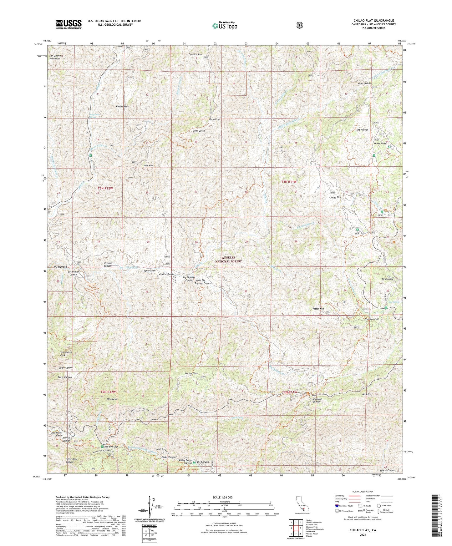
Chilao Flat California US Topo Map
Couldn't load pickup availability
Also explore the Chilao Flat Forest Service Topo of this same quad for updated USFS data
2021 topographic map quadrangle Chilao Flat in the state of California. Scale: 1:24000. Based on the newly updated USGS 7.5' US Topo map series, this map is in the following counties: Los Angeles. The map contains contour data, water features, and other items you are used to seeing on USGS maps, but also has updated roads and other features. This is the next generation of topographic maps. Printed on high-quality waterproof paper with UV fade-resistant inks.
Quads adjacent to this one:
West: Condor Peak
Northwest: Acton
North: Pacifico Mountain
Northeast: Juniper Hills
East: Waterman Mountain
Southeast: Azusa
South: Mount Wilson
Southwest: Pasadena
This map covers the same area as the classic USGS quad with code o34118c1.
Contains the following named places: Alder Creek, Alder Saddle, Bandido Campground, Barley Flats, Baughman Spring, Black Cargo Mine, Black Crow Mine, Camp Hidden Valley, Camp Hi-Hill, Camp Kole, Camp Rosenita, Cedar Canyon, Charlton Flat, Charlton Flats Picnic Grounds, Charlton Station, Chilao Campground, Chilao Creek, Chilao Flat, Chilao Station, Chilao Visitors Center, Cloudburst Canyon, Colby Bridge Day Use Area, Colby Ranch, Coldwater Canyon, Doe Spring, East Fork Alder Creek, Falcon Mine, Falls Canyon, Gabrielino National Scenic Trail, Gold Bar Mine, Granite Mountain, Grotto Creek, Horse Flats, Horse Flats Campground, Iron Mountain, Ladybug Canyon, Loomis Mine, Loomis Ranch, Lynx Gulch, Lynx Target Shooting Area, Middle Fork Alder Creek, Middle Fork Mill Creek, Middle Shooting Area, Mill Creek Picnic Grounds, Monte Cristo Creek, Monte Cristo Mine, Monte Cristo Station, Mount Hillyer, Mount Lawlor, Mount Mooney, Mount Sally, Mule Fork, Newcomb Ranch, Nike Site LA-09L, North Fork Alder Creek, Old Camp, Rabbit Peak, Red Box Gap, Red Box Station, Roundtop, Shortcut Picnic Grounds, Shortcut Station, Silver Moccasin Trail, Strawberry Peak, Trail Fork, Trail Fork Shortcut Canyon, Transverse Ranges, Upper Big Tujunga Canyon, Valley Forge, Valley Forge Canyon, Valley Forge Lodge, Vetter Mountain, West Fork Alder Creek, Wickiup Campground, Wickiup Canyon, Wildcat Gulch