MyTopo
Waterman Mountain California US Topo Map
Couldn't load pickup availability
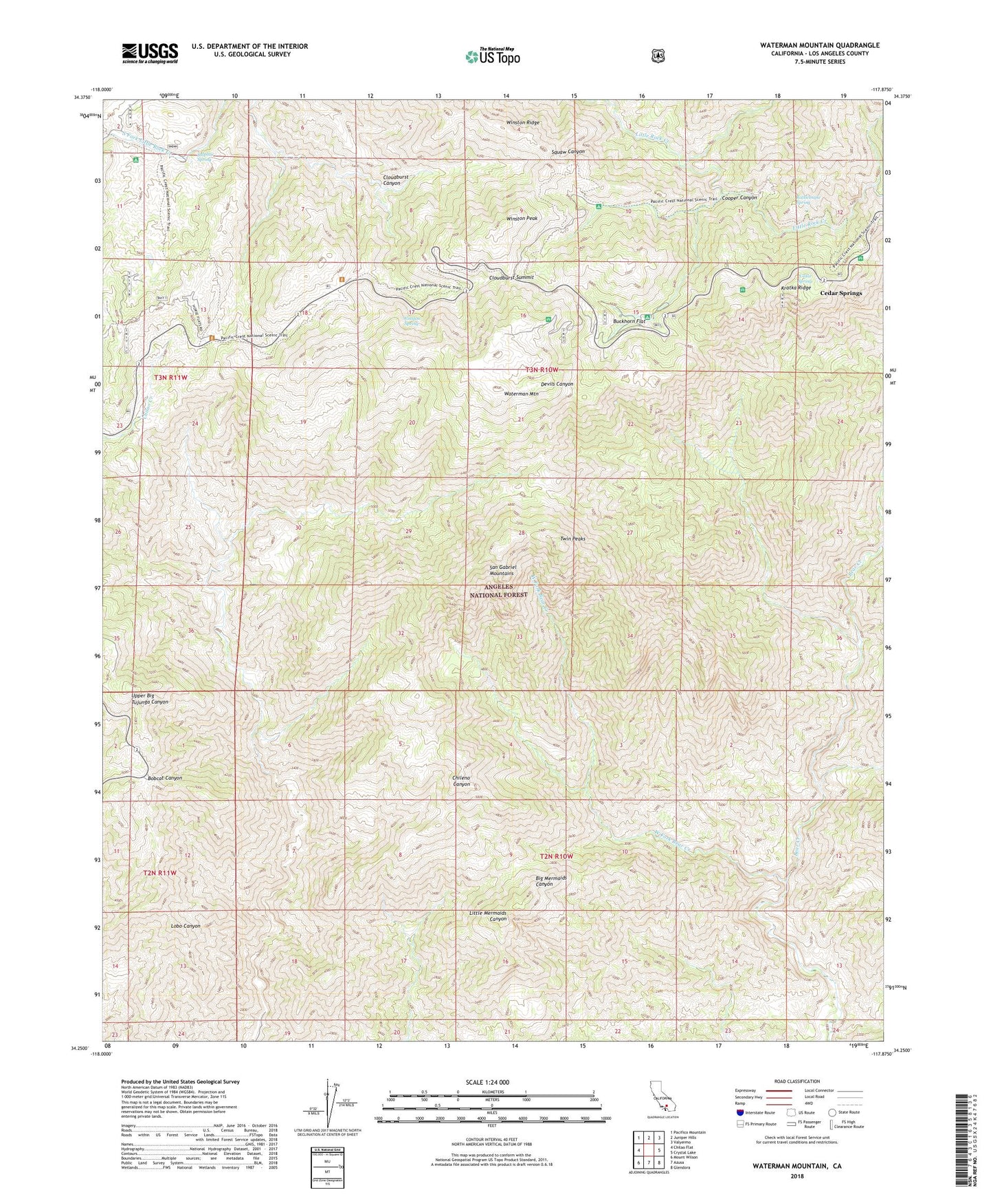
2023 topographic map quadrangle Waterman Mountain in the state of California. Scale: 1:24000. Based on the newly updated USGS 7.5' US Topo map series, this map is in the following counties: Los Angeles. The map contains contour data, water features, and other items you are used to seeing on USGS maps, but also has updated roads and other features. This is the next generation of topographic maps. Printed on high-quality waterproof paper with UV fade-resistant inks.
Quads adjacent to this one:
West: Chilao Flat
Northwest: Pacifico Mountain
North: Juniper Hills
Northeast: Valyermo
East: Crystal Lake
Southeast: Glendora
South: Azusa
Southwest: Mount Wilson
Contains the following named places: Buckhorn Flat, Buckhorn Guard Station, Buckhorn Spring, Camp Christian, Camp Cumorah Crest, Camp Glenwood, Camp Pajarito, Camp Singing Pines, Camp Valcrest, Cedar Spring, Cedar Springs, Cloudburst Canyon, Cloudburst Summit, Conservation Camp Thirtyseven, Cooper Canyon, Cooper Canyon Trail Camp, Eagles Roost Picnic Ground, Kratka Ridge, Kratka Ridge Ski Area, Louies Cabin, Lower Bear Campground, Mount Waterman Ski Area, Pasadena Camp, Rattlesnake Spring, Rattlesnake Trail, Ridge Crest Picnic Ground, San Gabriel Mountains National Monument, San Gabriel Wilderness, Sulpher Springs Campground, Sulphur Spring, Three Points, Twin Peaks, Upper Bear Trail Camp, Vista Picnic Ground, Waterman Mountain, West Fork Bear Creek, Winston Peak, Winston Ridge, Winston Spring