MyTopo
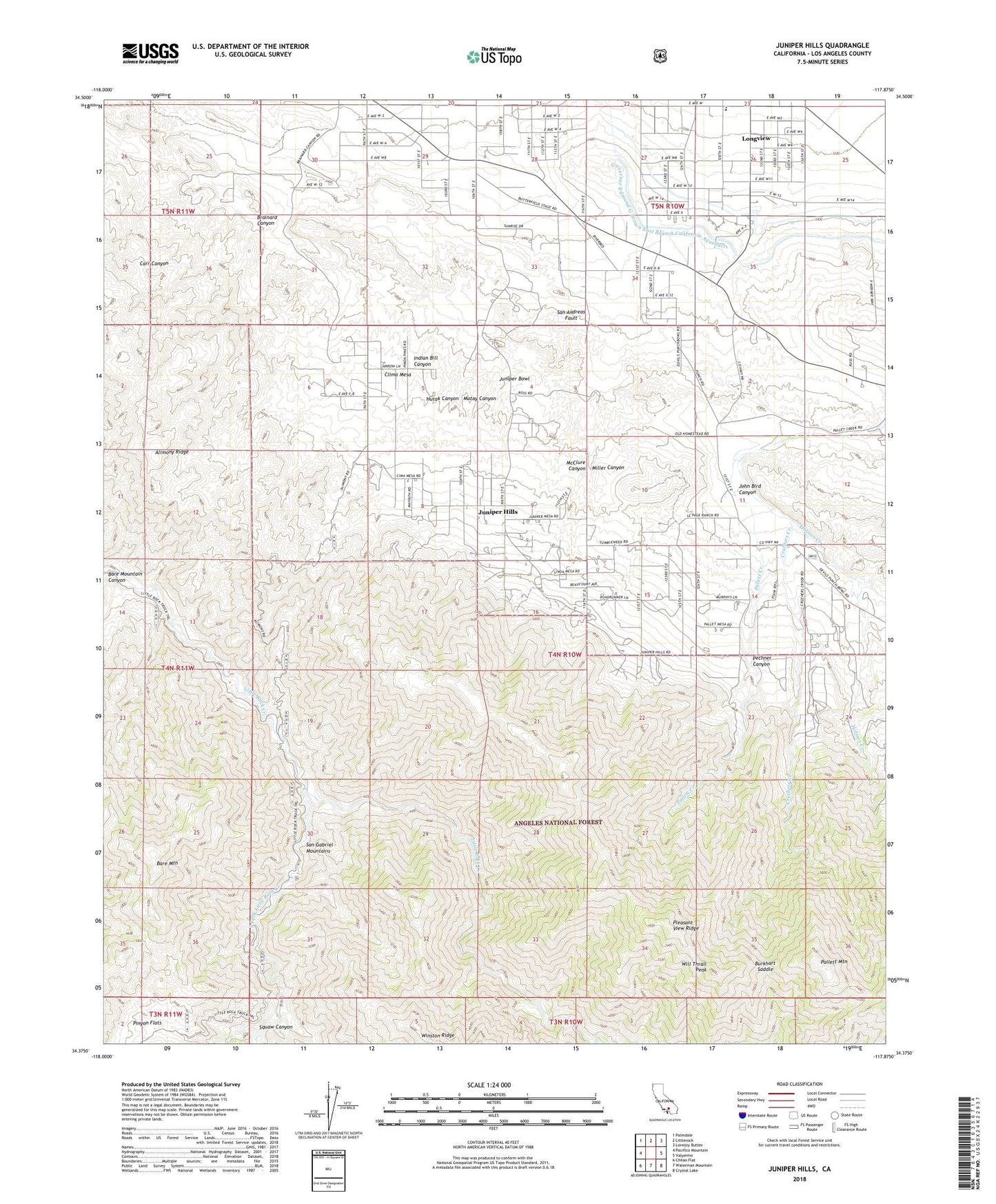
Juniper Hills California US Topo Map
Couldn't load pickup availability
Also explore the Juniper Hills Forest Service Topo of this same quad for updated USFS data
2023 topographic map quadrangle Juniper Hills in the state of California. Scale: 1:24000. Based on the newly updated USGS 7.5' US Topo map series, this map is in the following counties: Los Angeles. The map contains contour data, water features, and other items you are used to seeing on USGS maps, but also has updated roads and other features. This is the next generation of topographic maps. Printed on high-quality waterproof paper with UV fade-resistant inks.
Quads adjacent to this one:
West: Pacifico Mountain
Northwest: Palmdale
North: Littlerock
Northeast: Lovejoy Buttes
East: Valyermo
Southeast: Crystal Lake
South: Waterman Mountain
Southwest: Chilao Flat
This map covers the same area as the classic USGS quad with code o34117d8.
Contains the following named places: Aldrich Ranch, Alimony Ridge, Bare Mountain, Bare Mountain Canyon, Brainard Canyon, Burkhart Ranch, Burkhart Saddle, Burkhart Trail, Clima Mesa, Cobbleita Ranch, Cruthers Creek, East Ranch, Fort Tejon Siphon, Holmes Creek, Hutak Canyon, Indian Bill Canyon, John Bird Canyon, Juniper Bowl, Juniper Hills, Juniper Hills Park, Little Cedars Campground, Little Sycamore Campground, Longview, Matay Canyon, McClure Canyon, Miller Canyon, Moss Spring, Pallett Mountain, Pechner Canyon, Pinyon Flats, Pleasant View Ridge Wilderness, Saunders Ranch, South Antelope Valley Division, South Fork Little Rock Creek, Squaw Canyon, Stanton Ranch, Sycamore Campground, Watkins Creek, Will Thrall Peak, ZIP Codes: 93543, 93553