MyTopo
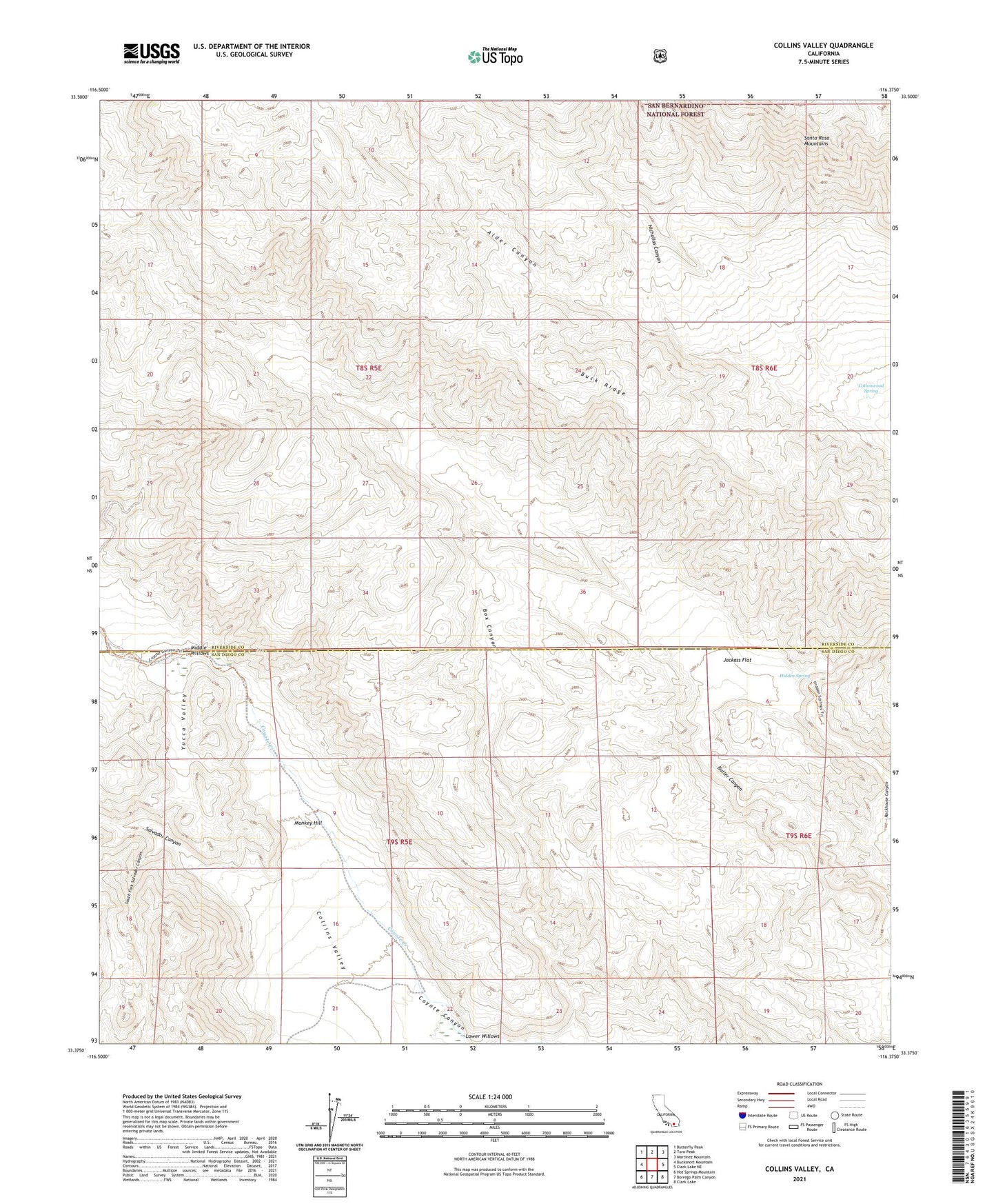
Collins Valley California US Topo Map
Couldn't load pickup availability
Also explore the Collins Valley Forest Service Topo of this same quad for updated USFS data
2021 topographic map quadrangle Collins Valley in the state of California. Scale: 1:24000. Based on the newly updated USGS 7.5' US Topo map series, this map is in the following counties: Riverside, San Diego. The map contains contour data, water features, and other items you are used to seeing on USGS maps, but also has updated roads and other features. This is the next generation of topographic maps. Printed on high-quality waterproof paper with UV fade-resistant inks.
Quads adjacent to this one:
West: Bucksnort Mountain
Northwest: Butterfly Peak
North: Toro Peak
Northeast: Martinez Mountain
East: Clark Lake NE
Southeast: Clark Lake
South: Borrego Palm Canyon
Southwest: Hot Springs Mountain
This map covers the same area as the classic USGS quad with code o33116d4.
Contains the following named places: Alder Canyon, Anza Trail, Buck Ridge, Cottonwood Spring, Coyote Canyon Cultural Preserve, Dry Wash, Hidden Spring, Jackass Flat, Lower Willows, Middle Willows, Monkey Hill, Nicholias Canyon, Salvador Canyon, South Fork Salvador Canyon, Yucca Valley