MyTopo
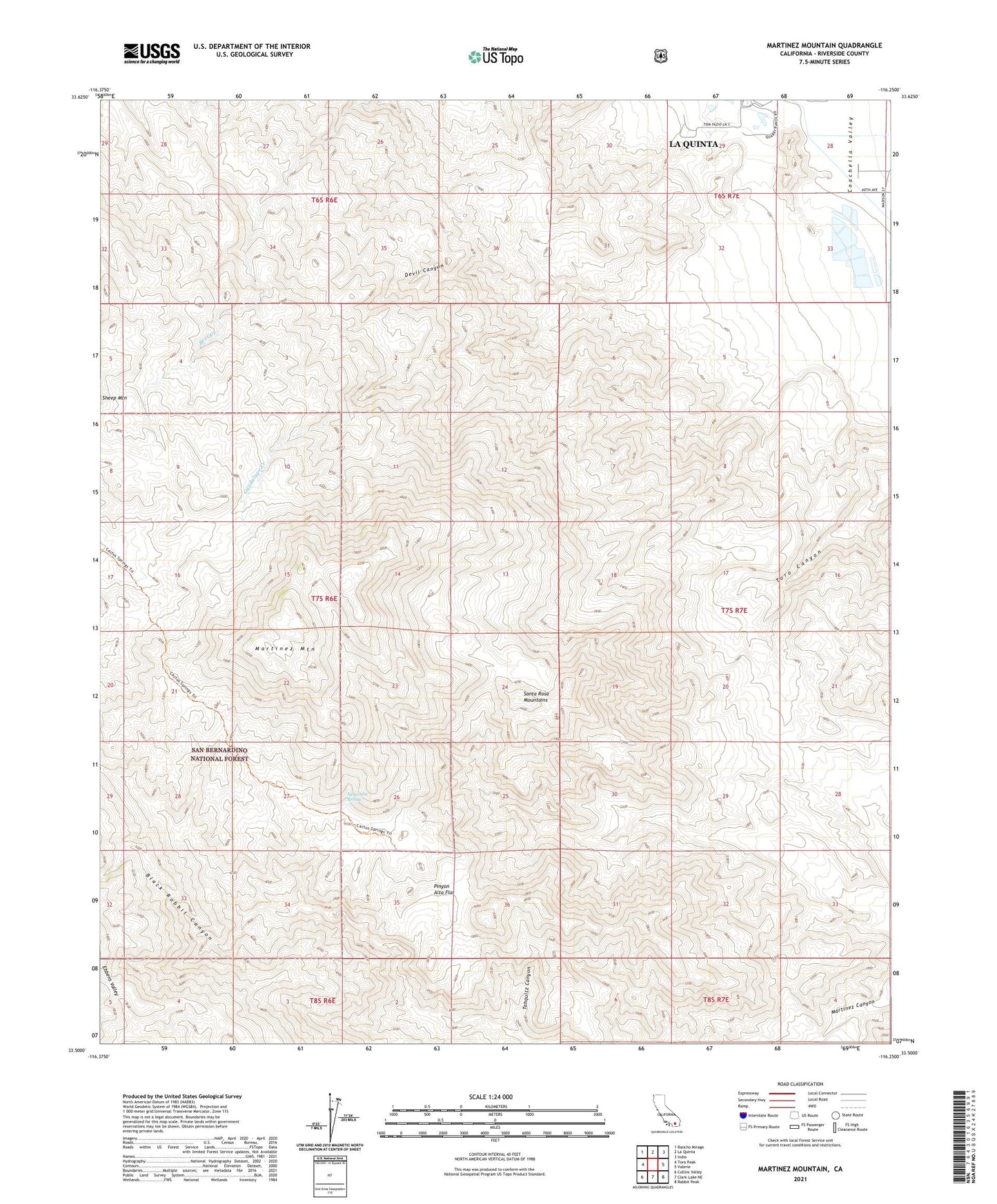
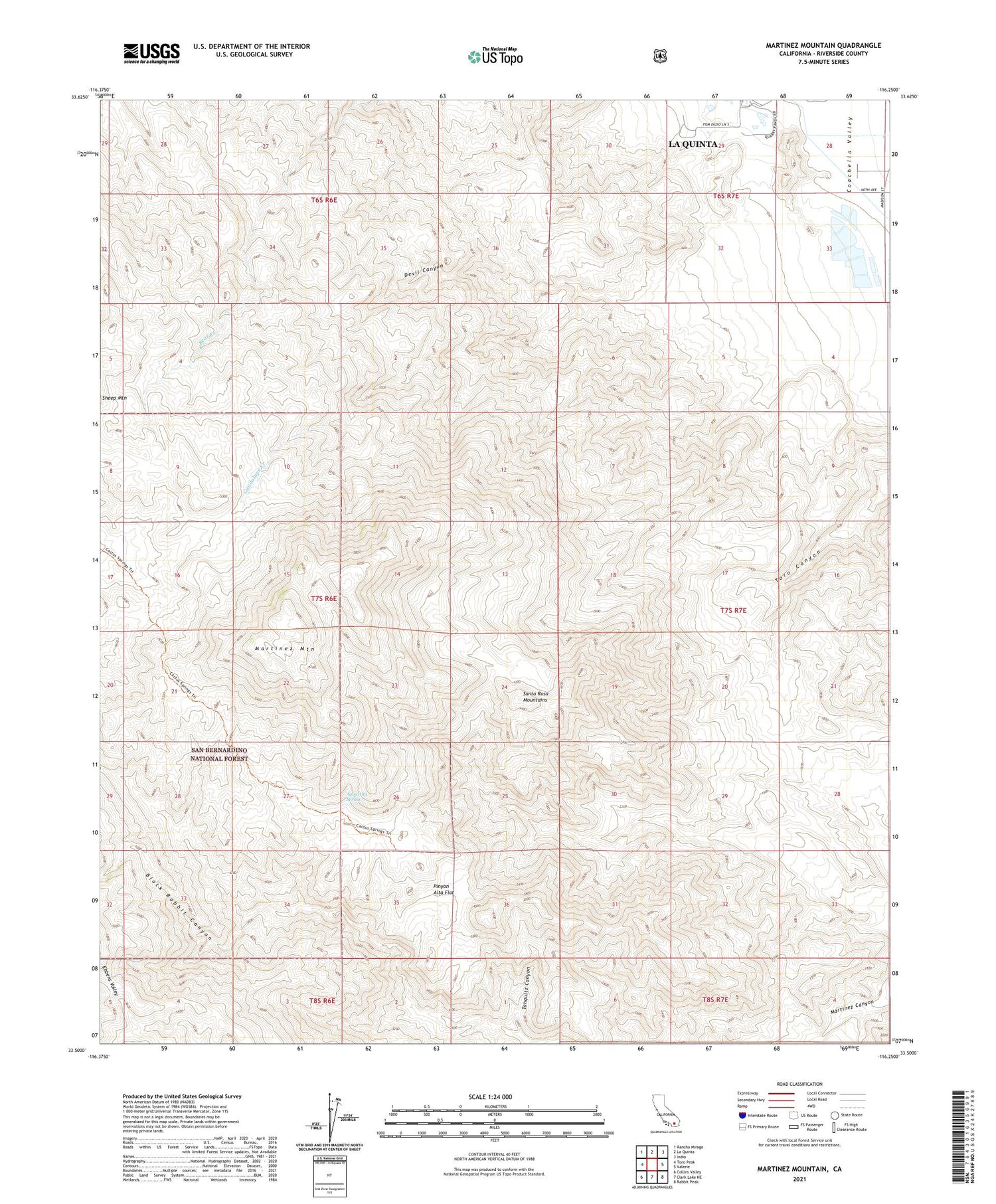
Martinez Mountain California US Topo Map
Couldn't load pickup availability
Also explore the Martinez Mountain Forest Service Topo of this same quad for updated USFS data
2021 topographic map quadrangle Martinez Mountain in the state of California. Scale: 1:24000. Based on the newly updated USGS 7.5' US Topo map series, this map is in the following counties: Riverside. The map contains contour data, water features, and other items you are used to seeing on USGS maps, but also has updated roads and other features. This is the next generation of topographic maps. Printed on high-quality waterproof paper with UV fade-resistant inks.
Quads adjacent to this one:
West: Toro Peak
Northwest: Rancho Mirage
North: La Quinta
Northeast: Indio
East: Valerie
Southeast: Rabbit Peak
South: Clark Lake NE
Southwest: Collins Valley
This map covers the same area as the classic USGS quad with code o33116e3.
Contains the following named places: Agua Alta Spring, Black Rabbit Canyon, Cactus Spring Trail, Casa de Cuerva, Devil Canyon, Ebbens Valley, Guadalupe Creek, Lake Cahuilla County Park, Martinez Mountain, Pinyon Alta Flat, Santa Rosa Wilderness, Tahquitz Canyon