MyTopo
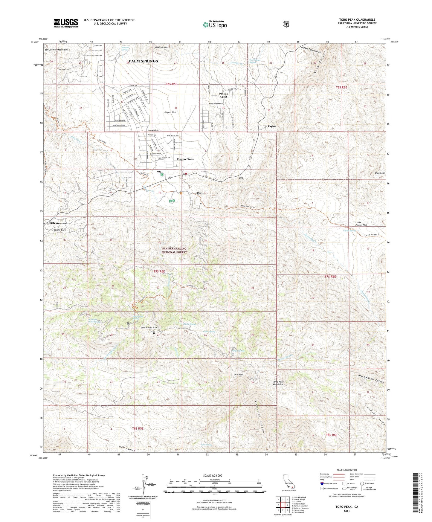
Toro Peak California US Topo Map
Couldn't load pickup availability
Also explore the Toro Peak Forest Service Topo of this same quad for updated USFS data
2021 topographic map quadrangle Toro Peak in the state of California. Scale: 1:24000. Based on the newly updated USGS 7.5' US Topo map series, this map is in the following counties: Riverside. The map contains contour data, water features, and other items you are used to seeing on USGS maps, but also has updated roads and other features. This is the next generation of topographic maps. Printed on high-quality waterproof paper with UV fade-resistant inks.
Quads adjacent to this one:
West: Butterfly Peak
Northwest: Palm View Peak
North: Rancho Mirage
Northeast: La Quinta
East: Martinez Mountain
Southeast: Clark Lake NE
South: Collins Valley
Southwest: Bucksnort Mountain
This map covers the same area as the classic USGS quad with code o33116e4.
Contains the following named places: Alpine Village, Asbestos Mine, Asbestos Spring, Big Horn Overlook, Cactus Spring, Cedar Spring, Dolomite Mine, Dos Palmas Spring, Garnet Queen Mine, Hidden Palm Canyon, Hidden Palms State Ecological Reserve, Horsethief Creek, Little Pinyon Flat, Mountain Home Spring, Pinyon Crest, Pinyon Flat, Pinyon Flat Campground, Pinyon Pines, Ribbonwood, Riverside County Fire Department Station 30, Santa Rosa Campground, Santa Rosa Mountain, Santa Rosa Spring, Santa Rosa Spring Campground, Sheep Mountain, Spring Crest, Stump Spring, Stump Spring Campground, Taylor, Toro Peak, Toro Spring, Virgin Spring