MyTopo
Zigzag Creek California US Topo Map
Couldn't load pickup availability
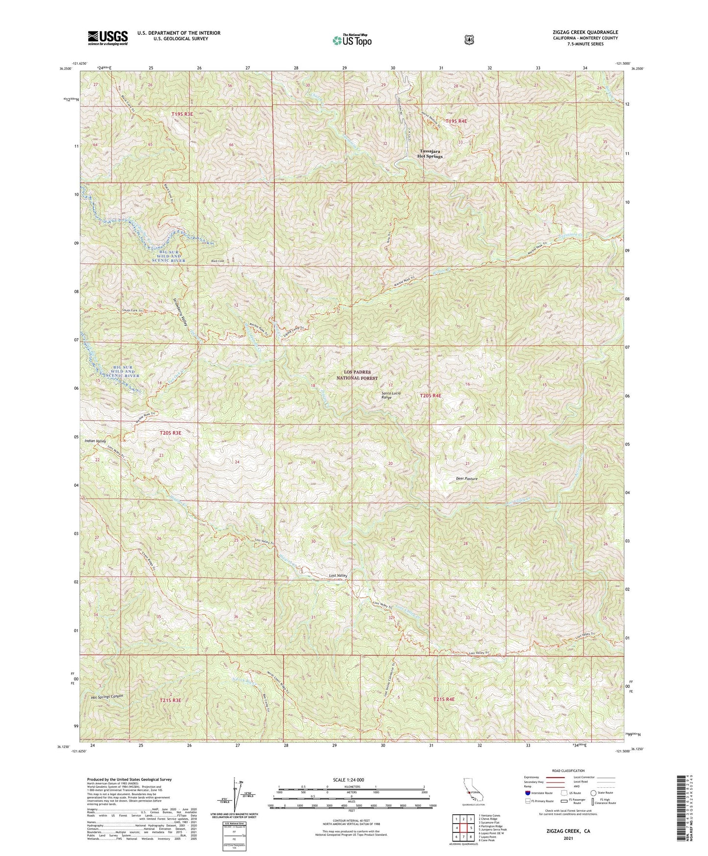
2021 topographic map quadrangle Zigzag Creek in the state of California. Scale: 1:24000. Based on the newly updated USGS 7.5' US Topo map series, this map is in the following counties: Monterey. The map contains contour data, water features, and other items you are used to seeing on USGS maps, but also has updated roads and other features. This is the next generation of topographic maps. Printed on high-quality waterproof paper with UV fade-resistant inks.
Quads adjacent to this one:
West: Partington Ridge
Northwest: Ventana Cones
North: Chews Ridge
Northeast: Sycamore Flat
East: Junipero Serra Peak
Southeast: Cone Peak
South: Lopez Point
Southwest: Lopez Point OE W
Contains the following named places: Bee Camp, Black Cone, Camp Creek, Church Creek, Deer Pasture, Fish Camp, Higgins Camp, Higgins Creek, Horse Pasture, Horse Pasture Camp, Horse Pasture Trail, Hot Springs Trail, Indian Valley, Indian Valley Campground, Lost Valley, Lost Valley Camp, Lost Valley Creek, Lost Valley Trail, Marble Peak Trail, Pelon Campground, Rocky Creek Camp, Shovel Handle Creek, South Fork Trail, Strawberry Camp, Strawberry Valley, Summit Trail, Tan Oak Camp, Tan Oak Creek, Tassajara Creek, Tassajara Creek Campground, Tassajara Hot Springs, Upper Higgins Campground, Ventana Wilderness, Willow Creek, Willow Creek Camp, Zigzag Creek, Zigzag Rustic Campsite