MyTopo
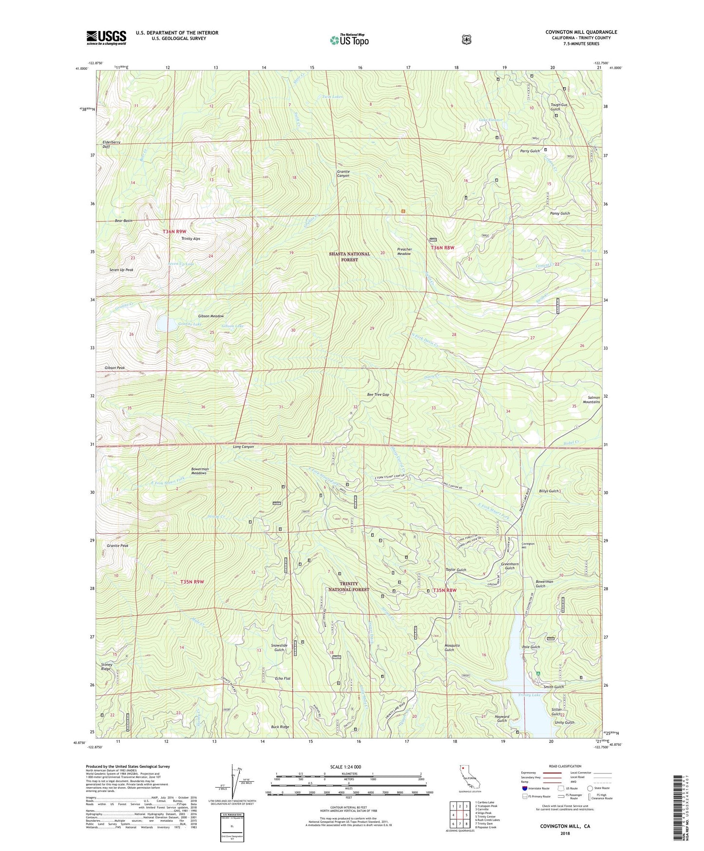
Covington Mill California US Topo Map
Couldn't load pickup availability
Also explore the Covington Mill Forest Service Topo of this same quad for updated USFS data
2021 topographic map quadrangle Covington Mill in the state of California. Scale: 1:24000. Based on the newly updated USGS 7.5' US Topo map series, this map is in the following counties: Trinity. The map contains contour data, water features, and other items you are used to seeing on USGS maps, but also has updated roads and other features. This is the next generation of topographic maps. Printed on high-quality waterproof paper with UV fade-resistant inks.
Quads adjacent to this one:
West: Siligo Peak
Northwest: Caribou Lake
North: Ycatapom Peak
Northeast: Carrville
East: Trinity Center
Southeast: Papoose Creek
South: Trinity Dam
Southwest: Rush Creek Lakes
This map covers the same area as the classic USGS quad with code o40122h7.
Contains the following named places: Alpine View Campground, Bear Basin, Bee Tree Gap, Big Spring, Billys Gulch, Bowerman Boat Launching Ramp, Bowerman Gulch, Bowerman Meadows, Bowermans Ranch, Buck Ridge, Cement Creek, Coffee Ditch, Covington Mill, Davis Creek, Diener Ditch, Diener Mine, East Fork Stuart Fork, Echo Flat, Elderberry Duff, Gibson Lake, Gibson Meadow, Gibson Peak, Granite Canyon, Granite Creek, Granite Lake, Granite Peak, Greenhorn Gulch, Hayward Gulch, Heath Ranch, Hobel Creek, Lake Eleanor, Long Canyon, Long Canyon Trailhead Parking, Mosquito Gulch, North Fork Davis Creek, Pansy Mine, Pole Gulch, Preacher Meadow, Seven Up Lake, Sheep Corral Creek, Smith Gulch, Snowslide Gulch, Steer Creek, Stiller Gulch, Strope Creek, Taylor Gulch, Twin Lakes, Unity Gulch, Weaverville Division