
MyTopo
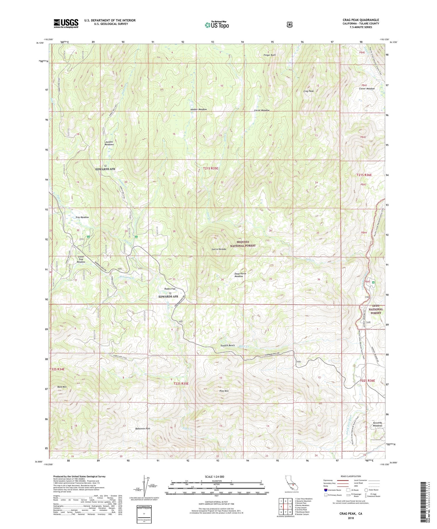
Crag Peak California US Topo Map
Couldn't load pickup availability
Also explore the Crag Peak Forest Service Topo of this same quad for updated USFS data
2021 topographic map quadrangle Crag Peak in the state of California. Scale: 1:24000. Based on the newly updated USGS 7.5' US Topo map series, this map is in the following counties: Tulare. The map contains contour data, water features, and other items you are used to seeing on USGS maps, but also has updated roads and other features. This is the next generation of topographic maps. Printed on high-quality waterproof paper with UV fade-resistant inks.
Quads adjacent to this one:
West: Bonita Meadows
Northwest: Casa Vieja Meadows
North: Monache Mountain
Northeast: Haiwee Pass
East: Long Canyon
Southeast: Sacatar Canyon
South: Rockhouse Basin
Southwest: Sirretta Peak
This map covers the same area as the classic USGS quad with code o36118a2.
Contains the following named places: Bakeoven Pass, Bitter Creek, Clover Meadow, Corral Meadow, Crag Peak, Dead Horse Meadow, Finger Rock, Fish Creek Campground, Hooker Meadow, Jackass Creek, Jackass Meadows, Kennedy Meadows, Kennedy Meadows Campground, Little Troy Meadow, Lost Creek, Mahogany Creek, Pine Mountain, Rodeo Flat, Sam Lewis Camp, Troy Meadow, Troy Meadow Campground, Tussock Bench, ZIP Code: 93527


