MyTopo
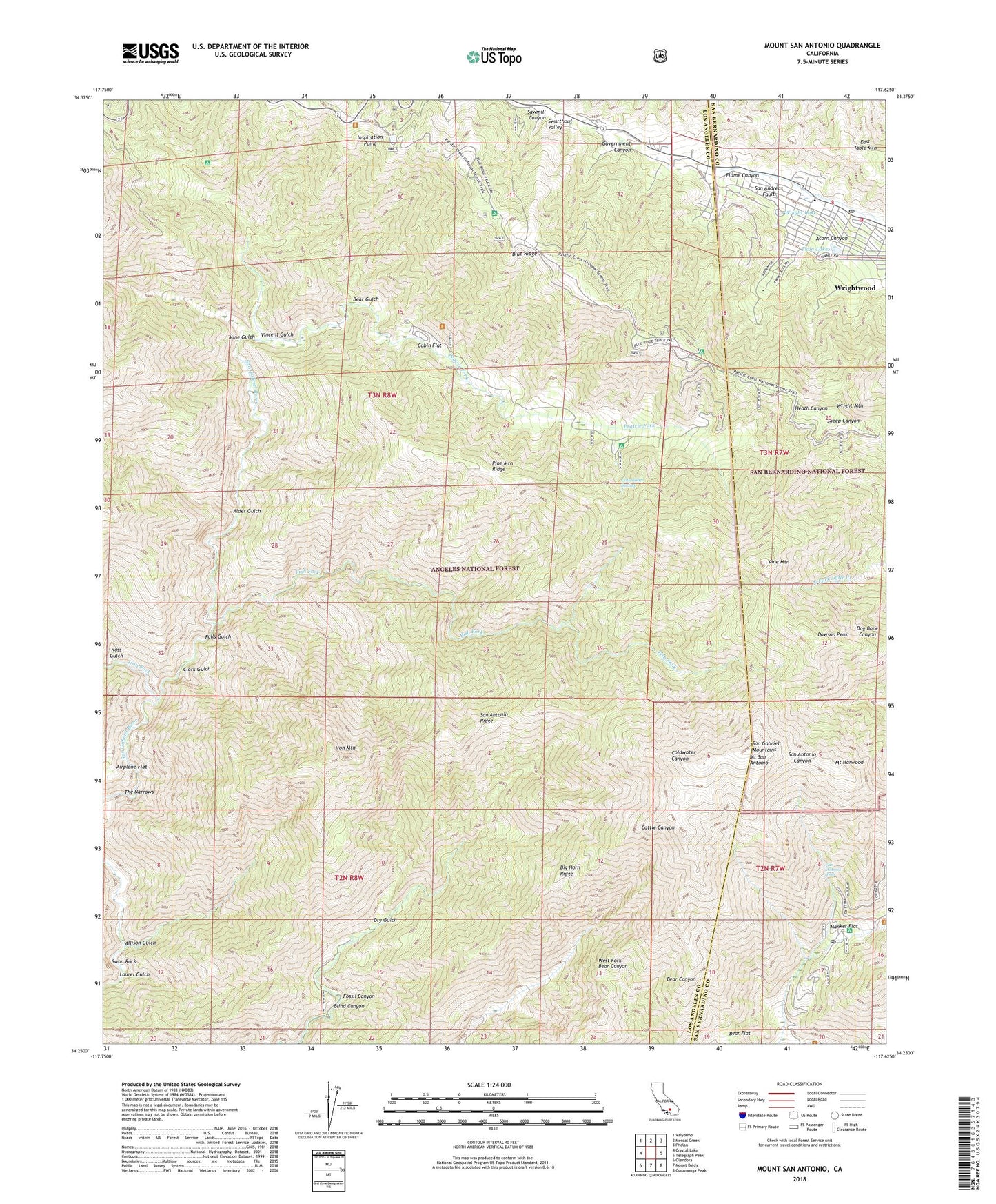
Mount San Antonio California US Topo Map
Couldn't load pickup availability
Also explore the Mount San Antonio Forest Service Topo of this same quad for updated USFS data
2021 topographic map quadrangle Mount San Antonio in the state of California. Scale: 1:24000. Based on the newly updated USGS 7.5' US Topo map series, this map is in the following counties: Los Angeles, San Bernardino. The map contains contour data, water features, and other items you are used to seeing on USGS maps, but also has updated roads and other features. This is the next generation of topographic maps. Printed on high-quality waterproof paper with UV fade-resistant inks.
Quads adjacent to this one:
West: Crystal Lake
Northwest: Valyermo
North: Mescal Creek
Northeast: Phelan
East: Telegraph Peak
Southeast: Cucamonga Peak
South: Mount Baldy
Southwest: Glendora
This map covers the same area as the classic USGS quad with code o34117c6.
Contains the following named places: Acorn Canyon, Airplane Flat, Alder Gulch, Allison Gulch, Allison Mine, Allison Trail, Baldora Mine, Baldy Trail, Bear Flat, Bear Gulch, Big Butch Wash, Big Horn Mine, Big Horn Ridge, Big Pine Station, Blind Canyon, Blue Ridge, Blue Ridge Camp, Blue RIdge Electronic Site, Blue Ridge Ski Lift, Cabin Flat, Cabin Flat Campground, Camp Lupine, Camp Maria Stella, Camp San Antonio, Clark Gulch, Columbine Spring, Dawson Peak, Dawson Peak Trail, Devils Backbone, Dry Gulch, Eagle Mine, East Table Mountain, Falls Gulch, Fish Fork, Fish Fork Camp, Flume Canyon, Fossil Canyon, Glacier Camp, Glacier Picnic Area, Glacier Picnic Ground, Gold Dollar Mine, Gold Ridge Mine, Government Canyon, Guffy Camp, Heaton Flat Trail, Holiday Hill Ski Lift, Inspiration Point, Iron Fork, Iron Fork Camp, Iron Mountain, Junior Republic Camp, Laurel Gulch, Manker Campground, Manker Flat, Mine Gulch, Mine Gulch Camp, Mount Baldy Post Office, Mount Harwood, Mount High East Ski Area, Mount High East Ski Lift, Mount High West Ski Area, Mount High West Ski Lift, Mount San Antonio, Mount View Organizational Camp, Native Son Mine, Pacific Crest Reservoir, Pine Mountain, Pine Mountain Ridge, PL and P Trail, Prairie Fork, Prairie Fork Guard Station, Ross Gulch, San Antonio Falls, San Antonio Ridge, San Bernardino County Fire Department Station 14 Wrightwood, San Gabriel Mountains, Sawmill Canyon, Sheep Mountain Wilderness, Stanley-Miller Mine, Swan Rock, The Narrows, Twin Lakes, Vincent Gulch, Weber Camp, Widco Mine, Widman Ranch, Wright Lake, Wright Mountain, Wrightwood, Wrightwood Census Designated Place, Wrightwood Elementary School, Wrightwood Post Office, ZIP Codes: 91759, 92397