MyTopo
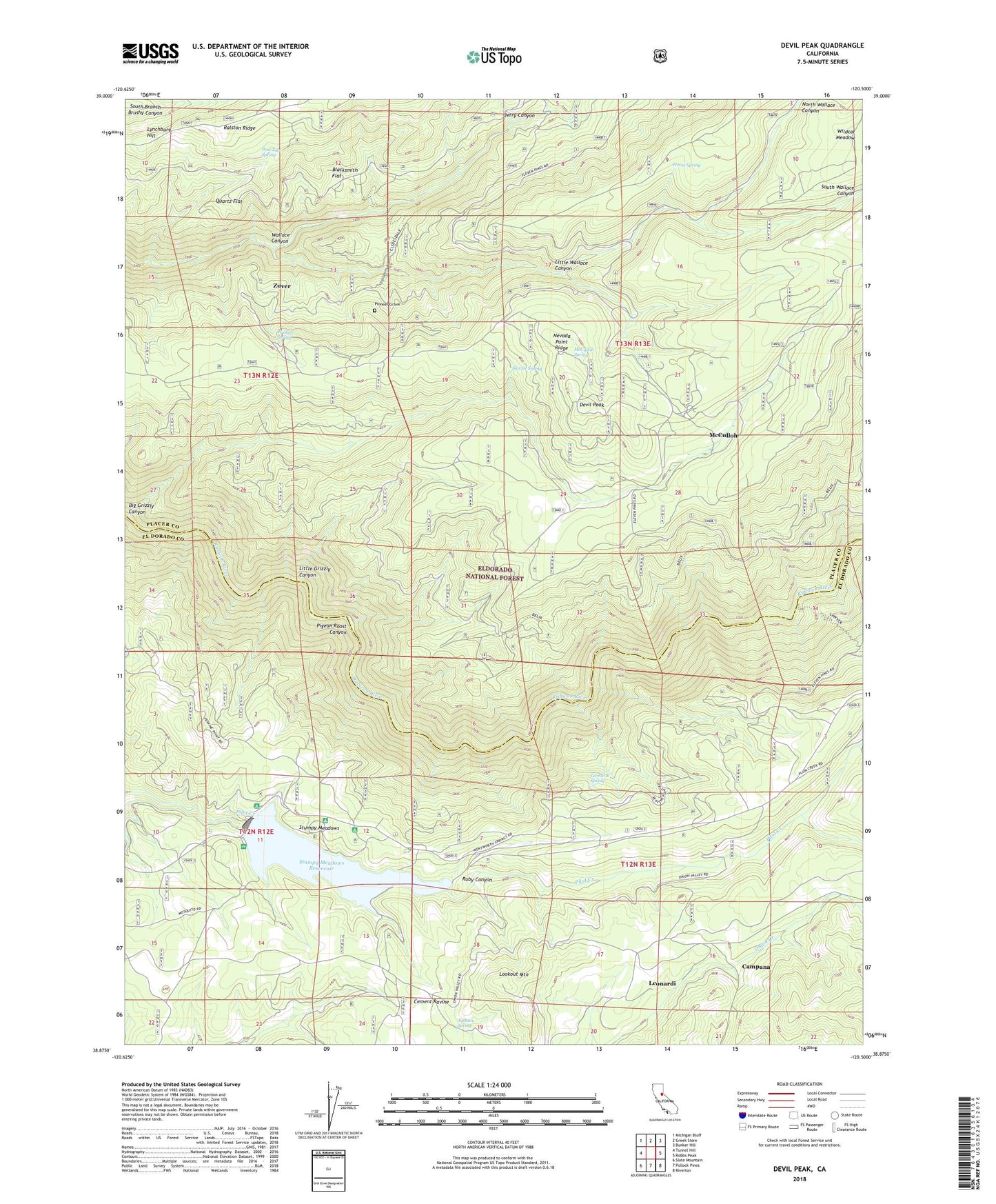
Devil Peak California US Topo Map
Couldn't load pickup availability
Also explore the Devil Peak Forest Service Topo of this same quad for updated USFS data
2021 topographic map quadrangle Devil Peak in the state of California. Scale: 1:24000. Based on the newly updated USGS 7.5' US Topo map series, this map is in the following counties: Placer, El Dorado. The map contains contour data, water features, and other items you are used to seeing on USGS maps, but also has updated roads and other features. This is the next generation of topographic maps. Printed on high-quality waterproof paper with UV fade-resistant inks.
Quads adjacent to this one:
West: Tunnel Hill
Northwest: Michigan Bluff
North: Greek Store
Northeast: Bunker Hill
East: Robbs Peak
Southeast: Riverton
South: Pollock Pines
Southwest: Slate Mountain
This map covers the same area as the classic USGS quad with code o38120h5.
Contains the following named places: Belix Trail, Big Grizzly Canyon, Black Oak Campground, Blacksmith Flat, Butcher Corral, Camp Ten, Campana, Clydesdale Mine, Clydesdale Trail, Cockrin Trail, Devil Peak, Eleven Pines, Four Corners, Grizzly Canyon Trail, Horse Spring, Horse Spring Trail, Jackson Spring, Jerry Canyon, Jerrys Pool, Lawyer Trail, Leonardi, Leonardi Spring, Little Grizzly Canyon, Little Wallace Canyon, Long Canyon Trail, Lookout Mountain, Lynchburg Hill, Mark Edson 460-003 Dam, Mark Edson Dam, McCulloh, McCulloh Spring, Nevada Point Ridge, North Wallace Canyon, Pigeon Roost Canyon, Pigeon Roost Mine, Pigeon Roost Trail, Pilot Creek House, Pine Tree Spring, Pioneer Grave, Plum Creek, Quartz Flat, Ramsey Crossing, Ruby Canyon, Sawpit Spring, South Wallace Canyon, Stumpy Meadows, Stumpy Meadows Campground, Stumpy Meadows Lake, Stumpy Meadows Reservoir, Vaughn Cabin, Vista Camp, Vista Overflow Campground, Wallace Canyon, Wallace Spring, Wallace Trail, Wildcat Meadow, Zuver, Zuver Mine