MyTopo
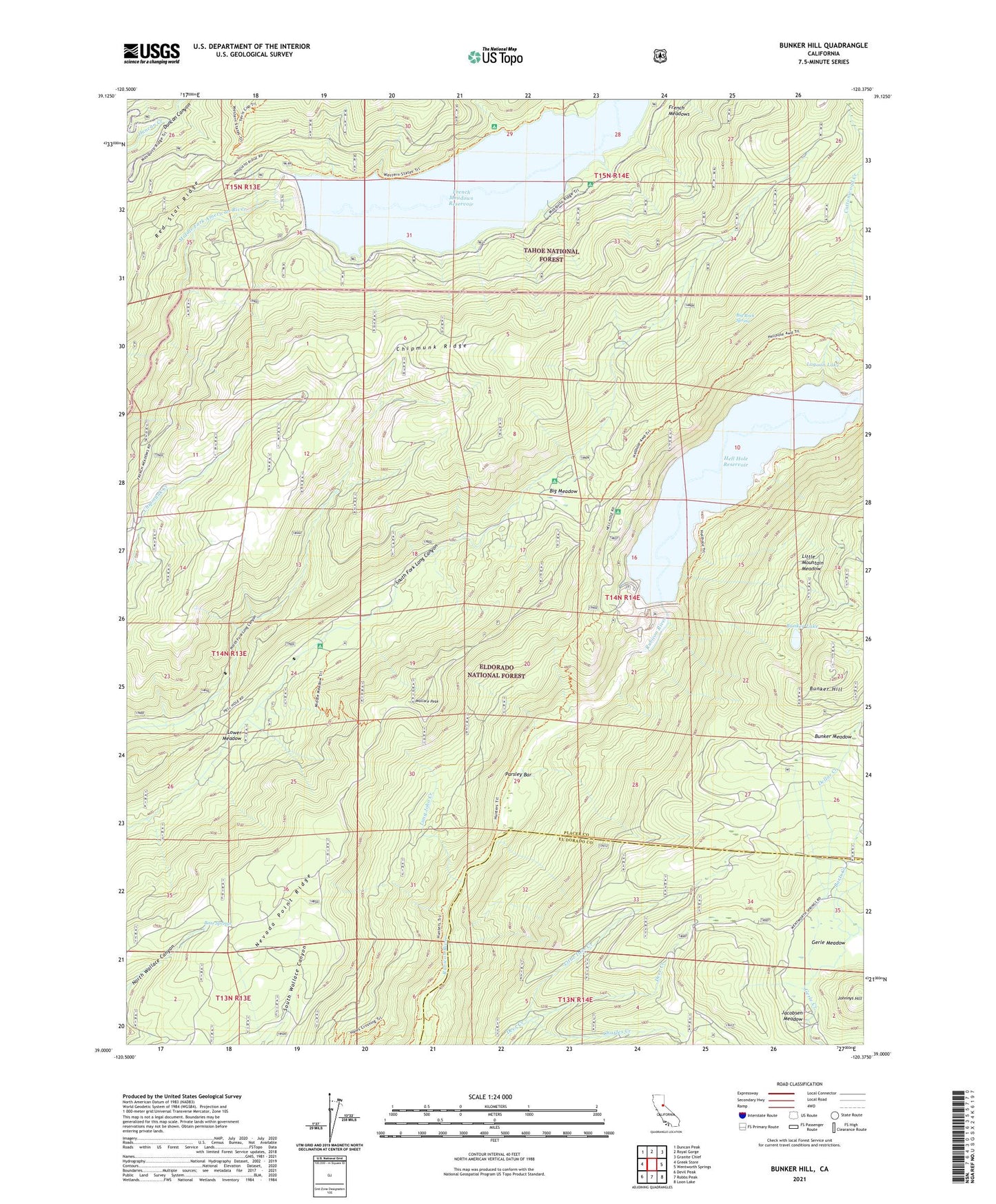
Bunker Hill California US Topo Map
Couldn't load pickup availability
Also explore the Bunker Hill Forest Service Topo of this same quad for updated USFS data
2021 topographic map quadrangle Bunker Hill in the state of California. Scale: 1:24000. Based on the newly updated USGS 7.5' US Topo map series, this map is in the following counties: Placer, El Dorado. The map contains contour data, water features, and other items you are used to seeing on USGS maps, but also has updated roads and other features. This is the next generation of topographic maps. Printed on high-quality waterproof paper with UV fade-resistant inks.
Quads adjacent to this one:
West: Greek Store
Northwest: Duncan Peak
North: Royal Gorge
Northeast: Granite Chief
East: Wentworth Springs
Southeast: Loon Lake
South: Robbs Peak
Southwest: Devil Peak
This map covers the same area as the classic USGS quad with code o39120a4.
Contains the following named places: Barts Creek, Baumann Trail, Bear Springs, Big Meadow, Big Meadows Campground, Big Rock Spring, Bunker Hill, Bunker Lake, Bunker Meadow, Charles Creek, Chipmunk Trail, Cottonwood Creek, Dellar Creek, Dellar Trail, Dewey Campground, Dobbas Cow Camp, French Meadows Boat Ramp and Picnic Area, French Meadows Boat Ramp and Picnic Recreation Site, French Meadows Forest Service Station, French Meadows Guard Station, French Meadows Recreation Site, French Meadows Reservoir, Gerle, Gerle Meadow, Gerle Mineral Spring, Gilberts, Hell Hole Campground, Hell Hole Picnic Ground, Hell Hole Reservoir, Hunters Trail, Jacobsen, Jacobsen Meadow, Johnnys Hill, L L Anderson 1030 Dam, L L Anderson Dam, Lagoon Lake, Lagoon Trail, Lawyer Cow Camp, Little Deer Creek, Little Mountain Meadow, Long John Creek, Lower Hell Hole, Lower Hell Hole 1030-002 Dam, Lower Meadow, McGuire Boat Ramp, McGuire Campground, McGuire Mine, McGuire Picnic and Beach Area, McGuire Picnic and Beach Recreation Site, Middle Meadows Campground, Murry Camp, Parsley Bar, Parsley Bar Crossing, Parsley Bar Trail, Poppy Campground, Red Star Dam, Red Star Mining Ditch, Rubicon Trail, S P Cabin, Wallace Peak