
MyTopo
Devils Punchbowl California US Topo Map
Couldn't load pickup availability
Also explore the Devils Punchbowl Forest Service Topo of this same quad for updated USFS data
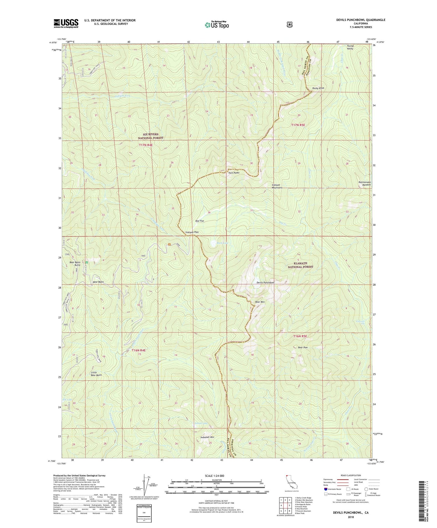
2022 topographic map quadrangle Devils Punchbowl in the state of California. Scale: 1:24000. Based on the newly updated USGS 7.5' US Topo map series, this map is in the following counties: Del Norte, Siskiyou. The map contains contour data, water features, and other items you are used to seeing on USGS maps, but also has updated roads and other features. This is the next generation of topographic maps. Printed on high-quality waterproof paper with UV fade-resistant inks.
Quads adjacent to this one:
West: Hurdygurdy Butte
Northwest: Shelly Creek Ridge
North: Broken Rib Mountain
Northeast: Polar Bear Mountain
East: Preston Peak
Southeast: Bear Peak
South: Prescott Mountain
Southwest: Ship Mountain
This map covers the same area as the classic USGS quad with code o41123g6.
Contains the following named places: Bear Basin, Bear Basin Butte, Bear Mountain, Bear Paw, Buck Lake, Devils Punchbowl, Doe Creek, Doe Flat, Elk Lake, Island Lake, Jedediah Mountain, Little Bear Basin, Prescott Cabin, Preston Creek, Rattlesnake Meadow, Rocky Knob, Siskiyou Mountains, Siskiyou Pass, Trout Camp, Twin Peaks, West Fork Clear Creek, Wilderness Falls


