
MyTopo
Preston Peak California US Topo Map
Couldn't load pickup availability
Also explore the Preston Peak Forest Service Topo of this same quad for updated USFS data
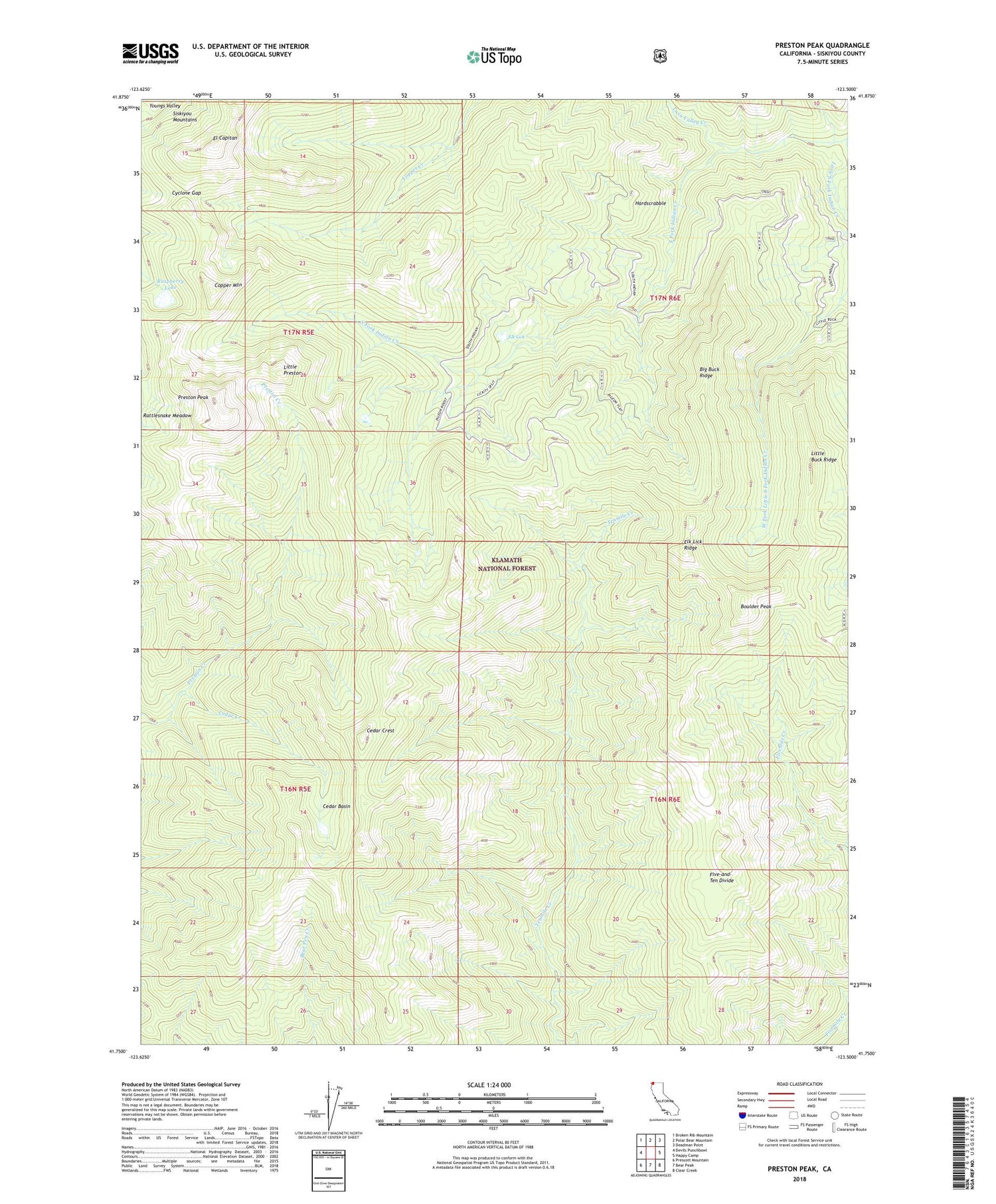
2022 topographic map quadrangle Preston Peak in the state of California. Scale: 1:24000. Based on the newly updated USGS 7.5' US Topo map series, this map is in the following counties: Siskiyou. The map contains contour data, water features, and other items you are used to seeing on USGS maps, but also has updated roads and other features. This is the next generation of topographic maps. Printed on high-quality waterproof paper with UV fade-resistant inks.
Quads adjacent to this one:
West: Devils Punchbowl
Northwest: Broken Rib Mountain
North: Polar Bear Mountain
Northeast: Deadman Point
East: Happy Camp
Southeast: Clear Creek
South: Bear Peak
Southwest: Prescott Mountain
This map covers the same area as the classic USGS quad with code o41123g5.
Contains the following named places: Big Buck Ridge, Boulder Peak, Cedar Basin, Cedar Creek, Cedar Crest, Copper Mountain, Cyclone Gap, El Capitan, Elk Lick, Elk Lick Ridge, Five-and-Ten Divide, Hardscrabble, Little Buck Ridge, Little Preston, Little South Fork Indian Creek, Preston Peak, Raspberry Lake, Twin Valley Creek


