
MyTopo
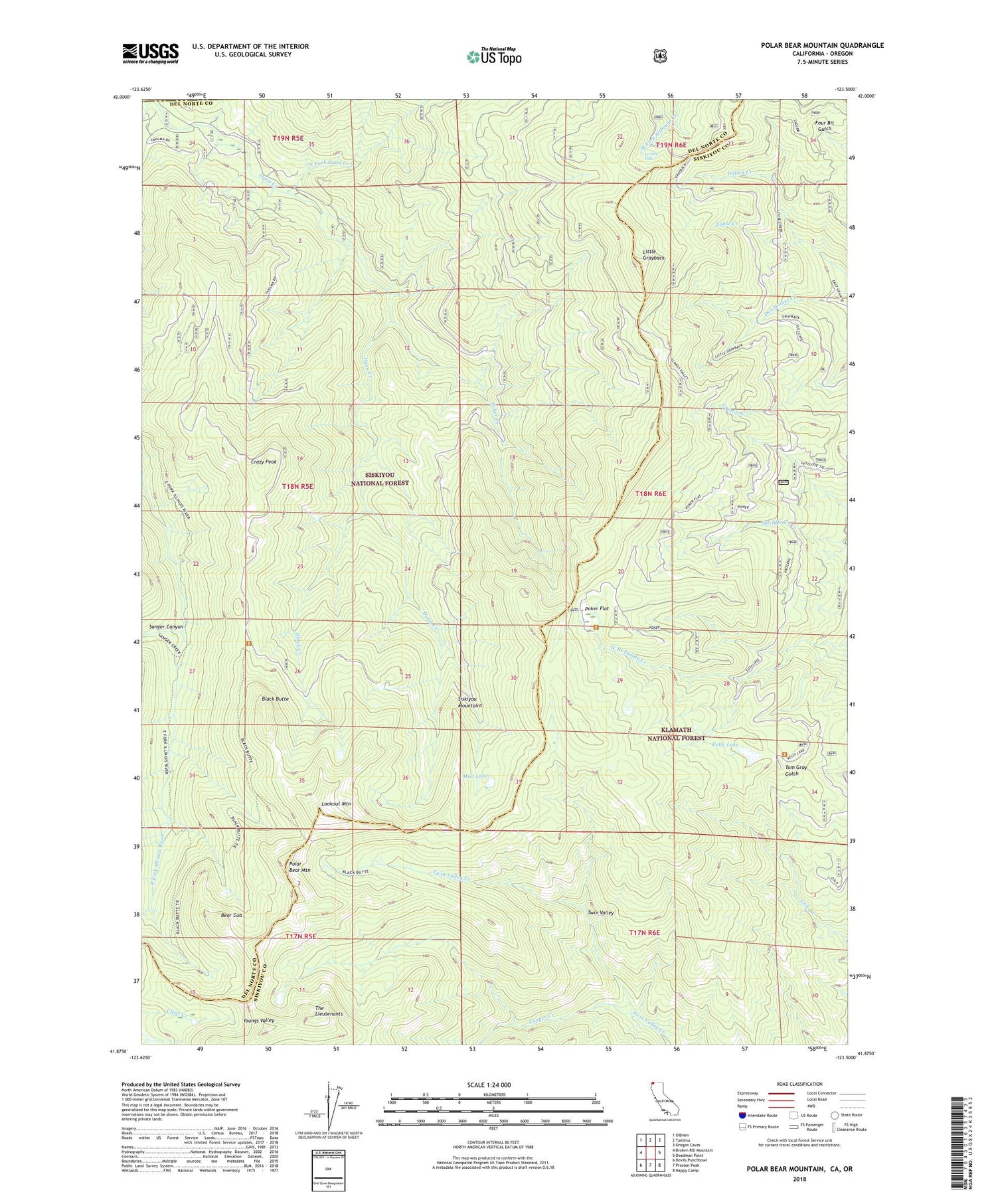
Polar Bear Mountain California US Topo Map
Couldn't load pickup availability
Also explore the Polar Bear Mountain Forest Service Topo of this same quad for updated USFS data
2022 topographic map quadrangle Polar Bear Mountain in the state of California. Scale: 1:24000. Based on the newly updated USGS 7.5' US Topo map series, this map is in the following counties: Del Norte, Siskiyou, Josephine. The map contains contour data, water features, and other items you are used to seeing on USGS maps, but also has updated roads and other features. This is the next generation of topographic maps. Printed on high-quality waterproof paper with UV fade-resistant inks.
Quads adjacent to this one:
West: Broken Rib Mountain
Northwest: O'Brien
North: Takilma
Northeast: Oregon Caves
East: Deadman Point
Southeast: Happy Camp
South: Preston Peak
Southwest: Devils Punchbowl
Contains the following named places: Bear Cub, Bell Echo Camp, Black Butte, Black Creek, Copper Creek, Crazy Peak, Dunn Creek, Kelly Lake, Little Grayback, Lookout Mountain, Loretta Falls, Louse Creek, Mud Lake, North Fork Dunn Creek, Orloff Mine, Packers Creek, Poker Creek, Poker Flat, Polar Bear Mountain, Porters Camp, Sanger Canyon, The Lieutenants, Twin Valley


