MyTopo
Double Point California US Topo Map
Couldn't load pickup availability
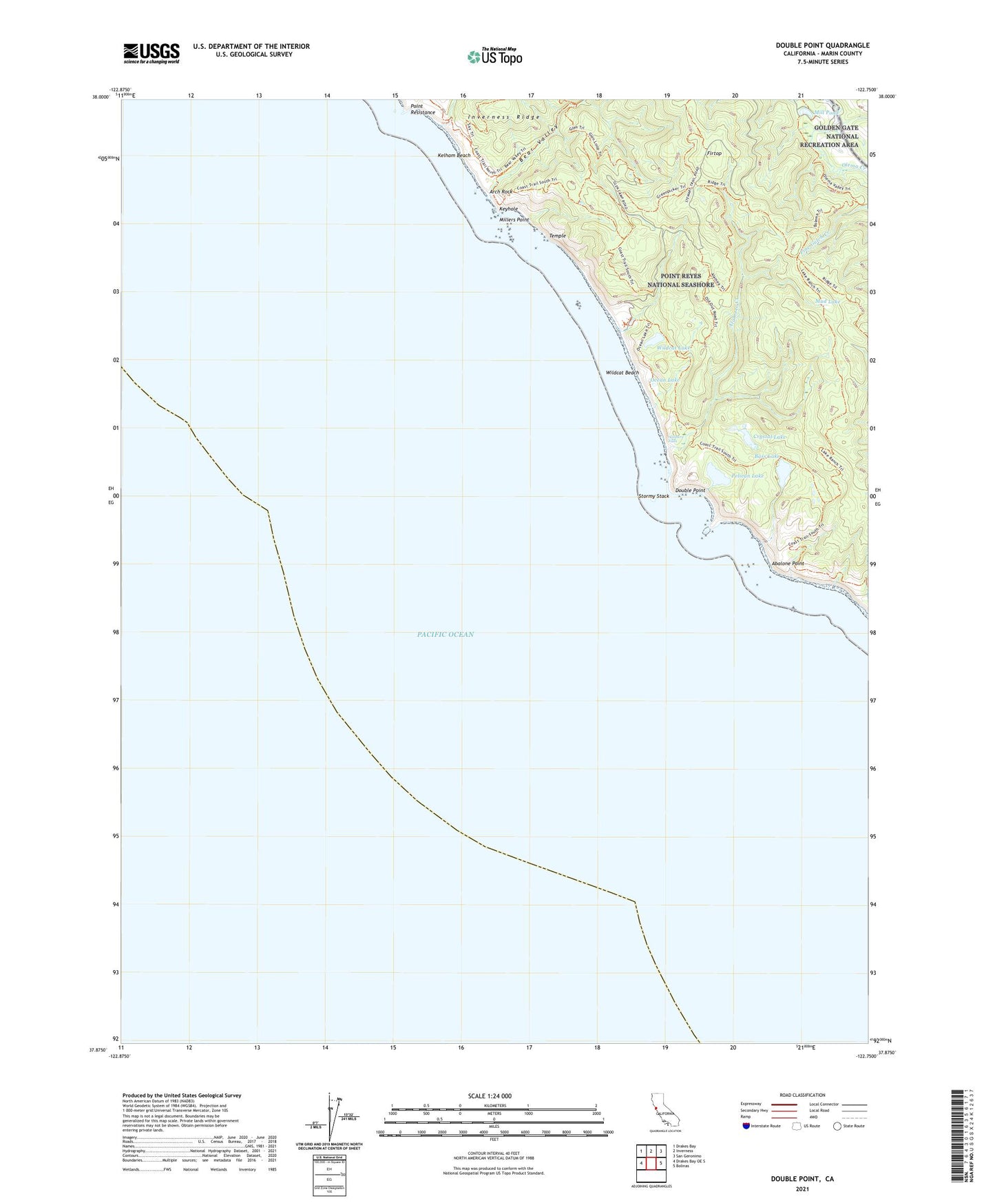
2021 topographic map quadrangle Double Point in the state of California. Scale: 1:24000. Based on the newly updated USGS 7.5' US Topo map series, this map is in the following counties: Marin. The map contains contour data, water features, and other items you are used to seeing on USGS maps, but also has updated roads and other features. This is the next generation of topographic maps. Printed on high-quality waterproof paper with UV fade-resistant inks.
Quads adjacent to this one:
West: Drakes Bay OE S
Northwest: Drakes Bay
North: Inverness
Northeast: San Geronimo
East: Bolinas
This map covers the same area as the classic USGS quad with code o37122h7.
Contains the following named places: Abalone Point, Alamere Creek, Alamere Falls, Arch Rock, Bass Lake, Bear Valley, Bear Valley Dam, Bolema Trail, Coast Creek, Crystal Lake, Double Point, Firtop, Glen Camp Trail, Glen Campground, Glenn Ranch, Highland Trail, Kelham Beach, Keyhole, Lake Ranch, Lake Ranch Trail, Mill Pond, Mill Pond Dam, Millers Point, Mud Lake, Ocean Lake, Ocean Lake Loop, Old Out Road Trail, Pelican Lake, Point Resistance, Stormy Stack, Temple, Wildcat Beach, Wildcat Camp, Wildcat Lake, Wildcat Ranch, Wildcat Trail, Y Ranch