
MyTopo
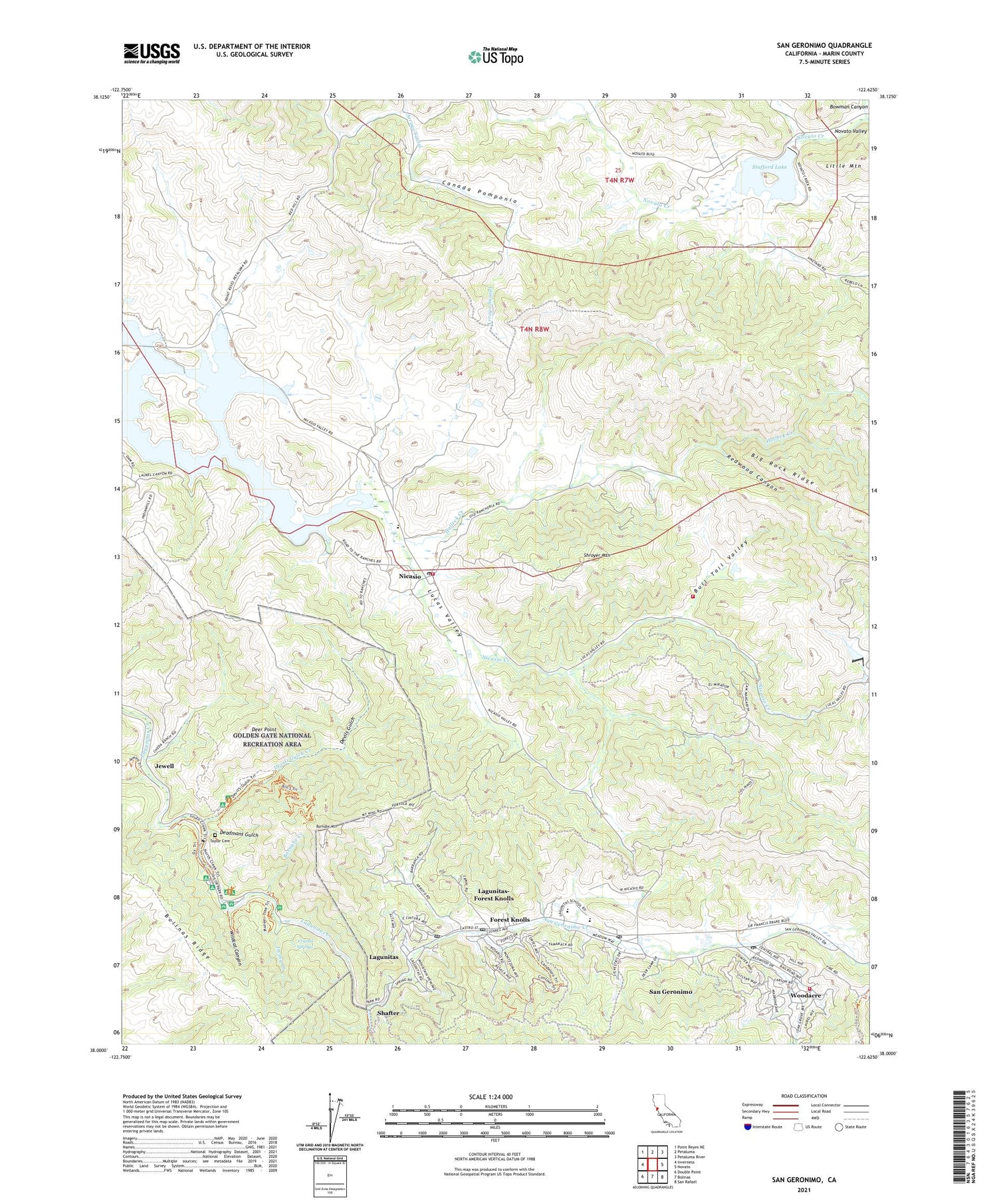
San Geronimo California US Topo Map
Couldn't load pickup availability
2021 topographic map quadrangle San Geronimo in the state of California. Scale: 1:24000. Based on the newly updated USGS 7.5' US Topo map series, this map is in the following counties: Marin. The map contains contour data, water features, and other items you are used to seeing on USGS maps, but also has updated roads and other features. This is the next generation of topographic maps. Printed on high-quality waterproof paper with UV fade-resistant inks.
Quads adjacent to this one:
West: Inverness
Northwest: Point Reyes NE
North: Petaluma
Northeast: Petaluma River
East: Novato
Southeast: San Rafael
South: Bolinas
Southwest: Double Point
This map covers the same area as the classic USGS quad with code o38122a6.
Contains the following named places: Barnabe Creek, Barnabe Mountain, Barnabe Trail, Bills Trail, Bolinas Ridge Fire Trail, Bowman Canyon, Bull Tail Valley, Burdell School, Camp Taylor, Camp Taylor Post Office, Canada Pomponio, Crystal Springs, Deadmans Gulch, Deer Point, Devils Gulch, Devils Gulch Creek, Devils Gulch Horse Camp, Forest Knolls, Forest Knolls Post Office, Halleck Creek, Indian Tree Preserve, Indian Valley Golf Course, Irving, Irving Creek, Irving Group Picnic Area, Jewell, Lafranchi Quarry, Lagunitas, Lagunitas Post Office, Lagunitas School, Lagunitas-Forest Knolls Census Designated Place, Little Mountain, Lower Campground, Lucas Valley, Madrone Group Area Campground, Mailliard, Marin County, Marin County Fire Department Woodacre Station, Maurice Thorner Memorial Preserve, Nicasio, Nicasio Census Designated Place, Nicasio Elementary School, Nicasio Post Office, Nicasio Reservoir, Nicasio Volunteer Fire Protection District, North Creek Trail, Novato Creek Dam, Ox Trail, Pacheco School, Pioneer Tree Trail, Redwood Canyon, Redwood Grove Picnic Area, Ridge Trail, Roys Redwoods Preserve, Samuel P Taylor State Park Office, Samuel P. Taylor State Park, San Geronimo, San Geronimo Census Designated Place, San Geronimo Creek, San Geronimo National Golf Course, San Geronimo Post Office, San Geronimo Valley Branch Marin County Free Library, San Geronimo Valley Elementary School, Shafter, Shafter Bridge, Shroyer Mountain, Skywalker Ranch Fire Brigade, Stafford County Park, Stafford Lake, Stairstep Falls Trail, Sunset Corral, Taylor Cemetery, Taylorville, Tocaloma School, Upper Campground, Wildcat Canyon, Woodacre, Woodacre Census Designated Place, Woodacre Post Office, ZIP Codes: 94933, 94938, 94946, 94947, 94963, 94973


