MyTopo
Valyermo California US Topo Map
Couldn't load pickup availability
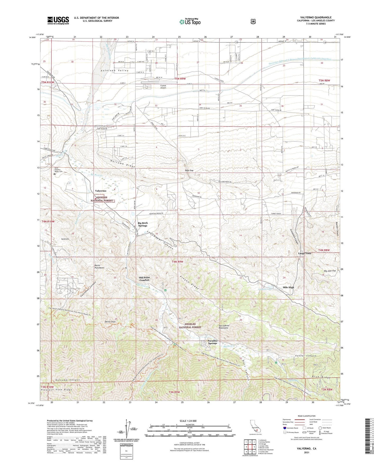
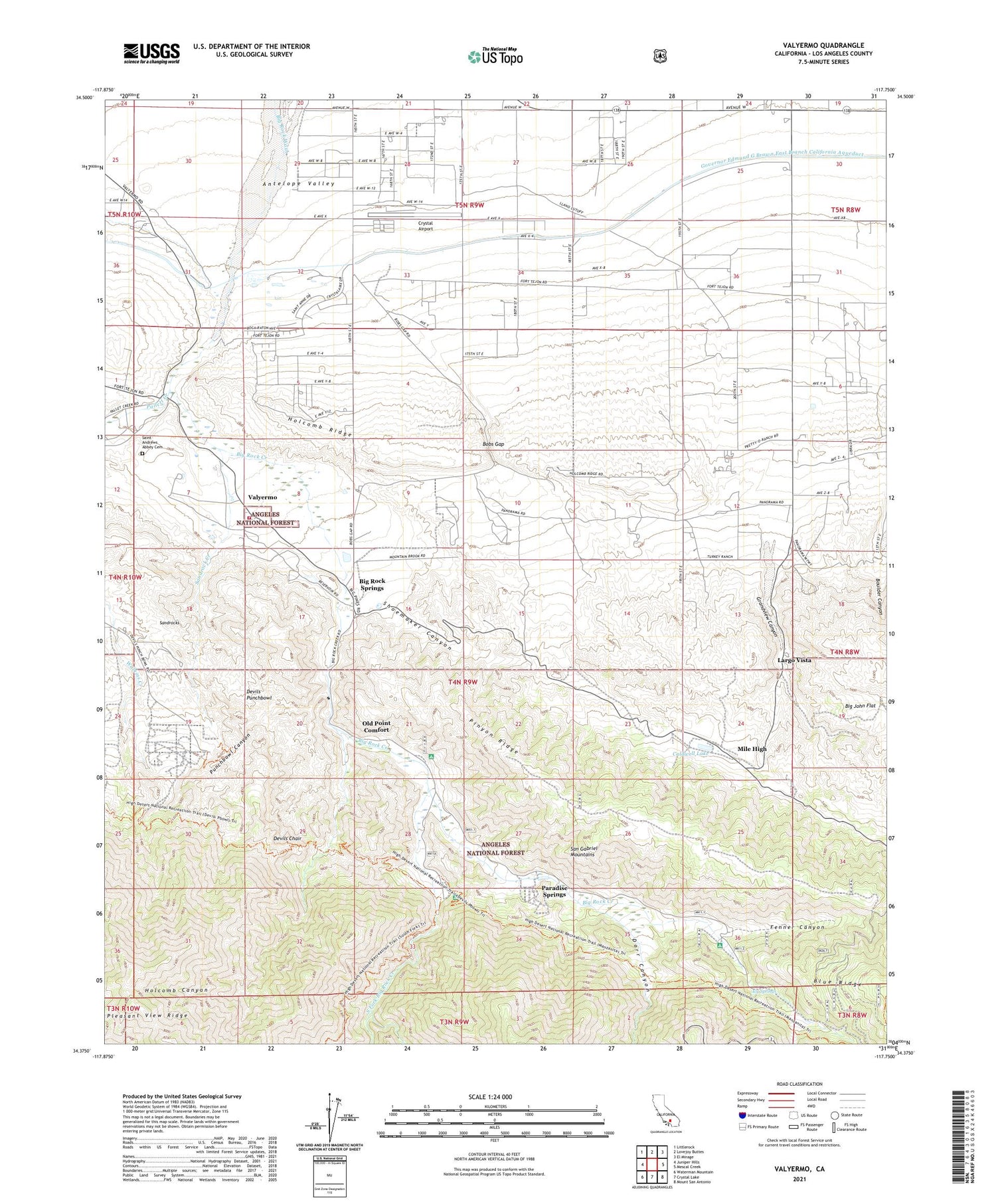
2021 topographic map quadrangle Valyermo in the state of California. Scale: 1:24000. Based on the newly updated USGS 7.5' US Topo map series, this map is in the following counties: Los Angeles. The map contains contour data, water features, and other items you are used to seeing on USGS maps, but also has updated roads and other features. This is the next generation of topographic maps. Printed on high-quality waterproof paper with UV fade-resistant inks.
Quads adjacent to this one:
West: Juniper Hills
Northwest: Littlerock
North: Lovejoy Buttes
Northeast: El Mirage
East: Mescal Creek
Southeast: Mount San Antonio
South: Crystal Lake
Southwest: Waterman Mountain
This map covers the same area as the classic USGS quad with code o34117d7.
Contains the following named places: Big Rock Campground, Big Rock Creek, Big Rock Patrol Station, Big Rock Ranch, Big Rock Siphon, Big Rock Springs, Bobs Gap, Boulder Canyon, Caldwell Lake, Country Mobile Estates, Crystal Airport, Crystalaire Country Club, Devils Chair, Devils Punchbowl, Devils Punchbowl County Park, Dorr Canyon, Fenner Canyon, Grandview Canyon, Holcomb Canyon, Holcomb Ridge, Icy Springs, Largo Vista, Llano Race Track, Los Angeles County Camp Farmer, McFarland Ranch, Mile High, Mile High Ranch, Mountain Brook Ranch, Old Point Comfort, Pallett Creek, Pallett Ranch, Paradise Springs, Pinyon Ridge, Pleasant View Ridge, Punchbowl Canyon, Punchbowl Trail, Saint Andrews Abbey, Sandrock Creek, Sandrocks, Shoemaker Canyon, South Fork Big Rock Creek, South Fork Campground, Sycamore Flat Campground, United States Forest Service Angeles National Forest Station Valyermo, Valyermo, Valyermo Post Office, Valyermo Ranch, Valyermo Ranger Station, ZIP Codes: 93544, 93563