
MyTopo
Lake Pillsbury California US Topo Map
Couldn't load pickup availability
Also explore the Lake Pillsbury Forest Service Topo of this same quad for updated USFS data
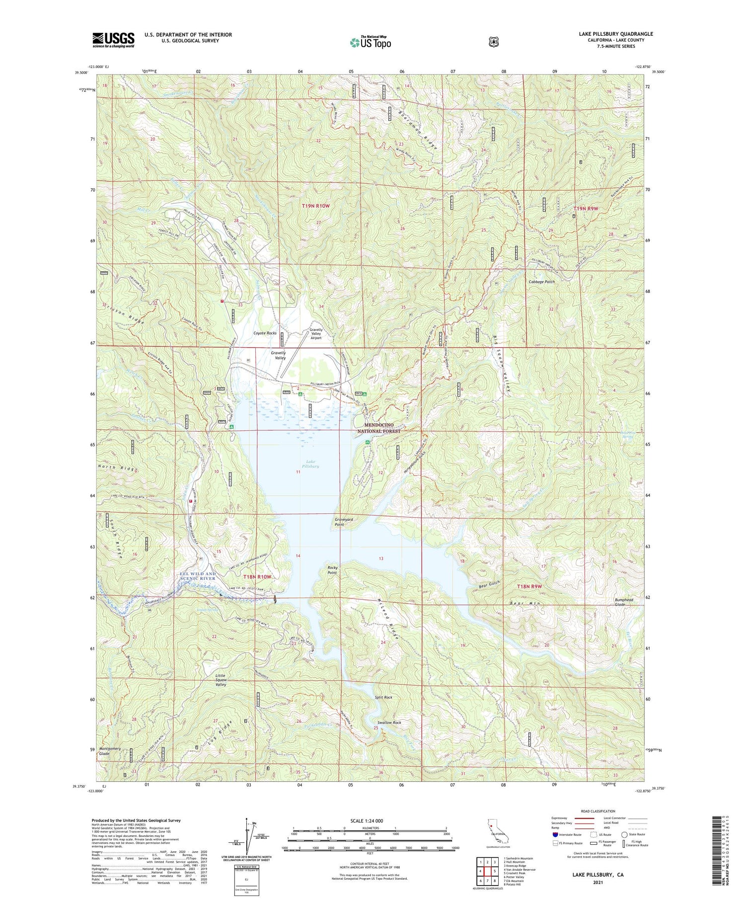
2023 topographic map quadrangle Lake Pillsbury in the state of California. Scale: 1:24000. Based on the newly updated USGS 7.5' US Topo map series, this map is in the following counties: Lake. The map contains contour data, water features, and other items you are used to seeing on USGS maps, but also has updated roads and other features. This is the next generation of topographic maps. Printed on high-quality waterproof paper with UV fade-resistant inks.
Quads adjacent to this one:
West: Van Arsdale Reservoir
Northwest: Sanhedrin Mountain
North: Hull Mountain
Northeast: Kneecap Ridge
East: Crockett Peak
Southeast: Potato Hill
South: Elk Mountain
Southwest: Potter Valley
This map covers the same area as the classic USGS quad with code o39122d8.
Contains the following named places: Bear Gulch, Bear Mountain, Benmore Creek, Big Squaw Valley, Boardman Camp, Boardman Creek, Bumphead Glade, Cabbage Patch, Coyote Rocks, Dead Cow Spring, Deer Creek, Faraway Ranch, Fuller Creek, Fuller Ranch, Gravelly Valley, Gravelly Valley Airport, Gravelly Valley Work Center, Graveyard Point, Horsepasture Gulch, Lake Pillsbury, Lake Pillsbury Fire Protection District, Lake Pillsbury Pines Resort, Lake Pillsbury Ranch, Lake Pillsbury Resort, Little Squaw Valley, Logan Spring, McLeod Ridge, Mill Creek, Montgomery Glade, North Ridge, Oak Flat Campground, Packsaddle Creek, Panther Creek, Pogie Point Campground, Rice Fork, Rice Fork Summer Homes, Rocky Point, Salmon Creek, Salt Spring Creek, Scott Dam, Smokehouse Creek, Soda Creek, Soda Creek Resort, Soda Creek Station, Split Rock, Squaw Valley Creek, Sunset Point Campground, Swallow Rock, Thistle Glade Creek, Thistle Glenn Camp, Welch Creek, Willow Creek


