MyTopo
Van Arsdale Reservoir California US Topo Map
Couldn't load pickup availability
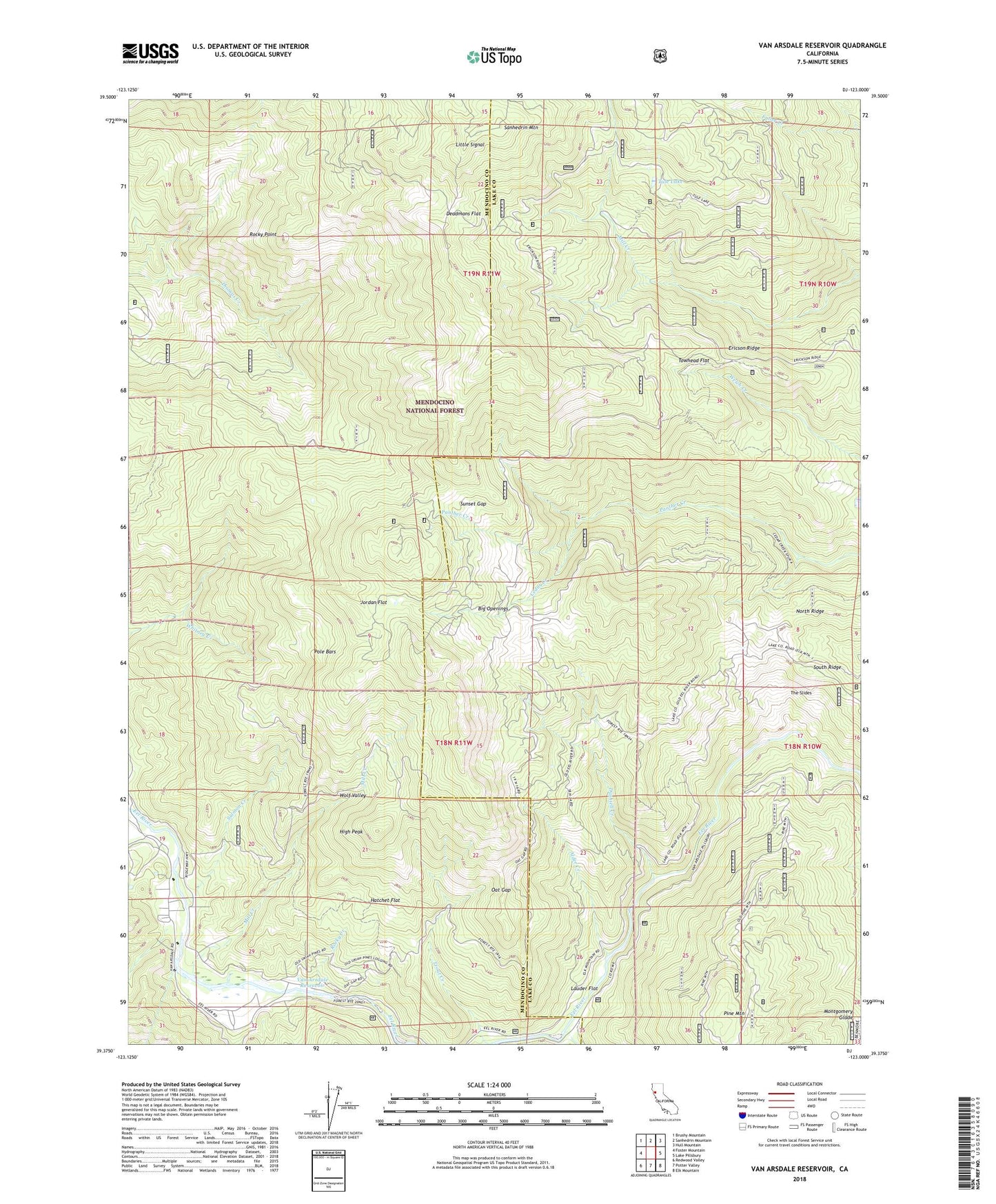
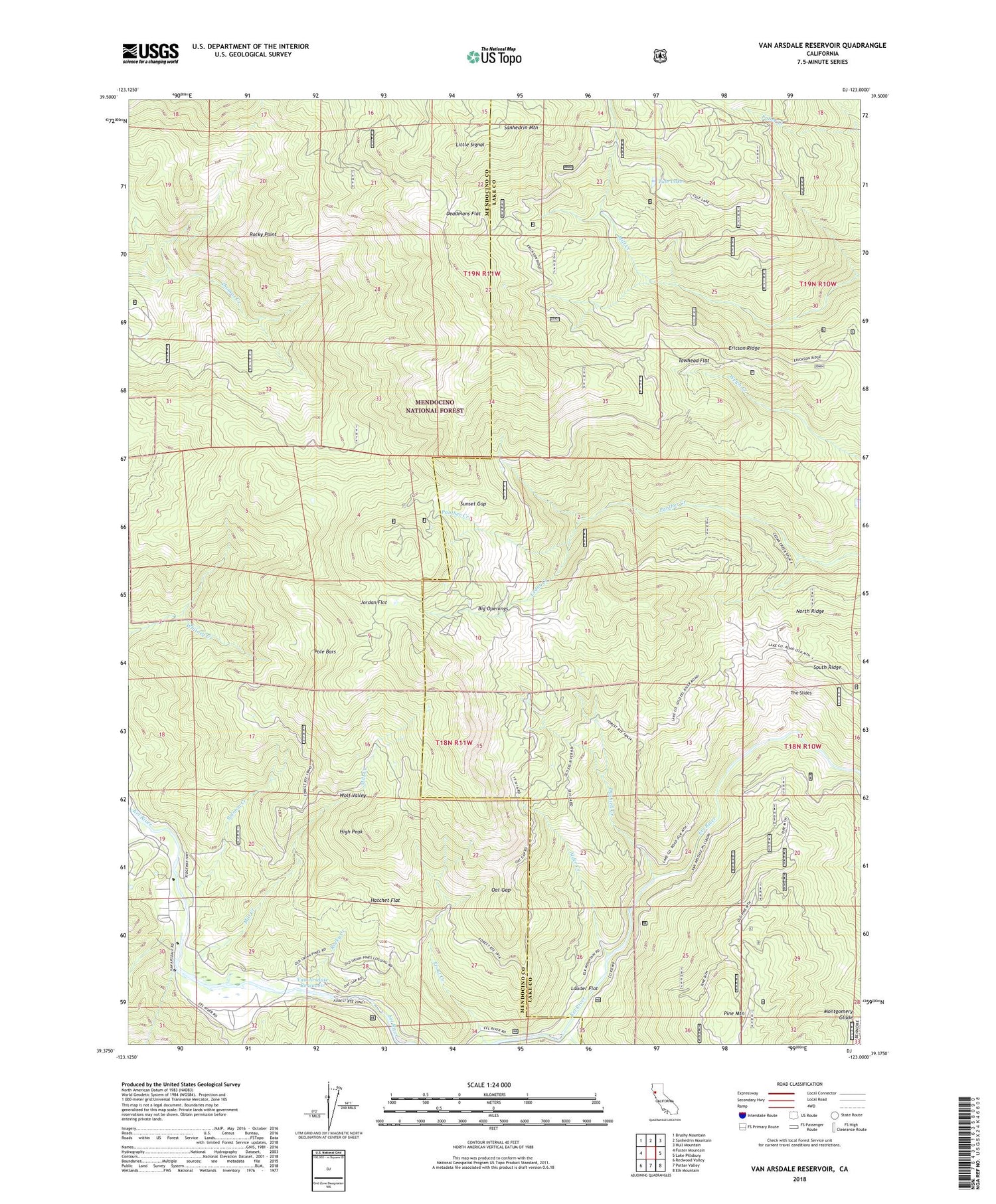
2021 topographic map quadrangle Van Arsdale Reservoir in the state of California. Scale: 1:24000. Based on the newly updated USGS 7.5' US Topo map series, this map is in the following counties: Mendocino, Lake. The map contains contour data, water features, and other items you are used to seeing on USGS maps, but also has updated roads and other features. This is the next generation of topographic maps. Printed on high-quality waterproof paper with UV fade-resistant inks.
Quads adjacent to this one:
West: Foster Mountain
Northwest: Brushy Mountain
North: Sanhedrin Mountain
Northeast: Hull Mountain
East: Lake Pillsbury
Southeast: Elk Mountain
South: Potter Valley
Southwest: Redwood Valley
This map covers the same area as the classic USGS quad with code o39123d1.
Contains the following named places: Alder Creek, Ascherman Ranch, Big Openings, Bucknell Creek, Cape Horn Dam, Cedar Creek, Dashiell Creek, Deadmans Flat, Ericson Ridge, Hartstone Camp, Hartstone Inn, Hatchet Flat, High Peak, Jordan Flat, Laleys Ranch, Lauder Flat, Little Signal, Louisiana Pacific Sawmill, Mill Creek, Mill Pond, Oat Gap, Old Dashiel Place, Old Dashiell Place, Pole Bars, Presley Ranch, Rocky Creek, Rocky Point, Salmon Creek, South Ridge, Sunset Gap, The Slides, Towhead Flat, Trout Creek, Tule Lake, Van Arsdale 97-102 Dam, Van Arsdale Reservoir, Wolf Valley, ZIP Code: 95469