MyTopo
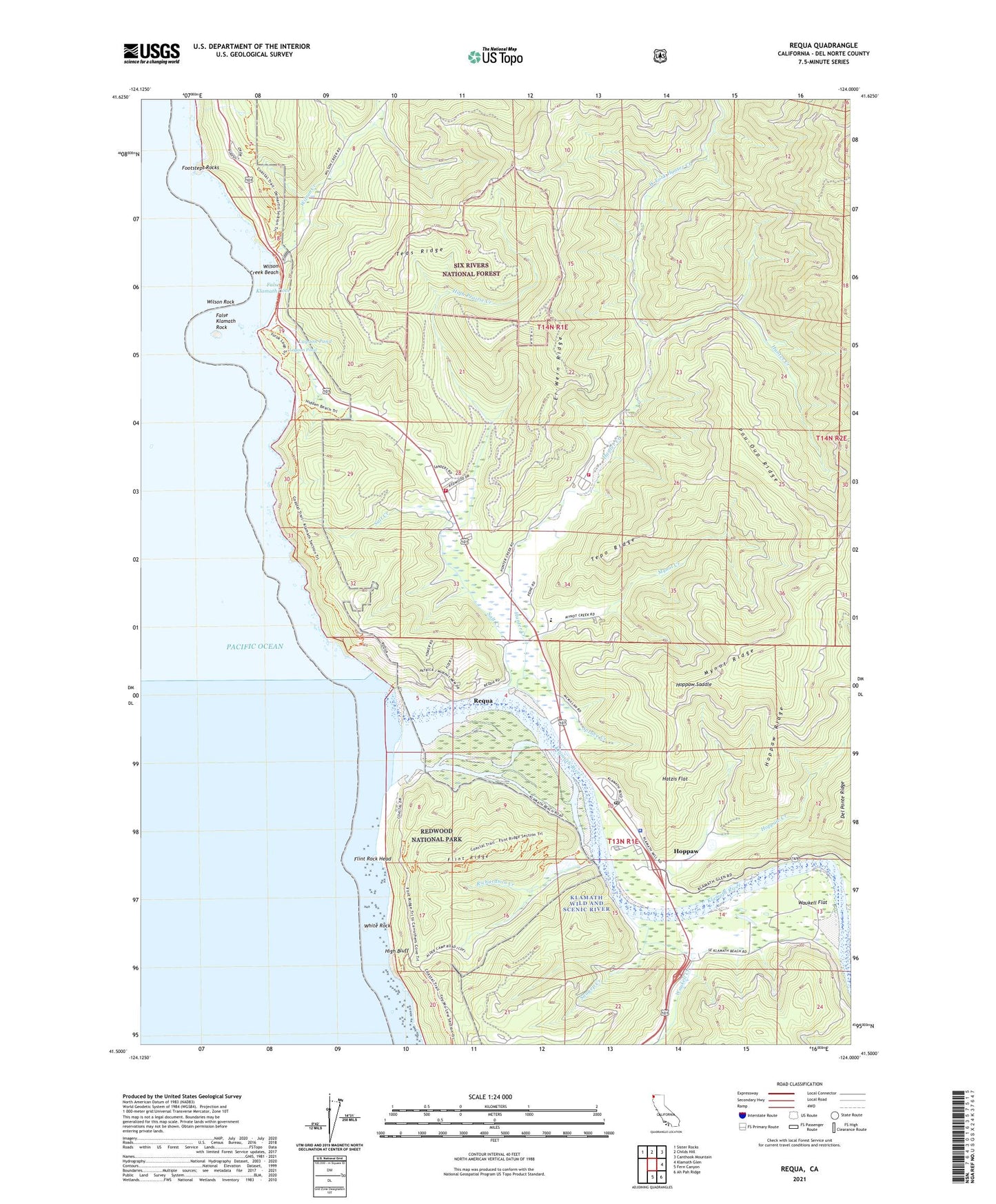
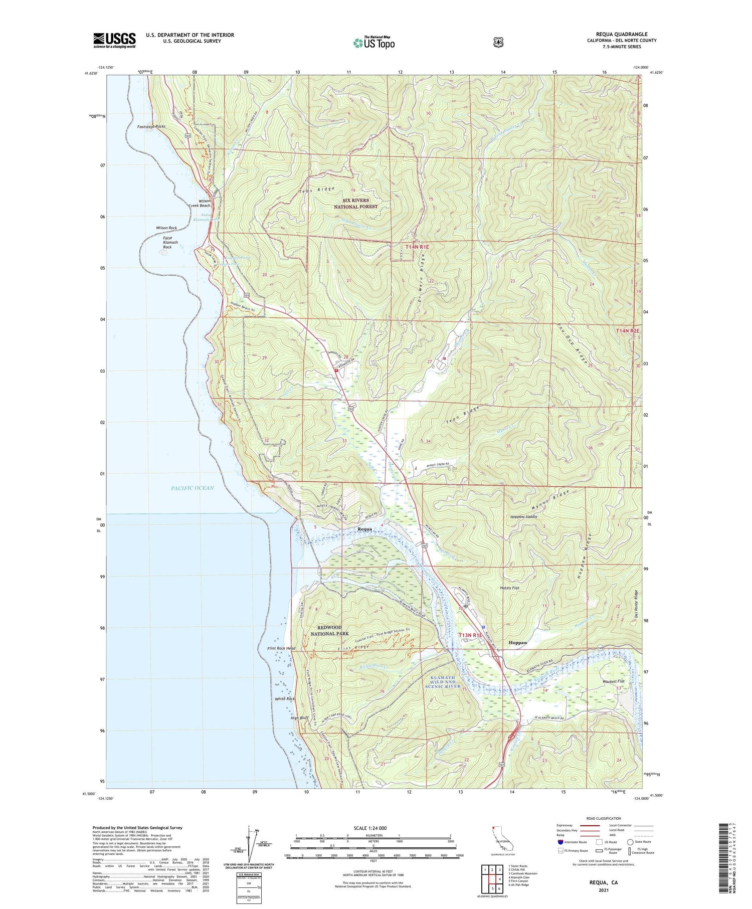
Requa California US Topo Map
Couldn't load pickup availability
Also explore the Requa Forest Service Topo of this same quad for updated USFS data
2021 topographic map quadrangle Requa in the state of California. Scale: 1:24000. Based on the newly updated USGS 7.5' US Topo map series, this map is in the following counties: Del Norte. The map contains contour data, water features, and other items you are used to seeing on USGS maps, but also has updated roads and other features. This is the next generation of topographic maps. Printed on high-quality waterproof paper with UV fade-resistant inks.
Quads adjacent to this one:
Northwest: Sister Rocks
North: Childs Hill
Northeast: Canthook Mountain
East: Klamath Glen
Southeast: Ah Pah Ridge
South: Fern Canyon
This map covers the same area as the classic USGS quad with code o41124e1.
Contains the following named places: Alder Forestry Conservation Camp, Camp Klamath, Del Norte County Landing Strip, Del Ponte Ridge, Douglas Memorial Bridge, Er-Wern Ridge, False Klamath, False Klamath Cove, False Klamath Rock, Flint Ridge, Flint Rock Head, Footsteps Rocks, Hatzis Flat, High Bluff, High Prairie Creek, Hoppaw, Hoppaw Creek, Hoppaw Ridge, Hoppaw Saddle, Hunter Creek, Khwunrghunme, Klamath, Klamath Air Force Station, Klamath Division, Klamath Fire Protection District Station 34, Klamath Fire Protection District Station 35, Klamath Post Office, Klamath River, Lagoon Creek Fishing Access, Lagoon Pond, Louis P DeMartin Senior Memorial Bridge, Margaret Keating Elementary School, Mynot Creek, Mynot Ridge, Pisgah View, Pou-Oup Ridge, Redwood Ranger Station, Rekwoi, Requa, Requa School, Resighini Rancheria, Richardson Creek, Safford Island, Salt Creek, Saugep Creek, Spruce Creek, Teds Ridge, Tepo Ridge, Trees of Mystery, Turwar Creek, Turwar Valley, Waukell Creek, Waukell Flat, West Fork Hunter Creek, White Rock, Wilson Creek, Wilson Creek Beach, Wilson Rock, Yurok Redwood Experimental Forest, ZIP Code: 95548