MyTopo
Fiddletown California US Topo Map
Couldn't load pickup availability
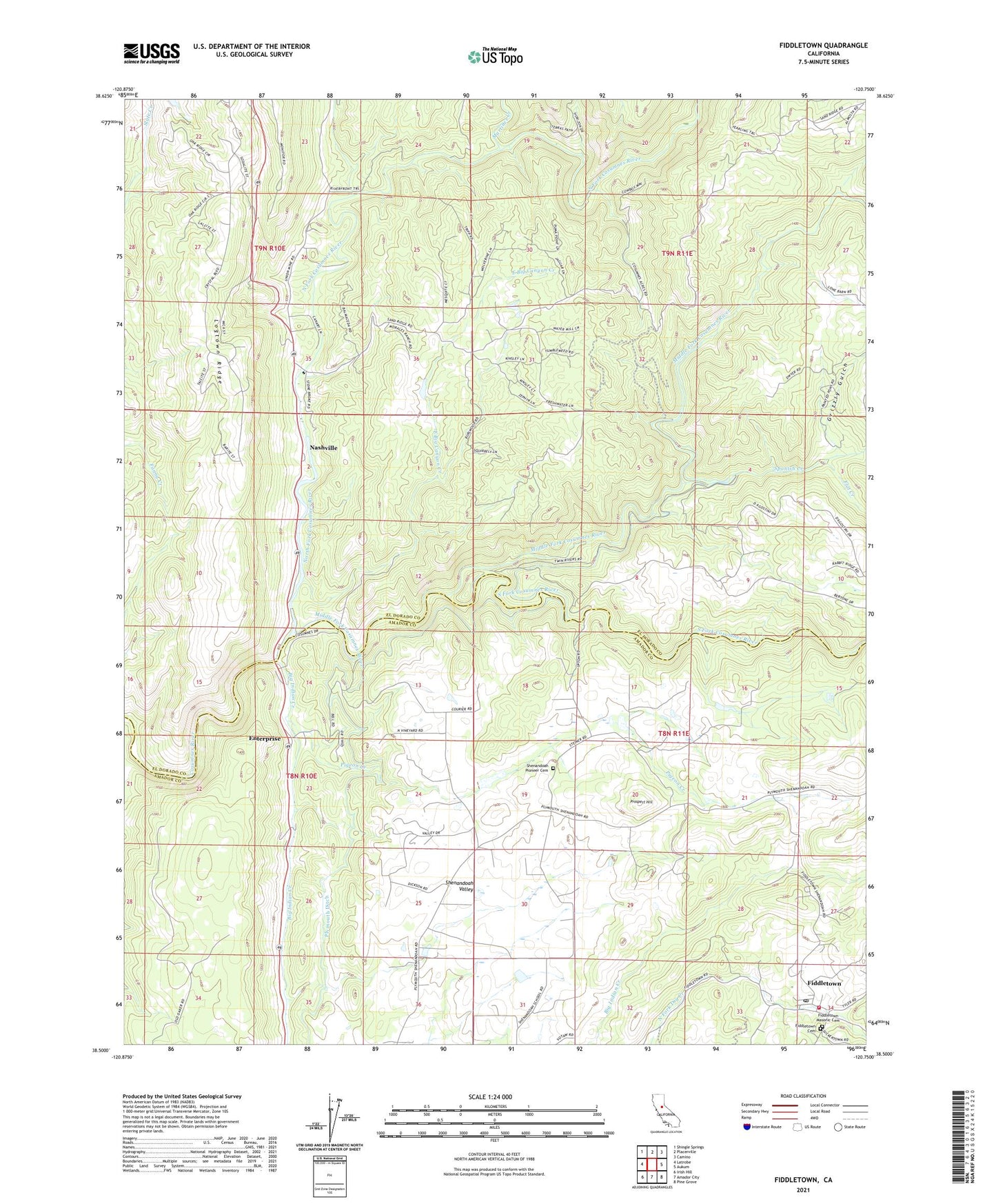
2021 topographic map quadrangle Fiddletown in the state of California. Scale: 1:24000. Based on the newly updated USGS 7.5' US Topo map series, this map is in the following counties: El Dorado, Amador. The map contains contour data, water features, and other items you are used to seeing on USGS maps, but also has updated roads and other features. This is the next generation of topographic maps. Printed on high-quality waterproof paper with UV fade-resistant inks.
Quads adjacent to this one:
West: Latrobe
Northwest: Shingle Springs
North: Placerville
Northeast: Camino
East: Aukum
Southeast: Pine Grove
South: Amador City
Southwest: Irish Hill
This map covers the same area as the classic USGS quad with code o38120e7.
Contains the following named places: Amador Fire Protection District Station 123, Amador Foothill Winery, Baldinelli Vineyards, Bell Ranch, Big Indian Creek, Briarcliff Mines, Charles Spinetta Vineyards, Clockspring Vineyards, D'Agostini Winery, Deaver Vineyards, Domaine De La Terre Rouge-Easton Winery, East Big Canyon Creek, Enterprise, Fiddletown, Fiddletown Cemetery, Fiddletown Census Designated Place, Fiddletown Community Hall, Fiddletown Masonic Cemetery, Fiddletown Post Office, Flat Creek, Grizzly Gulch, Head House, Jameson 481 Dam, Karly Vineyards, Kenworthy Vineyards, Martinez Creek, Middle Fork Cosumnes River, Montevina Winery, Nashville, North Fork Cosumnes River, Pigeon Creek, Pigeon Creek School, Plymouth Ditch, Prospect Hill, Renwood-Santino Winery, Santino Winery, Schallhorne Building, Shenandoah Lake 486 Dam, Shenandoah Pioneer Cemetery, Shenandoah School, Shenandoah Valley, Shenandoah Valley Museum, Shenandoah Vineyards, Sobon Estate Vineyards, South Fork Cosumnes River, Spanish Creek, Story Vineyards, The Vineyards, Vino Noceto Winery, ZIP Code: 95623