MyTopo
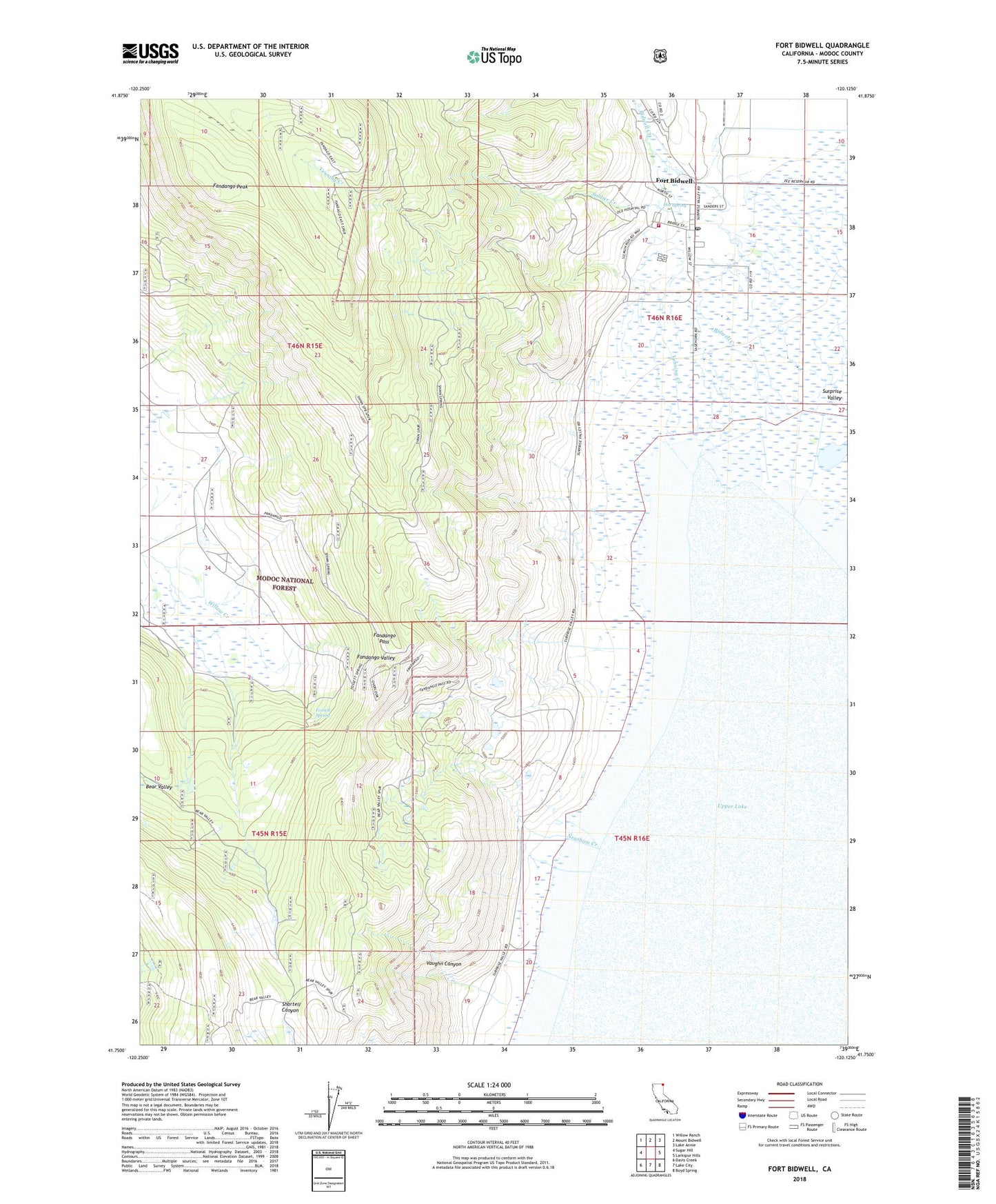
Fort Bidwell California US Topo Map
Couldn't load pickup availability
Also explore the Fort Bidwell Forest Service Topo of this same quad for updated USFS data
2021 topographic map quadrangle Fort Bidwell in the state of California. Scale: 1:24000. Based on the newly updated USGS 7.5' US Topo map series, this map is in the following counties: Modoc. The map contains contour data, water features, and other items you are used to seeing on USGS maps, but also has updated roads and other features. This is the next generation of topographic maps. Printed on high-quality waterproof paper with UV fade-resistant inks.
Quads adjacent to this one:
West: Sugar Hill
Northwest: Willow Ranch
North: Mount Bidwell
Northeast: Lake Annie
East: Larkspur Hills
Southeast: Boyd Spring
South: Lake City
Southwest: Davis Creek
This map covers the same area as the classic USGS quad with code o41120g2.
Contains the following named places: Bear Valley, Bidwell Creek, Fandango Pass, Fandango Peak, Fort Bidwell, Fort Bidwell Cemetery, Fort Bidwell Census Designated Place, Fort Bidwell Fire Department, Fort Bidwell Post Office, Fort Bidwell Reservation, Fossett Spring, Hot Spring, Mount Bidwell School, Neasham Creek, Soldier Creek, Upper Lake, Vaughn Canyon, Venning Creek