MyTopo
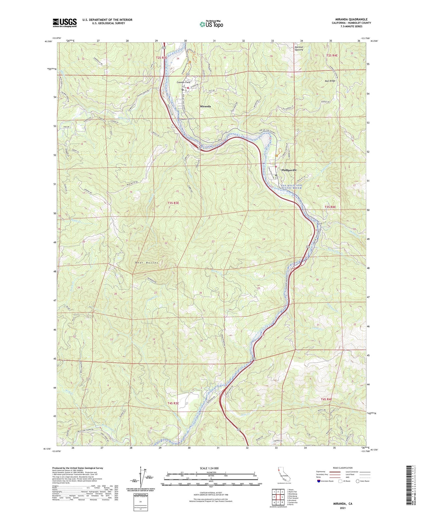
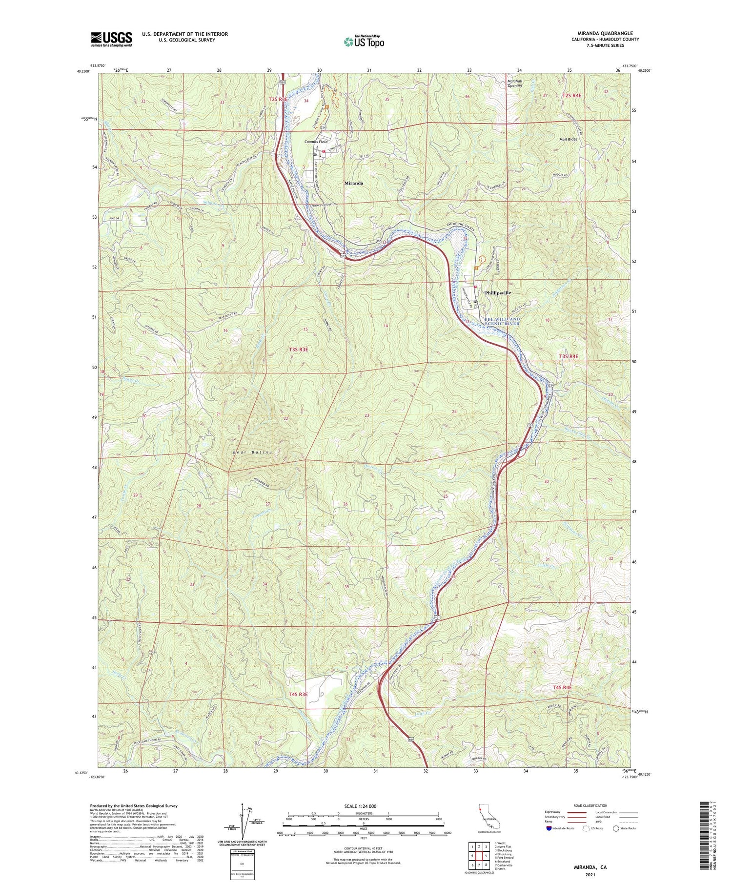
Miranda California US Topo Map
Couldn't load pickup availability
2021 topographic map quadrangle Miranda in the state of California. Scale: 1:24000. Based on the newly updated USGS 7.5' US Topo map series, this map is in the following counties: Humboldt. The map contains contour data, water features, and other items you are used to seeing on USGS maps, but also has updated roads and other features. This is the next generation of topographic maps. Printed on high-quality waterproof paper with UV fade-resistant inks.
Quads adjacent to this one:
West: Ettersburg
Northwest: Weott
North: Myers Flat
Northeast: Blocksburg
East: Fort Seward
Southeast: Harris
South: Garberville
Southwest: Briceland
This map covers the same area as the classic USGS quad with code o40123b7.
Contains the following named places: Alexander Grove, Anderson Creek, Barnum Memorial Bridge, Bear Buttes, Butte Creek, Coombs Field, Coon Creek, Dean Creek, Eel River Conservation Camp, Fish Creek, Garberville Division, Holbrook Grove, Hooker Creek, Hurlbutt Memorial Bridge, Lane Grove, Leggett Creek, Marshall Opening, Mill Creek, Miranda, Miranda Census Designated Place, Miranda Junior High School, Miranda Post Office, Miranda Volunteer Fire Department, North Coast Conservation Center, Oakdale School, Ohman Creek, Phillipsville, Phillipsville Census Designated Place, Phillipsville Post Office, Phillipsville Volunteer Fire Department, Rocky Glen Creek, Salmon Creek, School of the Redwoods, Seely Creek, South Fork High School, Stephens Grove, Stephens Grove Loop Trail, Tuttle Creek, Williams Creek, Wood Ranch, ZIP Code: 95560