MyTopo
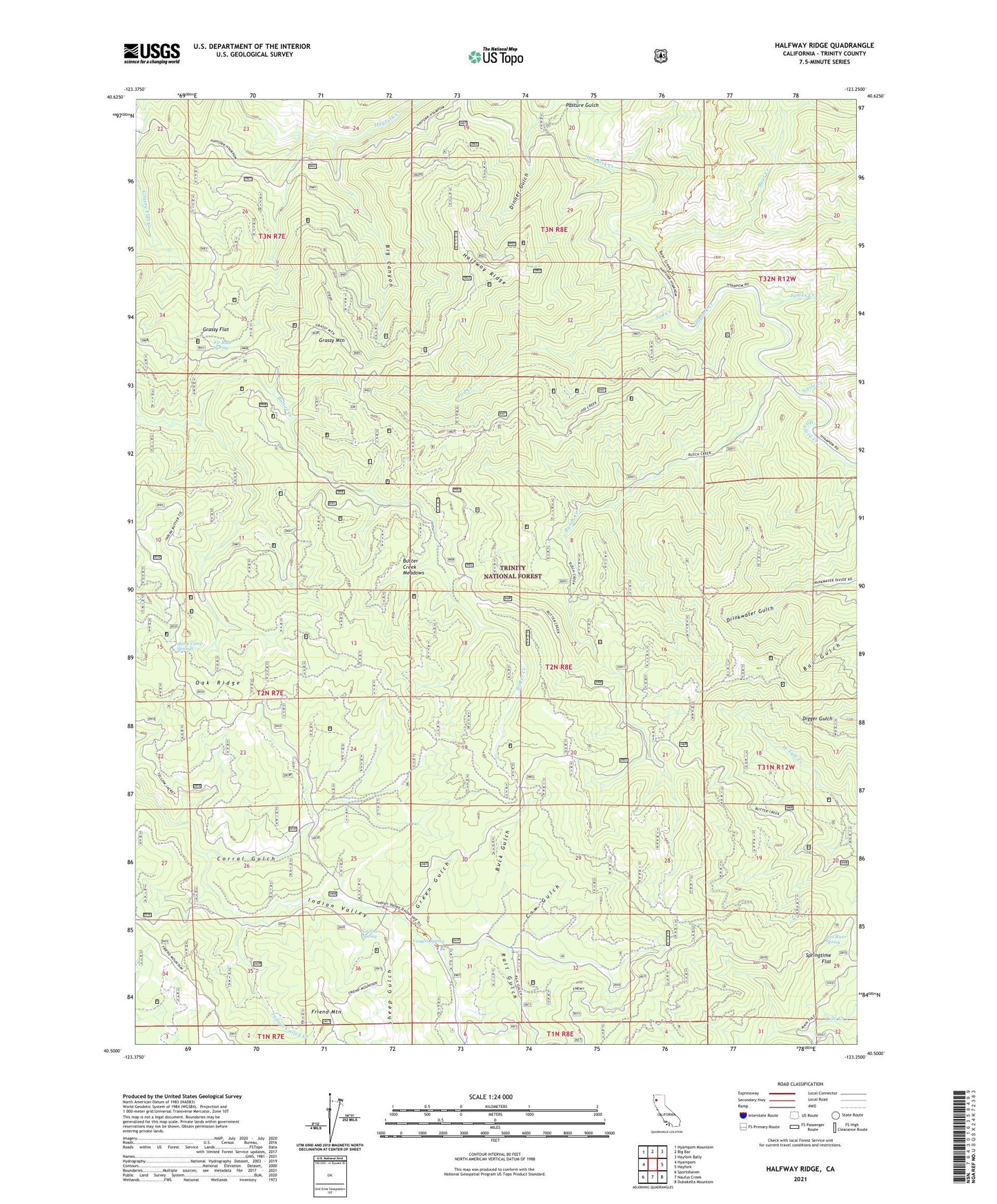
Halfway Ridge California US Topo Map
Couldn't load pickup availability
Also explore the Halfway Ridge Forest Service Topo of this same quad for updated USFS data
2021 topographic map quadrangle Halfway Ridge in the state of California. Scale: 1:24000. Based on the newly updated USGS 7.5' US Topo map series, this map is in the following counties: Trinity. The map contains contour data, water features, and other items you are used to seeing on USGS maps, but also has updated roads and other features. This is the next generation of topographic maps. Printed on high-quality waterproof paper with UV fade-resistant inks.
Quads adjacent to this one:
West: Hyampom
Northwest: Hyampom Mountain
North: Big Bar
Northeast: Hayfork Bally
East: Hayfork
Southeast: Dubakella Mountain
South: Naufus Creek
Southwest: Sportshaven
This map covers the same area as the classic USGS quad with code o40123e3.
Contains the following named places: Bear Creek, Big Canyon, Buck Gulch, Butter Creek Meadows, Camp Carter, Camp Springtime, Corral Gulch, Cow Gulch, Dinner Gulch, Fir Root Spring, Grassy Flat, Grassy Mountain, Green Gulch, Halfway Ridge, Hayfork Division, Indian Valley, Indian Valley Station, James Creek, Jim River Spring, Jud Creek, Little Creek, Oak Ridge, Pasture Gulch, Rail Gulch, Rusch Creek, Sardine Spring, Sheep Camp Springs, Sheep Gulch, Springtime Flat, Vaughn Spring