MyTopo
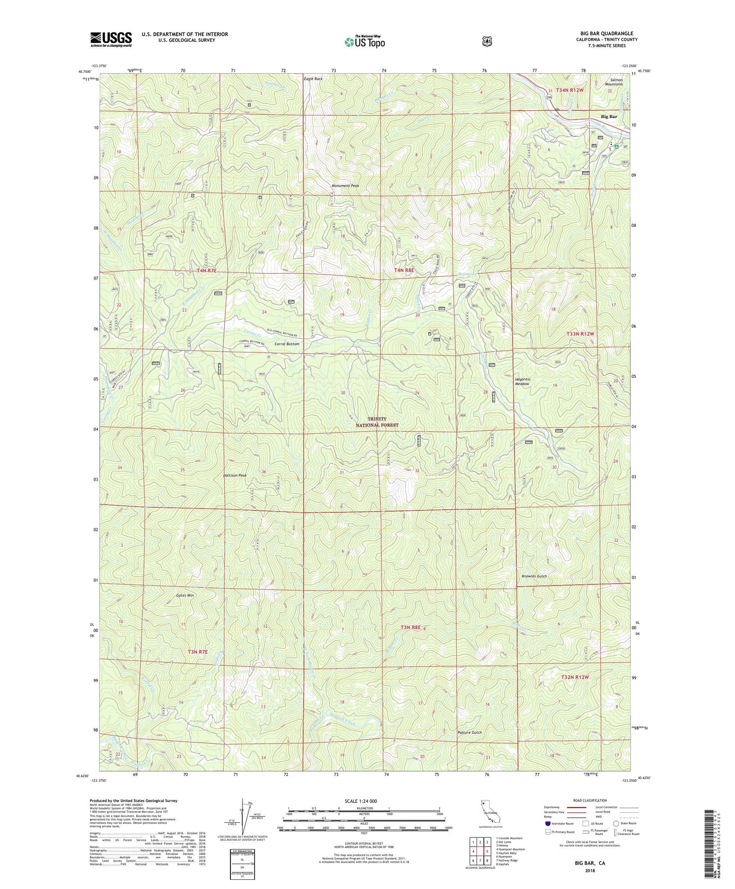
Big Bar California US Topo Map
Couldn't load pickup availability
Also explore the Big Bar Forest Service Topo of this same quad for updated USFS data
2022 topographic map quadrangle Big Bar in the state of California. Scale: 1:24000. Based on the newly updated USGS 7.5' US Topo map series, this map is in the following counties: Trinity. The map contains contour data, water features, and other items you are used to seeing on USGS maps, but also has updated roads and other features. This is the next generation of topographic maps. Printed on high-quality waterproof paper with UV fade-resistant inks.
Quads adjacent to this one:
West: Hyampom Mountain
Northwest: Ironside Mountain
North: Del Loma
Northeast: Helena
East: Hayfork Bally
Southeast: Hayfork
South: Halfway Ridge
Southwest: Hyampom
This map covers the same area as the classic USGS quad with code o40123f3.
Contains the following named places: Bidden Creek, Big Bar, Big Bar District Ranger Office, Big Bar Post Office, Big Bar Recreation Site, Corral Bottom, Cox Bar School, Deer Creek, Eagle Rock, East Hayshed Creek, Gates Creek, Gates Mountain, Hawk Creek, Haypress Meadow, Hayshed Creek, Hyampom Creek, Knowles Gulch, Miners Creek, Monkey Creek, Monument Peak, Mud Spring, Pattison Peak, Price Creek, Price Creek Cemetery, Treloar Creek, West Fork Miners Creek, West Hayshed Creek