
MyTopo
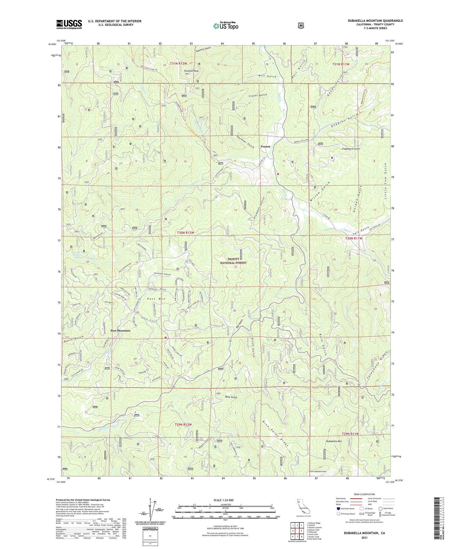
Dubakella Mountain California US Topo Map
Couldn't load pickup availability
Also explore the Dubakella Mountain Forest Service Topo of this same quad for updated USFS data
2021 topographic map quadrangle Dubakella Mountain in the state of California. Scale: 1:24000. Based on the newly updated USGS 7.5' US Topo map series, this map is in the following counties: Trinity. The map contains contour data, water features, and other items you are used to seeing on USGS maps, but also has updated roads and other features. This is the next generation of topographic maps. Printed on high-quality waterproof paper with UV fade-resistant inks.
Quads adjacent to this one:
West: Naufus Creek
Northwest: Halfway Ridge
North: Hayfork
Northeast: Hayfork Summit
East: Wildwood
Southeast: Pony Buck Peak
South: Smoky Creek
Southwest: Forest Glen
This map covers the same area as the classic USGS quad with code o40123d2.
Contains the following named places: Blue Point, Blue Point Ridge, Bone Gulch, Bule Gulch, Clapboard Gulch, Clover Gulch, Cold Creek, Cold Springs Campground, Ditch Gulch, Dobbins Gulch, Dry Gulch, Dubakella Mountain, Garden Gulch, Gardner Gulch, Goods Gulch, Hayfork Volunteer Fire Department, Little Cow Gulch, Mill Gulch, North Fork Philpot Creek, Peanut, Philpot Campground, Philpot Creek, Plummer Gulch, Plummer Peak, Plummer Spring, Post Mountain, Post Mountain Census Designated Place, Post Mountain Volunteer Fire Department, Post Ranger Station, Rail Gulch, Road Gulch, Salt Creek School, Salt Gulch, Sawmill Gulch, South Dubakella Mountain, Telephone Ridge, Trinity Pines, Willow Gulch


