MyTopo
Tamarack Flat California US Topo Map
Couldn't load pickup availability
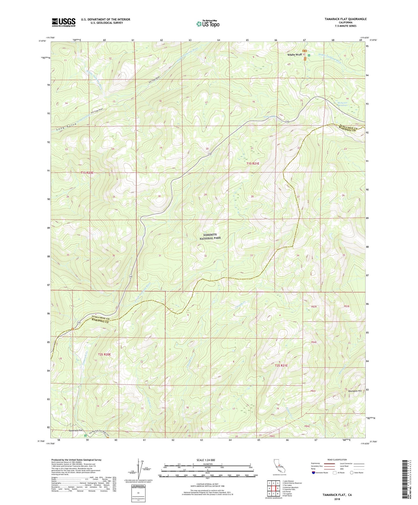
2021 topographic map quadrangle Tamarack Flat in the state of California. Scale: 1:24000. Based on the newly updated USGS 7.5' US Topo map series, this map is in the following counties: Tuolumne, Mariposa. The map contains contour data, water features, and other items you are used to seeing on USGS maps, but also has updated roads and other features. This is the next generation of topographic maps. Printed on high-quality waterproof paper with UV fade-resistant inks.
Quads adjacent to this one:
West: Ackerson Mountain
Northwest: Lake Eleanor
North: Hetch Hetchy Reservoir
Northeast: Ten Lakes
East: Yosemite Falls
Southeast: Half Dome
South: El Capitan
Southwest: El Portal
This map covers the same area as the classic USGS quad with code o37119g6.
Contains the following named places: Boundary Hill, McSwain Meadows, Siesta Lake, Smoky Jack Campground, Tamarack Flat, Tamarack Flat Campground, White Wolf