MyTopo
Homewood California US Topo Map
Couldn't load pickup availability
Also explore the Homewood Forest Service Topo of this same quad for updated USFS data
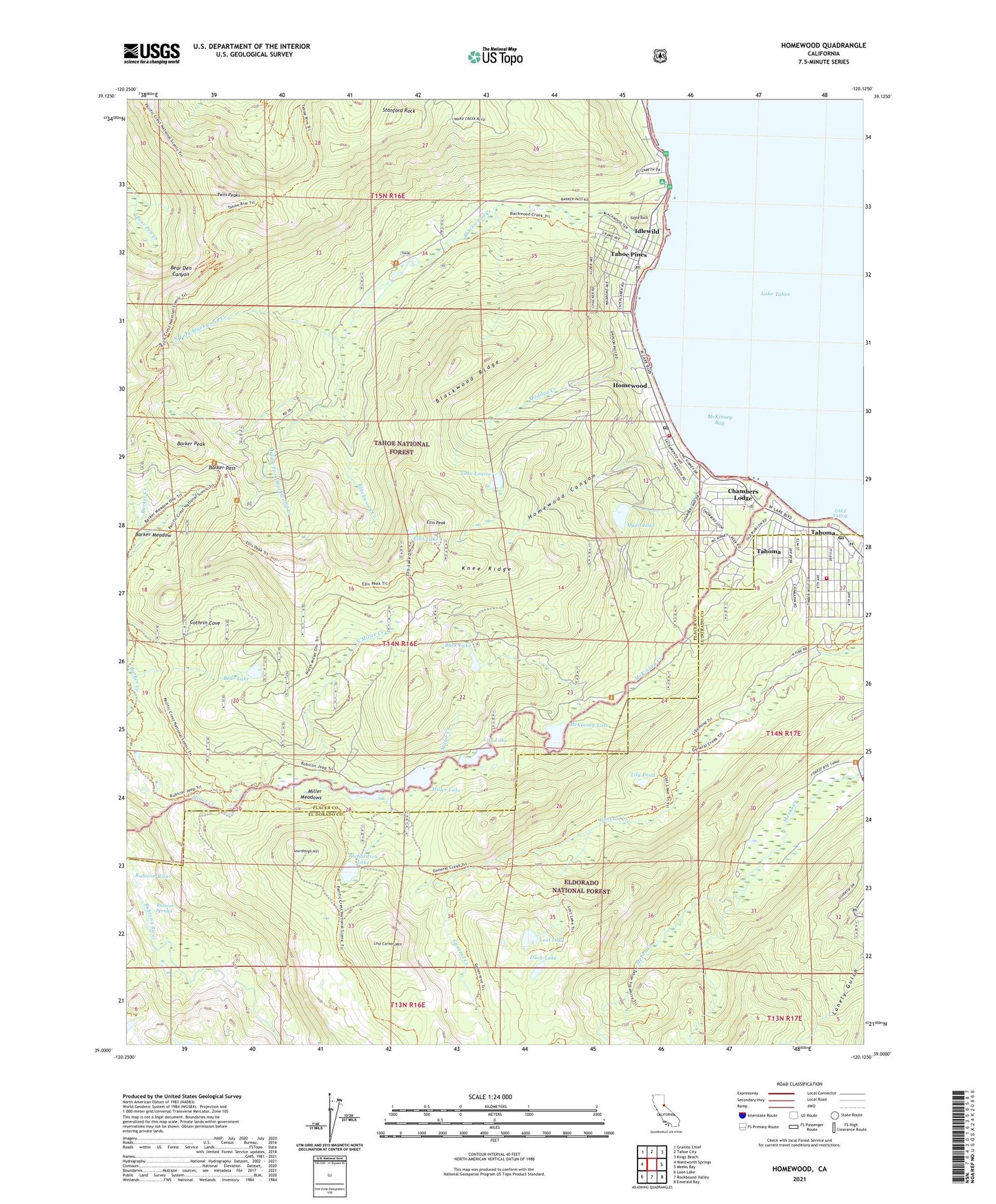
2021 topographic map quadrangle Homewood in the state of California. Scale: 1:24000. Based on the newly updated USGS 7.5' US Topo map series, this map is in the following counties: Placer, El Dorado. The map contains contour data, water features, and other items you are used to seeing on USGS maps, but also has updated roads and other features. This is the next generation of topographic maps. Printed on high-quality waterproof paper with UV fade-resistant inks.
Quads adjacent to this one:
West: Wentworth Springs
Northwest: Granite Chief
North: Tahoe City
Northeast: Kings Beach
East: Meeks Bay
Southeast: Emerald Bay
South: Rockbound Valley
Southwest: Loon Lake
This map covers the same area as the classic USGS quad with code o39120a2.
Contains the following named places: Barker Meadow, Barker Pass, Barker Peak, Bear Lake, Blackwood Creek, Blackwood Ridge, Buck Lake, Camp Wasiu, Chamberlands Estates, Chambers Lodge, Chambers Lodge Post Office, Cothrin Cove, Duck Lake, Eagle Rock, Ellis Lake, Ellis Peak, Fleur Du Lac School, General Creek Trail, Homewood, Homewood Canyon, Homewood Post Office, Homewood Seaplane Base, Homewood Ski Area, Idlewild, Kailua Park, Kasian Recreation Area, Kaspian Picnic Area, Knee Ridge, Lake Louise, Lily Lake, Lily Pond, Lost Corner Mountain, Lost Lake, Madden Creek, McKinney Bay, McKinney Creek, McKinney Lake, Meeks Bay Fire Protection District Station 62, Meeks Bay Ranger Station, Middle Fork Blackwood Creek, Miller Lake, Miller Meadows, Noonchester Mine, North Fork Blackwood Creek, North Miller Creek, North Tahoe Fire Protection District Station 53 North Tahoe, Pomins, Quail Lake, Quail Lake 326 Dam, Richardson Lake, Rubicon River, Rubicon Springs, Sourdough Hill, Stanford Rock, Tahoe Pines, Tahoe Ski Bowl Area, Tahoma, Tahoma Census Designated Place, Tahoma Meadows, Tahoma Post Office, Twin Peaks, West Shore Bike Trail, ZIP Code: 96141