MyTopo
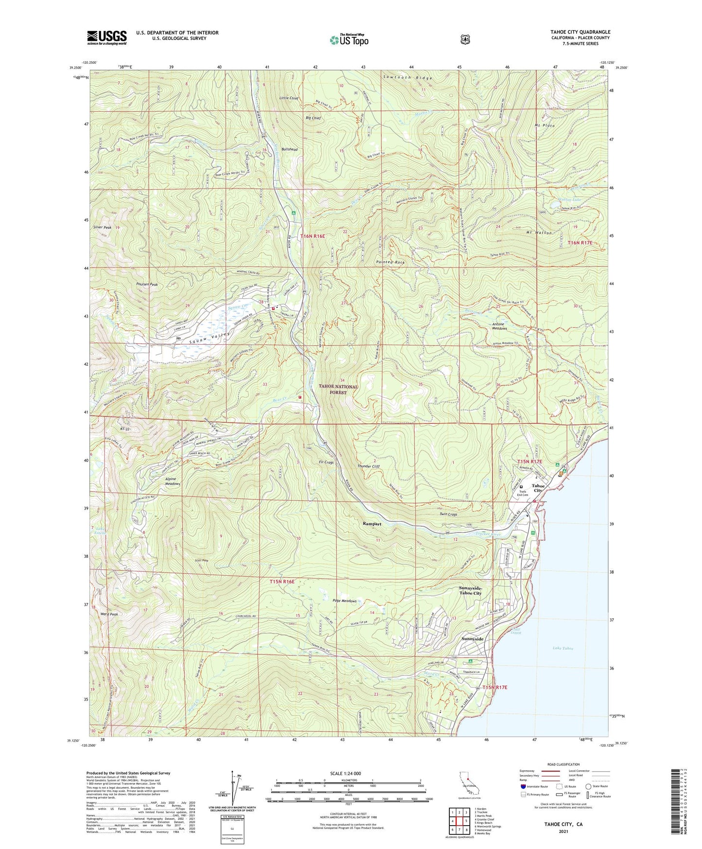
Tahoe City California US Topo Map
Couldn't load pickup availability
Also explore the Tahoe City Forest Service Topo of this same quad for updated USFS data
2023 topographic map quadrangle Tahoe City in the state of California. Scale: 1:24000. Based on the newly updated USGS 7.5' US Topo map series, this map is in the following counties: Placer. The map contains contour data, water features, and other items you are used to seeing on USGS maps, but also has updated roads and other features. This is the next generation of topographic maps. Printed on high-quality waterproof paper with UV fade-resistant inks.
Quads adjacent to this one:
West: Granite Chief
Northwest: Norden
North: Truckee
Northeast: Martis Peak
East: Kings Beach
Southeast: Meeks Bay
South: Homewood
Southwest: Wentworth Springs
This map covers the same area as the classic USGS quad with code o39120b2.
Contains the following named places: Alpine Meadows, Alpine Meadows Ski Area, Antone Meadows, Antone Meadows Natural Preserve, Bear Creek, Bear Creek Campground, Bear Trap Cabin, Big Chief, Bullshead, Burton Creek Natural Preserve, Burton Creek State Park, Comstock Acres, Deer Creek, Deer Park, Deer Park Ski Area, Fanny Bridge, Fir Crags, Five Lakes Trailhead, Granlibakken Ski Area, KT-22, Lake Estelle, Lake Tahoe Dam, Little Chief, Mount Pluto, Mount Watson, North Tahoe Fire Protection District Station 51 North Tahoe, North Tahoe Fire Protection District Station 56 Alpine Meadows, Northstar-at-Tahoe, Olympic Valley Post Office, Page Meadows, Painted Rock, Pine Land, Pole Creek, Poulsen Peak, Powder Bowl Ski Area, Rampart, Rideout Elementary School, Scott Peak, Silver Creek, Silver Creek Campground, Silver Peak, Squaw Creek, Squaw Valley, Squaw Valley Fire Department, Squaw Valley State Reservation Area, Sunnyside, Sunnyside-Tahoe City Census Designated Place, Tahoe City, Tahoe City Branch Auburn-Placer County Library, Tahoe City Golf Course, Tahoe City Post Office, Tahoe City Public Beach, Tahoe Lake Elementary School, Tahoe Park, Tahoe State Recreation Area, Tahoe Tavern, Tahoe Woods, Talmont, Thunder Cliff, Timberland, Trails End Cemetery, Twin Crags, Twin Peaks Estates, Ward Creek, Ward Creek Project, Ward Peak, Watson Lake, Westshore Community Center, William B Layton Park, William Kent Guard Station and Camp, ZIP Codes: 96145, 96146