MyTopo
Wentworth Springs California US Topo Map
Couldn't load pickup availability
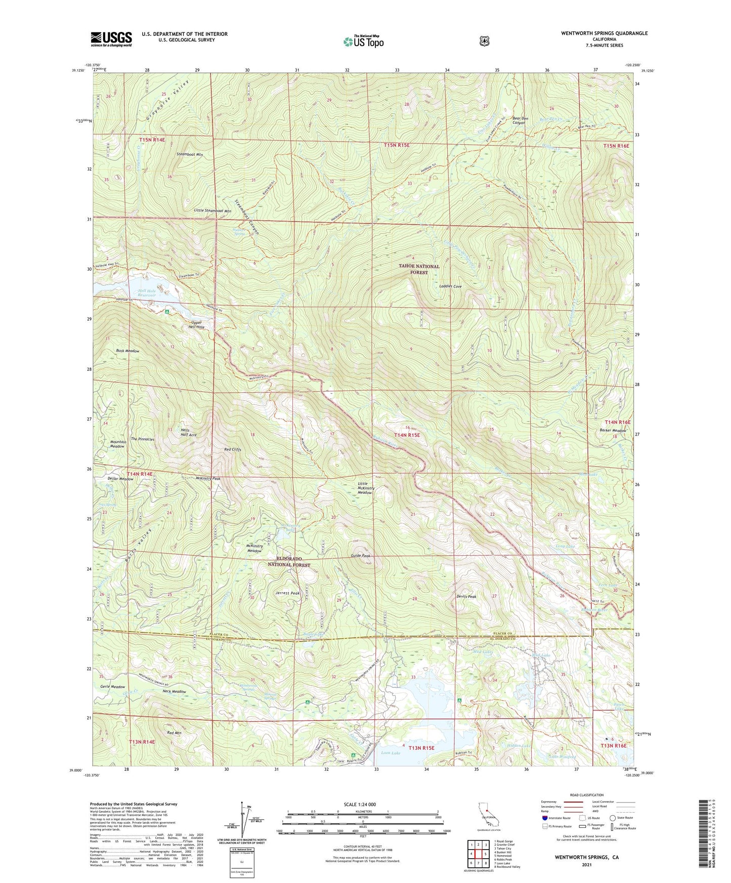
2021 topographic map quadrangle Wentworth Springs in the state of California. Scale: 1:24000. Based on the newly updated USGS 7.5' US Topo map series, this map is in the following counties: Placer, El Dorado. The map contains contour data, water features, and other items you are used to seeing on USGS maps, but also has updated roads and other features. This is the next generation of topographic maps. Printed on high-quality waterproof paper with UV fade-resistant inks.
Quads adjacent to this one:
West: Bunker Hill
Northwest: Royal Gorge
North: Granite Chief
Northeast: Tahoe City
East: Homewood
Southeast: Rockbound Valley
South: Loon Lake
Southwest: Robbs Peak
This map covers the same area as the classic USGS quad with code o39120a3.
Contains the following named places: Barker Creek, Barts Valley, Bear Den Canyon, Bear Pen Creek, Big Sluice Box, Buck Island 1009-008 Dam, Buck Island Lake, Buck Meadow, Buckskin Creek, Bugle Lake, Dellar Meadow, Devils Peak, Diamond Crossing, Ellis Creek, Fawn Lake, Fern Lake, Five Lakes Creek, Grayhorse Creek, Grayhorse Valley, Guide Peak, Hell Hole-In Campground, Hells Half Acre, Hidden Lake, Hunters Spring, Jerrett Creek, Jerrett Peak, Joes Spring, Laddies Cove, Lake Winifred, Little McKinstry Meadow, Little Powderhorn Creek, Little Sluice Box, Little Steamboat Mountain, Long Lake, Loon Lake 1009-007 Dam, McKinstry Lake, McKinstry Meadow, McKinstry Peak, McKinstry Trail, Miller Creek, Mineral Springs, Miranda Cabin, Mountain Meadow, Mud Lake, Mud Lakes, Neck Meadow, Pleasant Boat-In Campground, Powderhorn Creek, Red Cliffs, Red Mountain, Spider Lake, Steamboat Canyon, Steamboat Mountain, Steamboat Trail, The Pinnacles, Upper Hell Hole, Wentworth Springs, Wentworth Springs Campground, West Meadow Creek, Willow Creek