
MyTopo
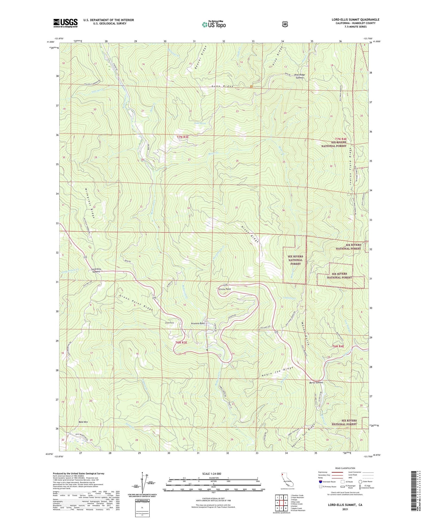
Lord-Ellis Summit California US Topo Map
Couldn't load pickup availability
Also explore the Lord-Ellis Summit Forest Service Topo of this same quad for updated USFS data
2021 topographic map quadrangle Lord-Ellis Summit in the state of California. Scale: 1:24000. Based on the newly updated USGS 7.5' US Topo map series, this map is in the following counties: Humboldt. The map contains contour data, water features, and other items you are used to seeing on USGS maps, but also has updated roads and other features. This is the next generation of topographic maps. Printed on high-quality waterproof paper with UV fade-resistant inks.
Quads adjacent to this one:
West: Blue Lake
Northwest: Panther Creek
North: Hupa Mountain
Northeast: Hoopa
East: Willow Creek
Southeast: Grouse Mountain
South: Maple Creek
Southwest: Korbel
This map covers the same area as the classic USGS quad with code o40123h7.
Contains the following named places: Bald Mountain, Berry Summit, Camp Anderson, Captains Creek, Circle Point, Dunn Ridge, Fern Prairie, Green Point, Green Point Ridge, Green Point School, Indian Field Ridge, Larson Ranch, Lord-Ellis Summit, Low Gap Creek, Lupton Creek, Mason Gulch, Minor Creek, Molasses Creek, Moon Creek, Negro Joe Ridge, Nixon Ridge, Pickle Spring, Pine Ridge Summit, Princess Rock, Redwood Creek Ranch, Redwood School, Squirrel Tail Ridge, Sweathouse Creek, Toss-up Creek, Windy Creek, ZIP Code: 95525


