MyTopo
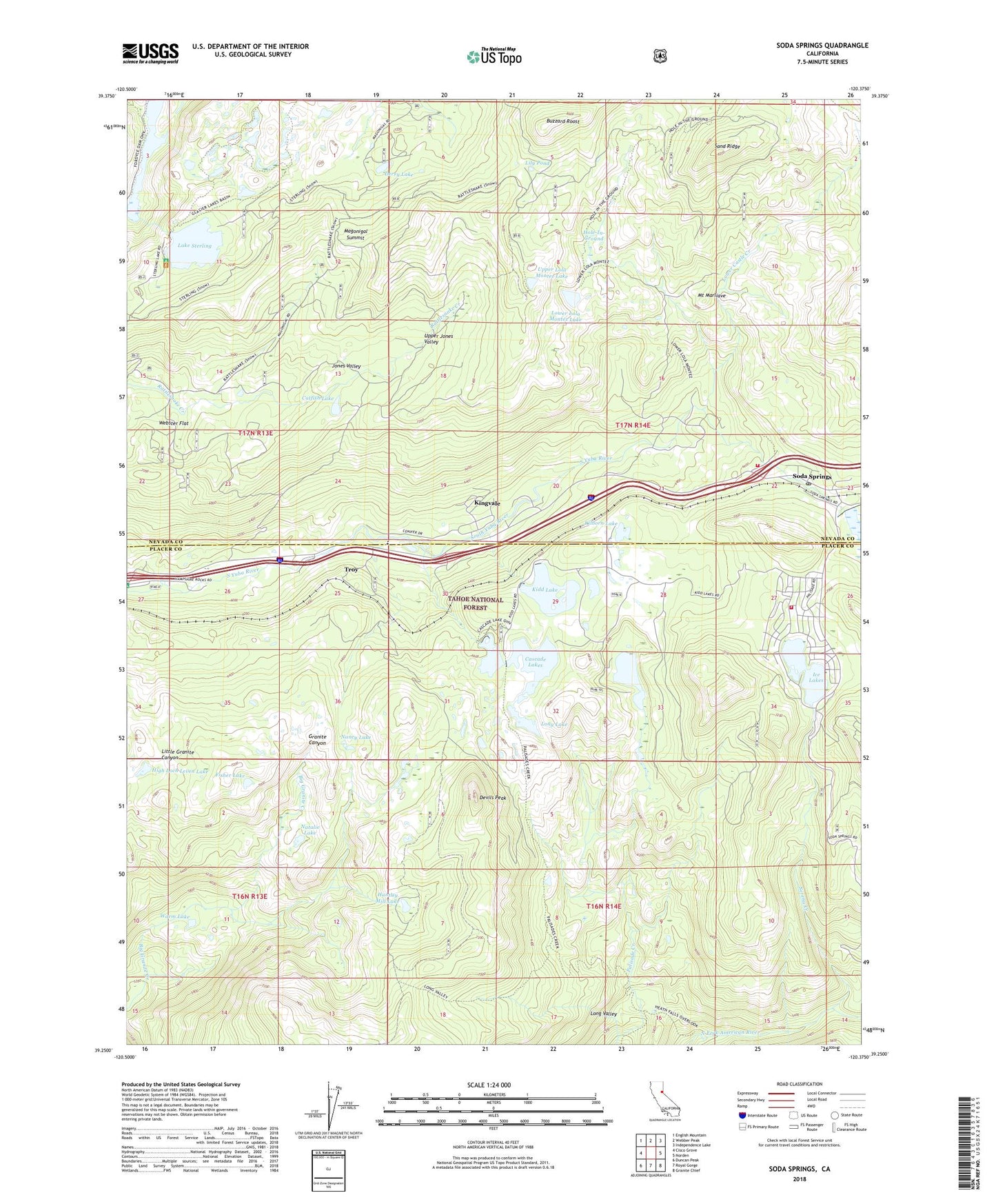
Soda Springs California US Topo Map
Couldn't load pickup availability
Also explore the Soda Springs Forest Service Topo of this same quad for updated USFS data
2021 topographic map quadrangle Soda Springs in the state of California. Scale: 1:24000. Based on the newly updated USGS 7.5' US Topo map series, this map is in the following counties: Nevada, Placer. The map contains contour data, water features, and other items you are used to seeing on USGS maps, but also has updated roads and other features. This is the next generation of topographic maps. Printed on high-quality waterproof paper with UV fade-resistant inks.
Quads adjacent to this one:
West: Cisco Grove
Northwest: English Mountain
North: Webber Peak
Northeast: Independence Lake
East: Norden
Southeast: Granite Chief
South: Royal Gorge
Southwest: Duncan Peak
This map covers the same area as the classic USGS quad with code o39120c4.
Contains the following named places: Buttes Area Camp, Buzzard Roost, Camp Pahatsi, Cascade Lakes, Catfish Lake, Cold Springs Campground, Derry Lake, Devils Peak, Donner Summit, Donner Trail Elementary School, Dulzura Lake, Fisher Lake, Glacier Lakes Trail, Glacier Trails Boy Scouts of America Camp, Hampshire Rocks Campground, Heath Falls Overlook Trail, High Loch Leven Lake, Hole-In-Ground, Huntley Mill Lake, Ice Lakes, Ice Lakes 1324 Dam, Jerry Lake, Jones Valley, Kidd Lake, Kidd Lake 97-025 Dam, Kidd Lake Campgrond, Kilborn Lake, Kingvale, Kingvale Census Designated Place, Lake Sterling, Lake Sterling 97-030 Dam, Lily Pond, Lola Montez Trail, Long Lake, Long Valley, Long Valley Trail, Lower Castle Creek, Lower Lola Montez Lake, Lower Peak Lake 97-037 Dam, Magonigal Camp, Magonigal Summit, Mossy Pond East Trail, Mossy Pond West Trail, Mount Marliave, Nancy Lake, Natalie Lake, Palisade Lake, Palisades Creek Trail, Sand Ridge, Serena Creek, Serena Lake, Soda Springs, Soda Springs Census Designated Place, Soda Springs Post Office, Soda Springs Ski Area, Spruce, Sterling Lake Campground, Tamarack, Tamarack Substation, Troy, Truckee Fire Protection District Station 97, Truckee Fire Protection District Station 98 Serene Lakes, Upper Jones Valley, Upper Lola Montez Lake, Upper Peak Lake 97-047 Dam, Van Norden Campground, Warm Lake, Webster Flat, ZIP Code: 95728