MyTopo
Noble Butte California US Topo Map
Couldn't load pickup availability
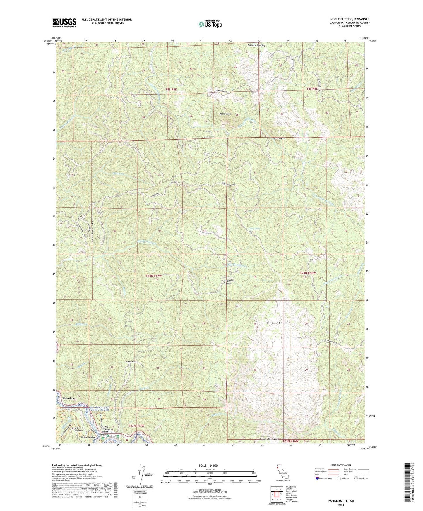
2021 topographic map quadrangle Noble Butte in the state of California. Scale: 1:24000. Based on the newly updated USGS 7.5' US Topo map series, this map is in the following counties: Mendocino. The map contains contour data, water features, and other items you are used to seeing on USGS maps, but also has updated roads and other features. This is the next generation of topographic maps. Printed on high-quality waterproof paper with UV fade-resistant inks.
Quads adjacent to this one:
West: Piercy
Northwest: Garberville
North: Harris
Northeast: Jewett Rock
East: Bell Springs
Southeast: Tan Oak Park
South: Leggett
Southwest: Hales Grove
This map covers the same area as the classic USGS quad with code o39123h6.
Contains the following named places: Big Tree Meadow, Big Tree Trail, Buckhorn Ranch, Cabin Meadow, California Department of Forestry and Fire Protection Leggett, Captain Miles Standish Tree, Cedar Spring, Elkhorn Creek, Foster Creek, Garden Creek, Grove Trail, Hickey Campground, Hiltabidels Opening, Holohan Gulch, Linser Mine, Little Butte, Little Cedar Creek, Mill Creek, Mill Creek Falls, Mill Creek Loop Trail, Milsted Ranch, Mud Creek, Noble Butte, North Fork Cedar Creek, Pratt Place, Ray Meadow, Red Mountain, Redwood Cmapground, Riverdale, Rock Creek Campground, School Section Creek, Smithe Redwoods State Natural Reserve, South Fork Eel River Wilderness, Standish-Hickey State Recreation Area, Talsma Meadow, Windy Gap