MyTopo
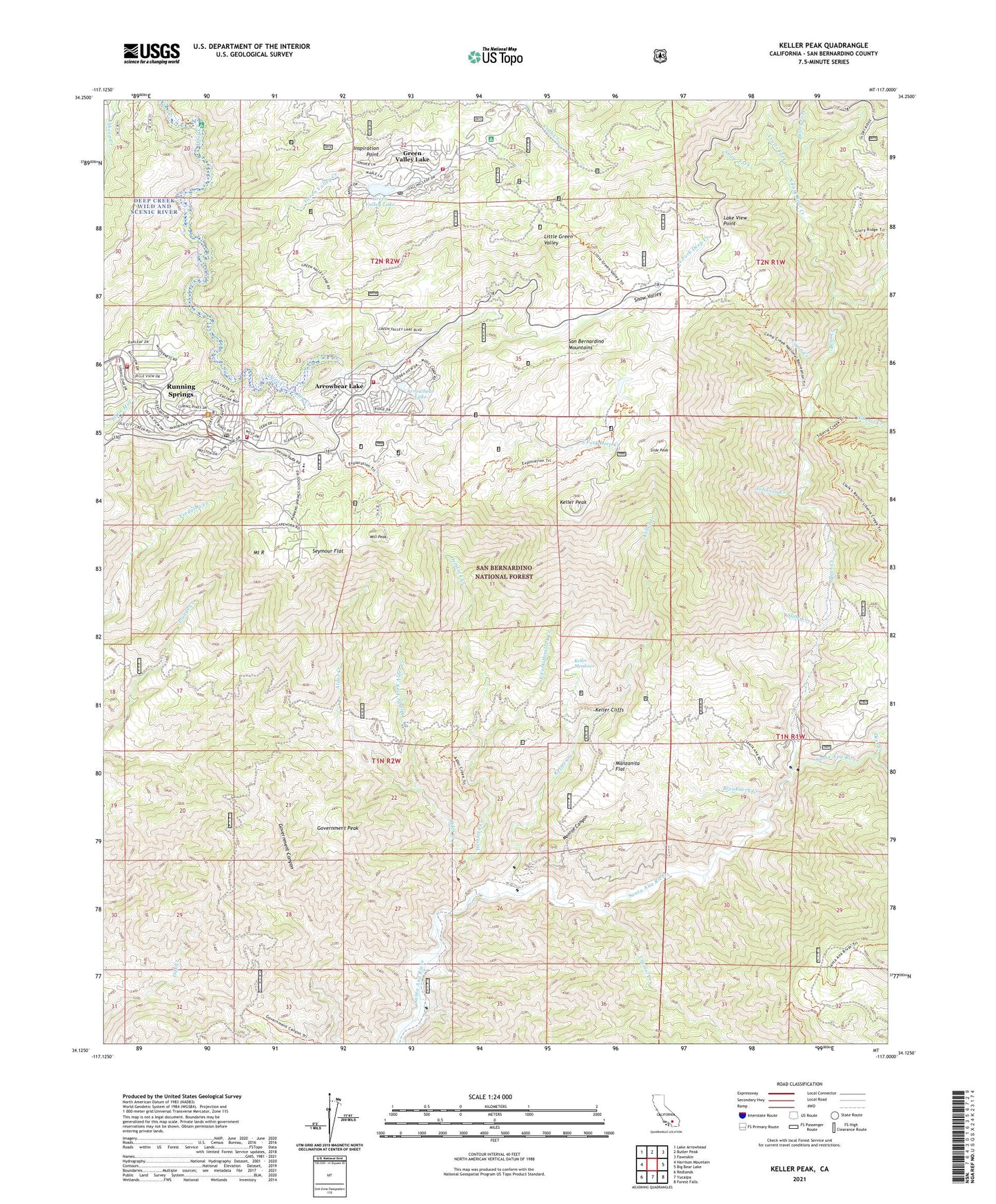
Keller Peak California US Topo Map
Couldn't load pickup availability
Also explore the Keller Peak Forest Service Topo of this same quad for updated USFS data
2021 topographic map quadrangle Keller Peak in the state of California. Scale: 1:24000. Based on the newly updated USGS 7.5' US Topo map series, this map is in the following counties: San Bernardino. The map contains contour data, water features, and other items you are used to seeing on USGS maps, but also has updated roads and other features. This is the next generation of topographic maps. Printed on high-quality waterproof paper with UV fade-resistant inks.
Quads adjacent to this one:
West: Harrison Mountain
Northwest: Lake Arrowhead
North: Butler Peak
Northeast: Fawnskin
East: Big Bear Lake
Southeast: Forest Falls
South: Yucaipa
Southwest: Redlands
This map covers the same area as the classic USGS quad with code o34117b1.
Contains the following named places: Alder Creek, Alder Creek Trail, Arrowbear Dam, Arrowbear Lake, Arrowbear Lake Fire Department Station 271, Arrowbear Lake Post Office, Arrowbear Reservoir, Bear Creek, Bear Creek Campground, Breakneck Creek, Butter Fork, California Highway Patrol - Arrowhead, Camp Awahanee, Camp Cedar Crest, Camp Conifer, Camp Creek, Camp Creek Trailhead, Camp Wintaka, Charles Hoffman Elementary School, Crafts Fork, Crystal Creek, Deep Creek Lake, Deer Creek, Deer Lick Station, Dry Creek, East Fork Hemlock Creek, Fishermans Campground, Government Canyon Trail, Government Peak, Green Valley Campground, Green Valley Creek, Green Valley Lake, Green Valley Lake 804 Dam, Green Valley Lake Community Church, Green Valley Lake Post Office, Green Valley Recreation Area, Green Valley Ski Area, Green Valley Trail, Helendale Reservation, Hemlock Creek, Hollywood Boys Club, Inspiration Point, Johnson Creek, Keller Cliffs, Keller Creek, Keller Meadows, Keller Peak, Keller Peak Lookout, KUOR-FM (Redlands), Lake View Point, Little Green Valley, Manzanita Flat, Middle Fork Alder Creek, Mill Peak, Monroe Canyon, Mount R, Music Camp, National Childreaus Forest, North Fork Bear Creek, North Fork Deep Creek, Rainbow Lake, Running Springs, Running Springs Branch San Bernardino County Library, Running Springs Census Designated Place, Running Springs Fire Department Station 50, Running Springs Fire Department Station 51, Running Springs Post Office, Running Springs Station, San Bernardino County Fire Department Station 95 - Green Valley Lake, Seymour Flat, Shady Cove Group Campground, Siberia Creek, Siberia Creek Campground, Siberia Creek Trail, Slide Creek, Slide Lake Campground, Slide Peak, Snow Fork, Snow Valley, Snow Valley Recreation Area, Snow Valley Ski Area, South Fork Deep Creek, Thomas Hunting Grounds, ZIP Codes: 92341, 92382