MyTopo
Lathrop California US Topo Map
Couldn't load pickup availability
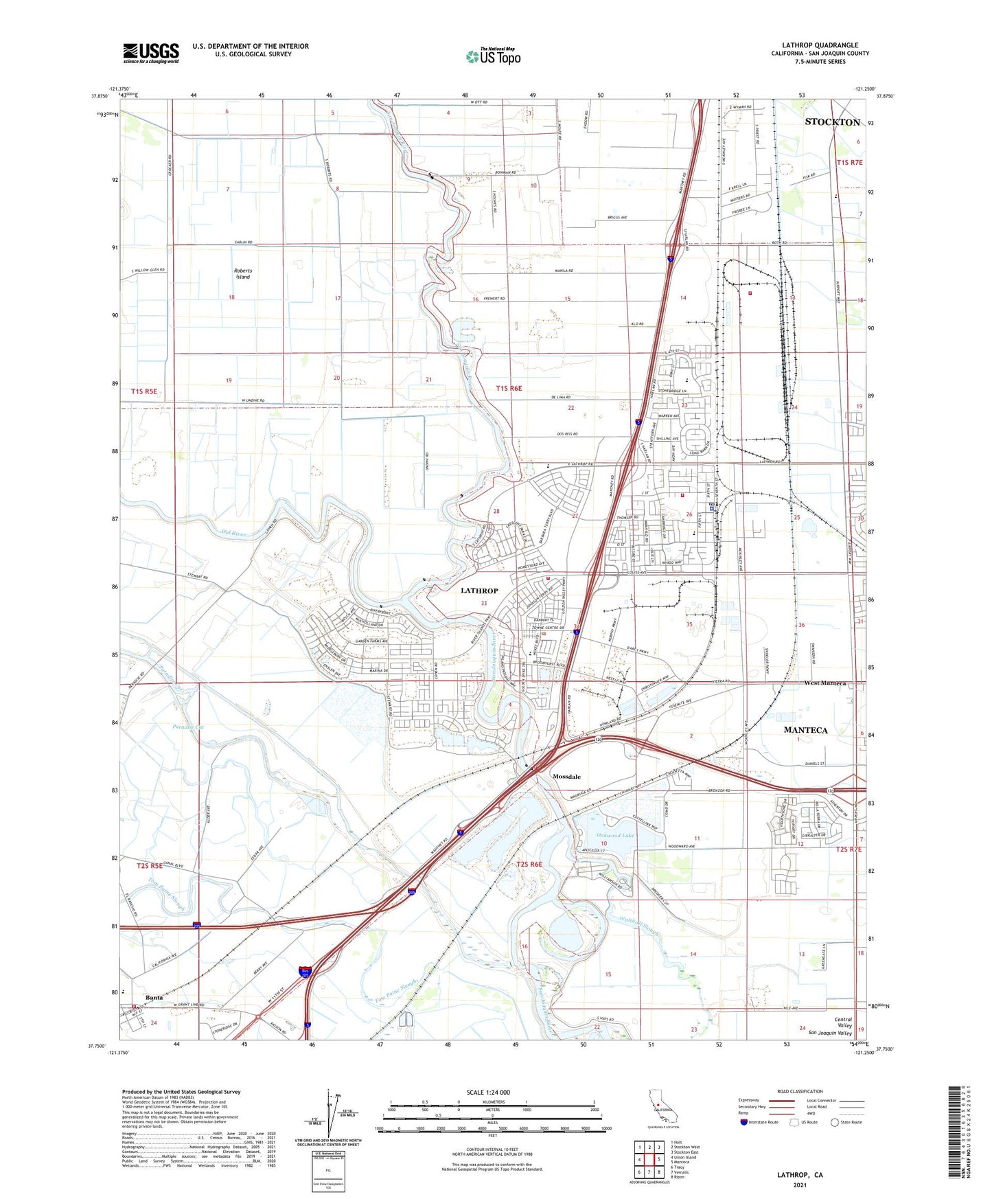
2021 topographic map quadrangle Lathrop in the state of California. Scale: 1:24000. Based on the newly updated USGS 7.5' US Topo map series, this map is in the following counties: San Joaquin. The map contains contour data, water features, and other items you are used to seeing on USGS maps, but also has updated roads and other features. This is the next generation of topographic maps. Printed on high-quality waterproof paper with UV fade-resistant inks.
Quads adjacent to this one:
West: Union Island
Northwest: Holt
North: Stockton West
Northeast: Stockton East
East: Manteca
Southeast: Ripon
South: Vernalis
Southwest: Tracy
This map covers the same area as the classic USGS quad with code o37121g3.
Contains the following named places: Alegre Pit, Banta, Banta Elementary School, Banta Post Office, Big Valley Factory Stores Shopping Center, Brandt Bridge, Brandts Ferry, City of Lathrop, Defense Logistics Agency Sharp, Dos Reis County Park, Garden School, Green Belt Park, Highlight Church of God and Christ, Horizon Park, ITT Technical Institute, Kisst Dairy, KSGO-FM (Tracy), Lathrop, Lathrop - Manteca Fire Protection District Station 31 Lathrop J Street, Lathrop - Manteca Fire Protection District Station 34 Lathrop Mossdale, Lathrop City Hall, Lathrop Elementary School, Lathrop Lighthouse of the Cross Church, Lathrop Police Department, Lathrop Post Office, Libby-Mingo Park, Manteca Waterslide, Mossdale, Mossdale County Park, Mossdale Marina, Mossdale School, Oakwood Lake, Oakwood Lake Resort, Paradise Cut, Paradise Dam, Rustic School, San Joaquin Depot Sharpe, Sharpe Army Depot, Shepherds Ferry, Stewart Tract, Tracy Fire Department Station 92, Valverde Park, Walthall Slough, Weatherbee Lake, West Manteca, Woodfield Park, Yosemite Elementary School, ZIP Codes: 95231, 95330