MyTopo
Union Island California US Topo Map
Couldn't load pickup availability
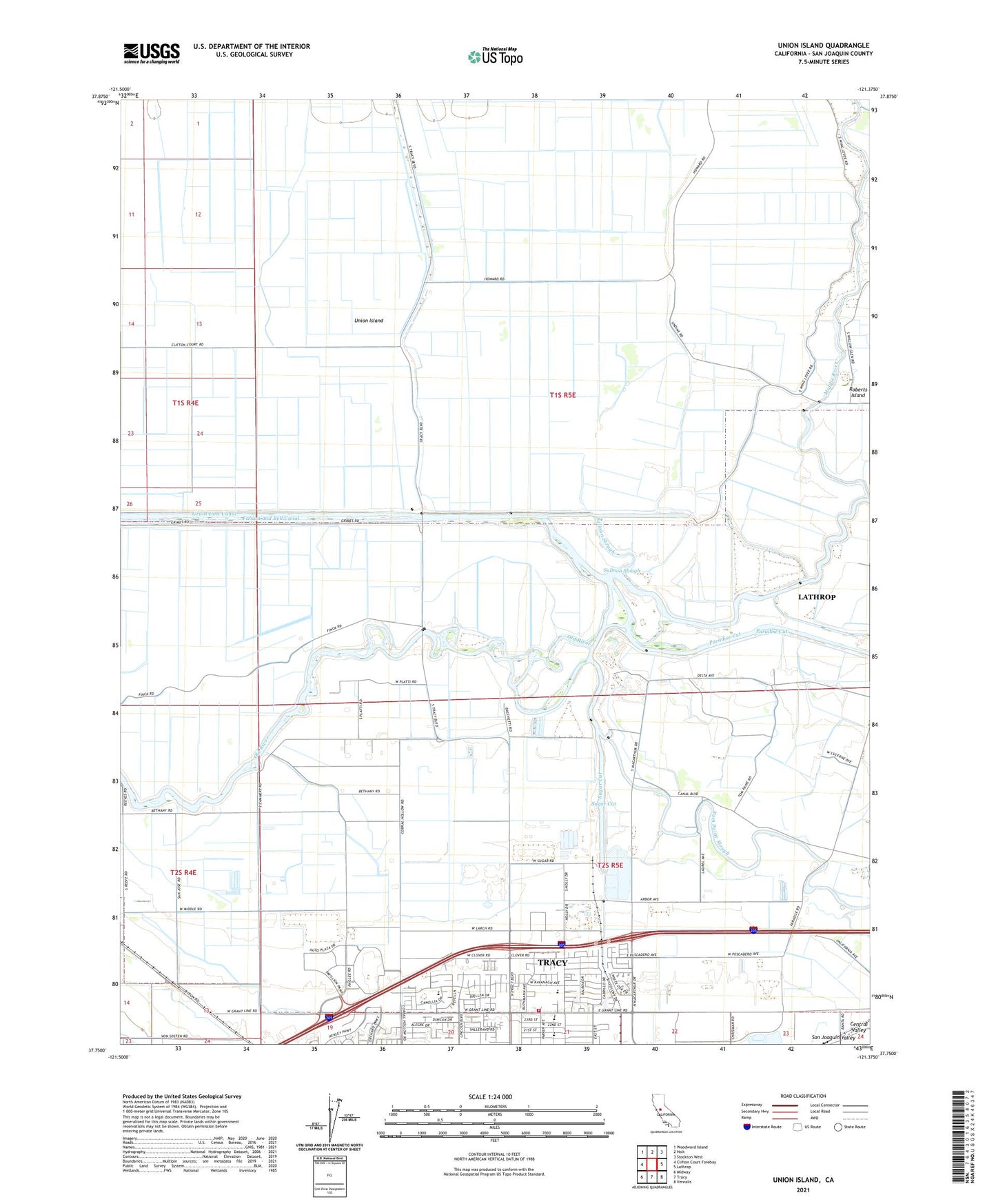
2021 topographic map quadrangle Union Island in the state of California. Scale: 1:24000. Based on the newly updated USGS 7.5' US Topo map series, this map is in the following counties: San Joaquin. The map contains contour data, water features, and other items you are used to seeing on USGS maps, but also has updated roads and other features. This is the next generation of topographic maps. Printed on high-quality waterproof paper with UV fade-resistant inks.
Quads adjacent to this one:
West: Clifton Court Forebay
Northwest: Woodward Island
North: Holt
Northeast: Stockton West
East: Lathrop
Southeast: Vernalis
South: Tracy
Southwest: Midway
This map covers the same area as the classic USGS quad with code o37121g4.
Contains the following named places: Amazing Grace Church True Tabernacle of God, California Highway Patrol Valley Division - Tracy, Church of Christ, Crossroads Christian Church, Delta Island Elementary School, Duncan-Russell Continuation High School, El Pescadero, El Pescadero Park, Fabian and Bell Canal, Family Bible Church, Grant Line Canal, Kenner Park, Larch Clover Park, Lower Main Canal, McKinley Village Shopping Center, Melville S Jacobson Elementary School, Moreda Valley Dairy Number 4, Naglee School, North Elementary School, Ornellas Dairy, Salmon Slough, Slayter Park, Sugar Cut, The Church of Jesus Christ of Latter Day Saints, Tom Paine Slough, Tracy Ball Park, Tracy Bible Fellowship Church, Tracy Fire Department Station 96, Tracy Police Department Substation, Tracy Seventh Day Adventist Church, Tracy Shopping Center, Trinity Baptist Church, Undine School, Union Island, Union Island Gas Field, Valley Shopping Center