
MyTopo
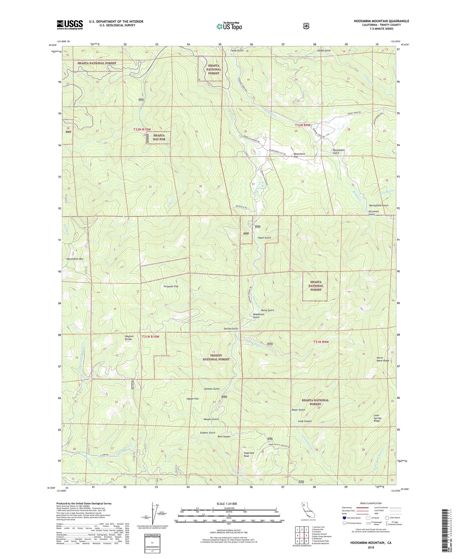
Hoosimbim Mountain California US Topo Map
Couldn't load pickup availability
Also explore the Hoosimbim Mountain Forest Service Topo of this same quad for updated USFS data
2023 topographic map quadrangle Hoosimbim Mountain in the state of California. Scale: 1:24000. Based on the newly updated USGS 7.5' US Topo map series, this map is in the following counties: Trinity. The map contains contour data, water features, and other items you are used to seeing on USGS maps, but also has updated roads and other features. This is the next generation of topographic maps. Printed on high-quality waterproof paper with UV fade-resistant inks.
Quads adjacent to this one:
West: Hayfork Summit
Northwest: Junction City
North: Weaverville
Northeast: Lewiston
East: Bully Choop Mountain
Southeast: Arbuckle Mountain
South: Chanchelulla Peak
Southwest: Wildwood
This map covers the same area as the classic USGS quad with code o40122e8.
Contains the following named places: Barleyfield Creek, Barleyfield Gulch, Betty Gulch, Blanchard Flat, Blanchard Flat School, Box Canyon, Boyer Gulch, Byrons Creek, Camp Gulch, Clements Ranch, Dinkles Ranch, East Fork Browns Creek, Ferguson Flat, Goods Gulch, Hazel Gulch, Hoosimbim Mountain, Horse Mane Creek, Horse Mane Ridge, Johnson Gulch, Lone Springs Ridge, Long Canyon, Maupin Gulch, Middleton Gulch, North Fork Hayfork Creek, O'Connell Gulch, Old Man Gulch, Panwauket Gulch, Reese Brothers Coal Mine, Spring Gulch, Squaw Flat, Sugarloaf Peak, Sulphur Gulch, ZIP Code: 96024


