MyTopo
Lick Observatory California US Topo Map
Couldn't load pickup availability
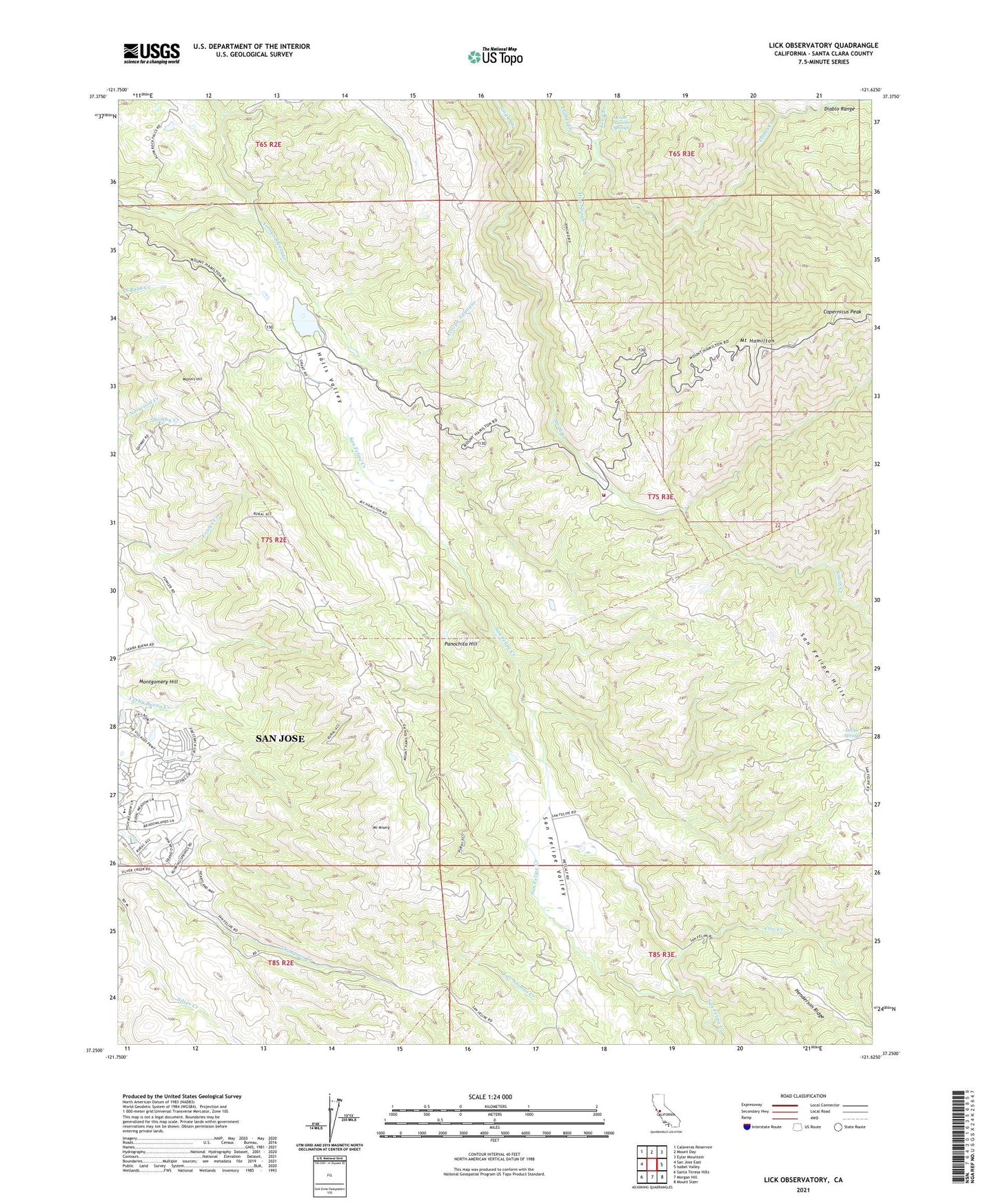
2021 topographic map quadrangle Lick Observatory in the state of California. Scale: 1:24000. Based on the newly updated USGS 7.5' US Topo map series, this map is in the following counties: Santa Clara. The map contains contour data, water features, and other items you are used to seeing on USGS maps, but also has updated roads and other features. This is the next generation of topographic maps. Printed on high-quality waterproof paper with UV fade-resistant inks.
Quads adjacent to this one:
West: San Jose East
Northwest: Calaveras Reservoir
North: Mount Day
Northeast: Eylar Mountain
East: Isabel Valley
Southeast: Mount Sizer
South: Morgan Hill
Southwest: Santa Teresa Hills
This map covers the same area as the classic USGS quad with code o37121c6.
Contains the following named places: Alexander Ranch, Bonita Creek, CAL FIRE Smith Creek Fire Station 12 Santa Clara Unit, Canada De Pala, Chaboya Middle School, Coe Ranch, Copernicus Peak, Copernicus Peak Lookout Tower, Cow Creek, Crossley Reflector, Divide Springs, Evergreen Elementary School, Evergreen Ranch, Grant Company Number 2 1057-002 Dam, Grant Ranch, Halls Valley, Halls Valley Lake, Halls Valley School, Hendricks Ranch, Highland School, Hog Slough, Joseph D Grant County Park, Kuhn 624 Dam, Kuhn Ranch, Lick Observatory, Long Branch, Masters Hill, Mount Hamilton, Mount Hamilton Springs, Mount Misery, Panochita Hill, Richmond Ranch, San Felipe Hills, San Felipe Ranch 1621 Dam, San Felipe Valley, Scott Ranch, Silver Creek Valley Country Club, Smith Creek Ranger Station, Sulphur Creek, Tom Matsumoto Elementary School, ZIP Code: 95135