MyTopo
Eylar Mountain California US Topo Map
Couldn't load pickup availability
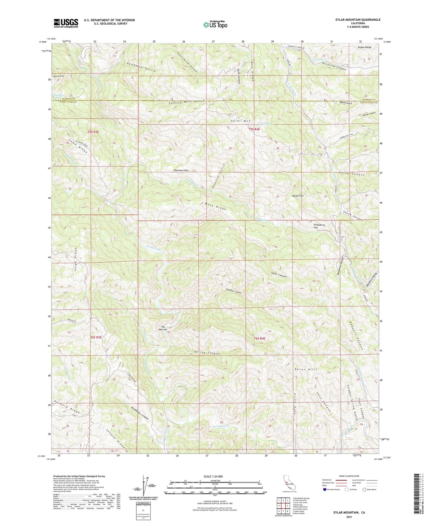
2021 topographic map quadrangle Eylar Mountain in the state of California. Scale: 1:24000. Based on the newly updated USGS 7.5' US Topo map series, this map is in the following counties: Santa Clara, Alameda. The map contains contour data, water features, and other items you are used to seeing on USGS maps, but also has updated roads and other features. This is the next generation of topographic maps. Printed on high-quality waterproof paper with UV fade-resistant inks.
Quads adjacent to this one:
West: Mount Day
Northwest: Mendenhall Springs
North: Cedar Mountain
Northeast: Lone Tree Creek
East: Mount Boardman
Southeast: Mount Stakes
South: Isabel Valley
Southwest: Lick Observatory
This map covers the same area as the classic USGS quad with code o37121d5.
Contains the following named places: Arroyo Bayo, Banta Spring, Blackbird Valley, Blumbago Canyon, Burnt Hills, Camp Bessie, Coffey Mill Gulch, Colorado Camp, Colorado Creek, Deadman Gulch, Dry Creek, Eylar Canyon, Eylar Mountain, Fisher Homestead, Hays Camp, Hoodoo Gulch, Horsethief Canyon, Ingram Flat, Long Gulch, Lost Canyon, Man Ridge, McGlinchey Spring, Mesa Ridge, Mowry Camp, Parman Ranch, Pino Creek, Pulse Canyon, Rancho Arroyo Bayo, Sams Canyon, San Antonio Creek, Seeboy Ridge, Sherman Flats, Smith Gulch, South Pocket, Spring Canyon, Strawberry Flat, Sulphur Gulch, Sulphur Spring Gulch, Sycamore Creek, Tarraville Canyon, Tarraville Creek, The Narrows, Trail Canyon, Turner Gulch, ZIP Code: 95140